MyTopo
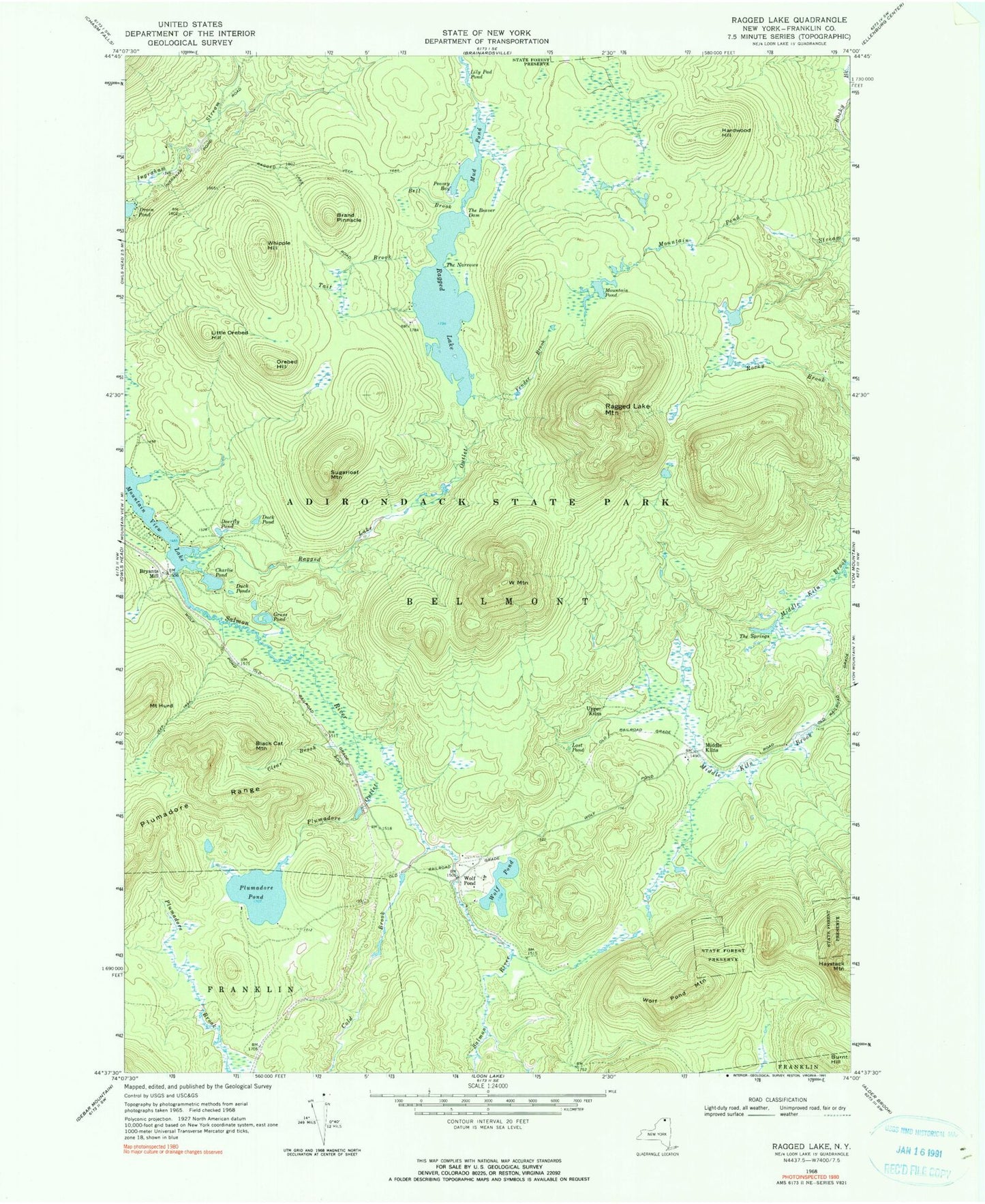
Classic USGS Ragged Lake New York 7.5'x7.5' Topo Map
Couldn't load pickup availability
Historical USGS topographic quad map of Ragged Lake in the state of New York. Typical map scale is 1:24,000, but may vary for certain years, if available. Print size: 24" x 27"
This quadrangle is in the following counties: Franklin.
The map contains contour lines, roads, rivers, towns, and lakes. Printed on high-quality waterproof paper with UV fade-resistant inks, and shipped rolled.
Contains the following named places: Bell Brook, Black Cat Mountain, Brand Pinnacle, Burnt Hill, Charlie Pond, Clear Brook, Cold Brook, Deerfly Pond, Drain Pond, Duck Pond, Duck Ponds, Fender Brook, Grass Pond, Hardwood Hill, Haystack Mountain, Mount Hurd, Lily Pod Pond, Little Orebed Hill, Lost Pond, Middle Kilns, Mountain Pond, Mud Pond, Orebed Hill, Peavey Bay, Plumadore Outlet, Plumadore Pond, Ragged Lake, Ragged Lake Mountain, Ragged Lake Outlet, Sugarloaf Mountain, Tait Brook, The Beaver Dam, The Narrows, The Springs, Upper Kilns, W Mountain, Whipple Hill, Wolf Pond, Wolf Pond Mountain, Bryants Mill, Wolf Pond, Town of Bellmont