MyTopo
Classic USGS Raglin Ridge California 7.5'x7.5' Topo Map
Couldn't load pickup availability
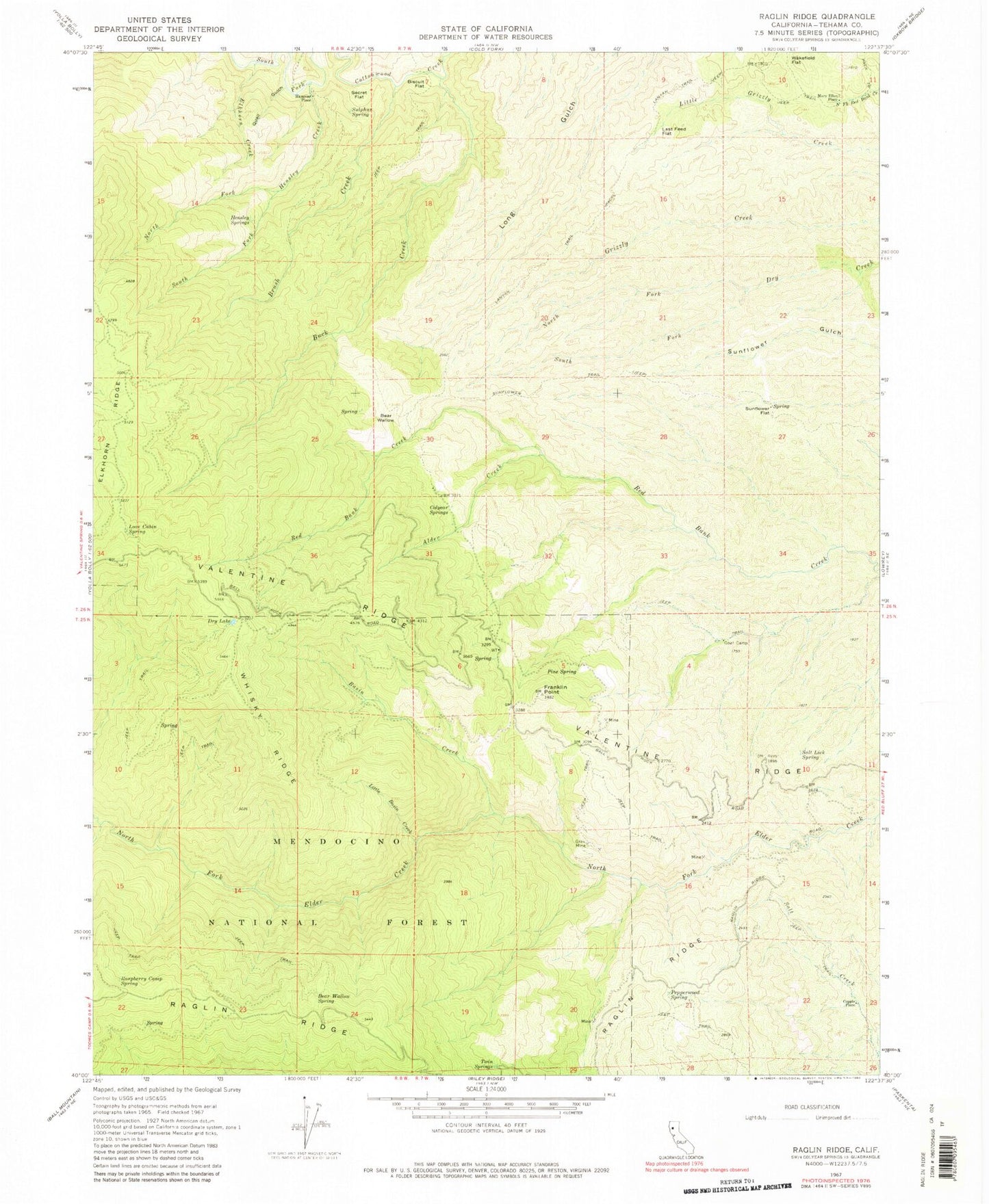
Historical USGS topographic quad map of Raglin Ridge in the state of California. Map scale may vary for some years, but is generally around 1:24,000. Print size is approximately 24" x 27"
This quadrangle is in the following counties: Tehama.
The map contains contour lines, roads, rivers, towns, and lakes. Printed on high-quality waterproof paper with UV fade-resistant inks, and shipped rolled.
Contains the following named places: Alder Creek, Basin Creek, Bear Wallow, Bear Wallow Spring, Biscuit Flat, Brush Creek, Buck Creek, Copple Place, Dry Lake, Elkhorn Creek, Elkhorn Ridge, Franklin Point, Grau Mine, Hammer Place, Hensley Creek, Hensley Springs, Last Feed Flat, Little Basin Creek, Love Cabin Spring, Mary Ellen Place, North Fork Dry Creek, North Fork Hensley Creek, Pepperwood Spring, Pine Spring, Quail Gulch, Raspberry Camp, Raspberry Camp Spring, Salt Lick Spring, Secret Flat, South Fork Dry Creek, South Fork Hensley Creek, Sulphur Spring, Sunflower Flat, Sunflower Trail, Twin Springs, Wakefield Flat, Watson, West Tehama Division, Whisky Ridge