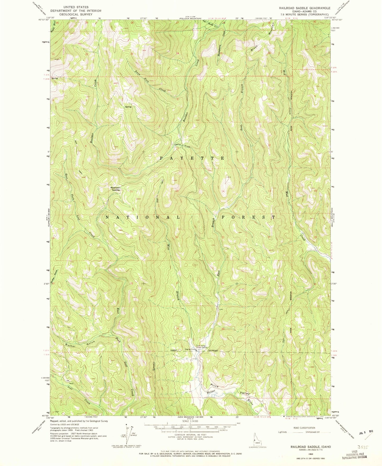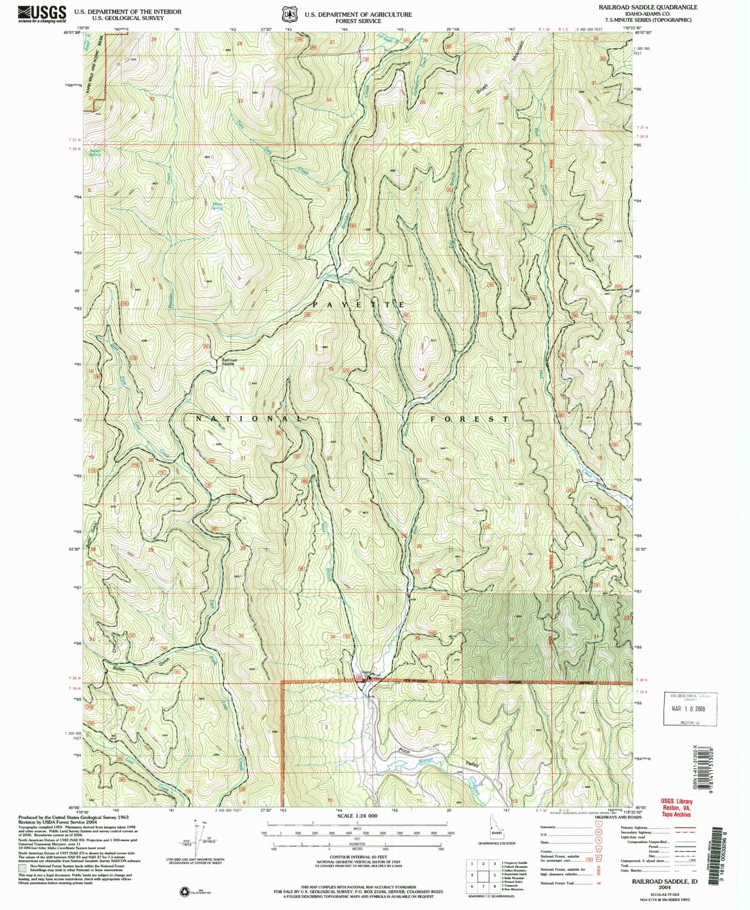
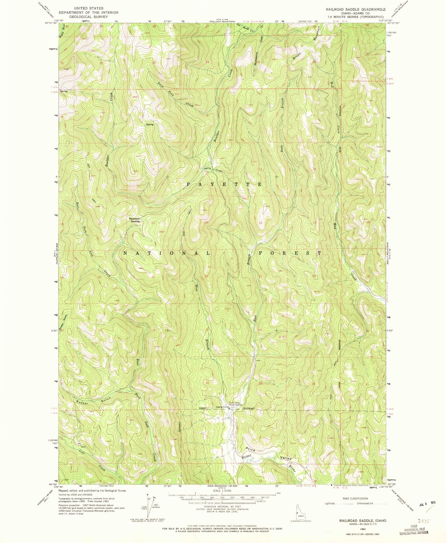
MyTopo
Classic USGS Railroad Saddle Idaho 7.5'x7.5' Topo Map
Regular price
$16.95
Regular price
Sale price
$16.95
Unit price
per
Couldn't load pickup availability
Historical USGS topographic quad map of Railroad Saddle in the state of Idaho. Map scale may vary for some years, but is generally around 1:24,000. Print size is approximately 24" x 27"
This quadrangle is in the following counties: Adams.
The map contains contour lines, roads, rivers, towns, and lakes. Printed on high-quality waterproof paper with UV fade-resistant inks, and shipped rolled.
Contains the following named places: Ant Basin Creek, Aspen Spring, Butter Gulch, East Branch Weiser River, Huckleberry Creek, Miller Spring, Price Valley Guard Station, Railroad Saddle, Twin Fork Creek, West Branch Weiser River, Yantis Ditch