MyTopo
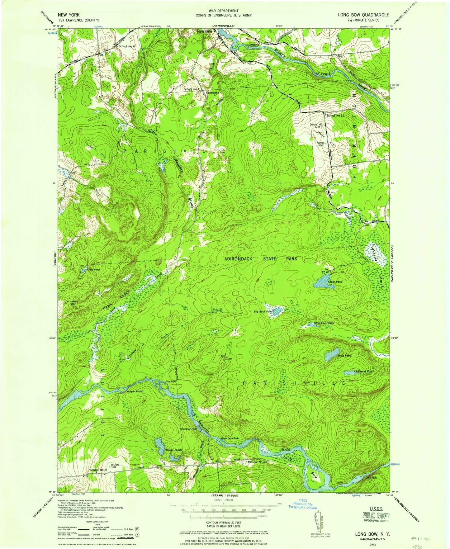
Classic USGS Rainbow Falls New York 7.5'x7.5' Topo Map
Couldn't load pickup availability
Historical USGS topographic quad map of Rainbow Falls in the state of New York. Typical map scale is 1:24,000, but may vary for certain years, if available. Print size: 24" x 27"
This quadrangle is in the following counties: St. Lawrence.
The map contains contour lines, roads, rivers, towns, and lakes. Printed on high-quality waterproof paper with UV fade-resistant inks, and shipped rolled.
Contains the following named places: Clear Pond, Close Pond, Dead Creek, Five Falls Reservoir, French Hill, Harvey Brook, Hawk Ledge, Horton Ponds, Lilypad Pond, Little Rock Pond, Long Pond, Morgan Rapids, Pickettville, Rainbow Brook, Rainbow Falls, Rainbow Falls Reservoir, Rock Pond, Saint Lawrence State Forest, South Colton Reservoir, Wheeler Marsh, Whites Hill, Town of Parishville, Five Falls (historical), Gain Twist Falls (historical), Little Falls (historical), School Number 8 (historical), School Number 11 (historical), School Number 11 (historical), School Number 13 (historical), Clear Pond, Close Pond, Dead Creek, Five Falls Reservoir, French Hill, Harvey Brook, Hawk Ledge, Horton Ponds, Lilypad Pond, Little Rock Pond, Long Pond, Morgan Rapids, Pickettville, Rainbow Brook, Rainbow Falls, Rainbow Falls Reservoir, Rock Pond, Saint Lawrence State Forest, South Colton Reservoir, Wheeler Marsh, Whites Hill, Town of Parishville, Five Falls (historical), Gain Twist Falls (historical), Little Falls (historical), School Number 8 (historical), School Number 11 (historical), School Number 11 (historical), School Number 13 (historical)