MyTopo
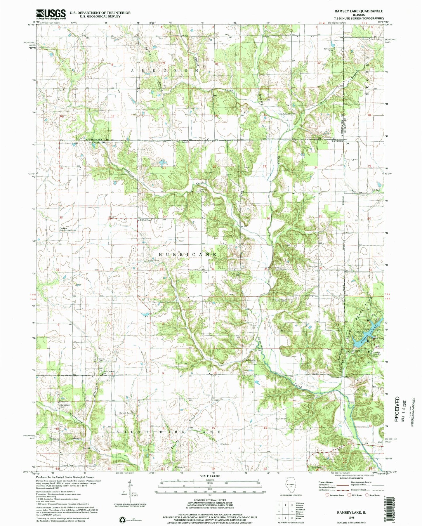
Classic USGS Ramsey Lake Illinois 7.5'x7.5' Topo Map
Couldn't load pickup availability
Historical USGS topographic quad map of Ramsey Lake in the state of Illinois. Map scale may vary for some years, but is generally around 1:24,000. Print size is approximately 24" x 27"
This quadrangle is in the following counties: Fayette, Montgomery, Shelby.
The map contains contour lines, roads, rivers, towns, and lakes. Printed on high-quality waterproof paper with UV fade-resistant inks, and shipped rolled.
Contains the following named places: Bailey Branch, Big Three School, Blackberry Fork Picnic Area, Caesar Creek, Carlock Cemetery, Casey Cemetery, Coon Ridge Picnic Area, Crabapple Ridge Camping Area, Craig Cemetery, Craigtown School, Donaldson Cemetery, Elliott Creek, Fairview Community Center, Fairview School, Fox Cemetery, Fox Hunt Hollow, Fox Knoll Picnic Area, Gamble Branch, Halford Cemetery, Halford Chapel, Harris Cemetery, Hickory Creek, Hickory Grove Camping Area, Lake View Picnic Area, Liberty Cemetery, Liberty Church, Little Hickory Cemetery, Little Hickory Church, Little Hickory School, Mount Carmel Cemetery, Mount Carmel Church, Mount Zion School, Nave Cemetery, New Bethel Church, Oak Valley Church, Otter Branch, Pine Bend Picnic Area, Poland Cemetery, Prairie Mound School, Ramsey Hills Nature Trail, Ramsey Lake, Ramsey Lake Dam, Ramsey Lake State Park, Shady Grove Picnic Area, Sterling School, Stokes Cemetery, Success School, Tennessee Cemetery, Township of Hurricane, Virden School, White Oak Camping Area, Whitfield Lake, Whitfield Lake Dam, Whitten School, ZIP Code: 62011