MyTopo
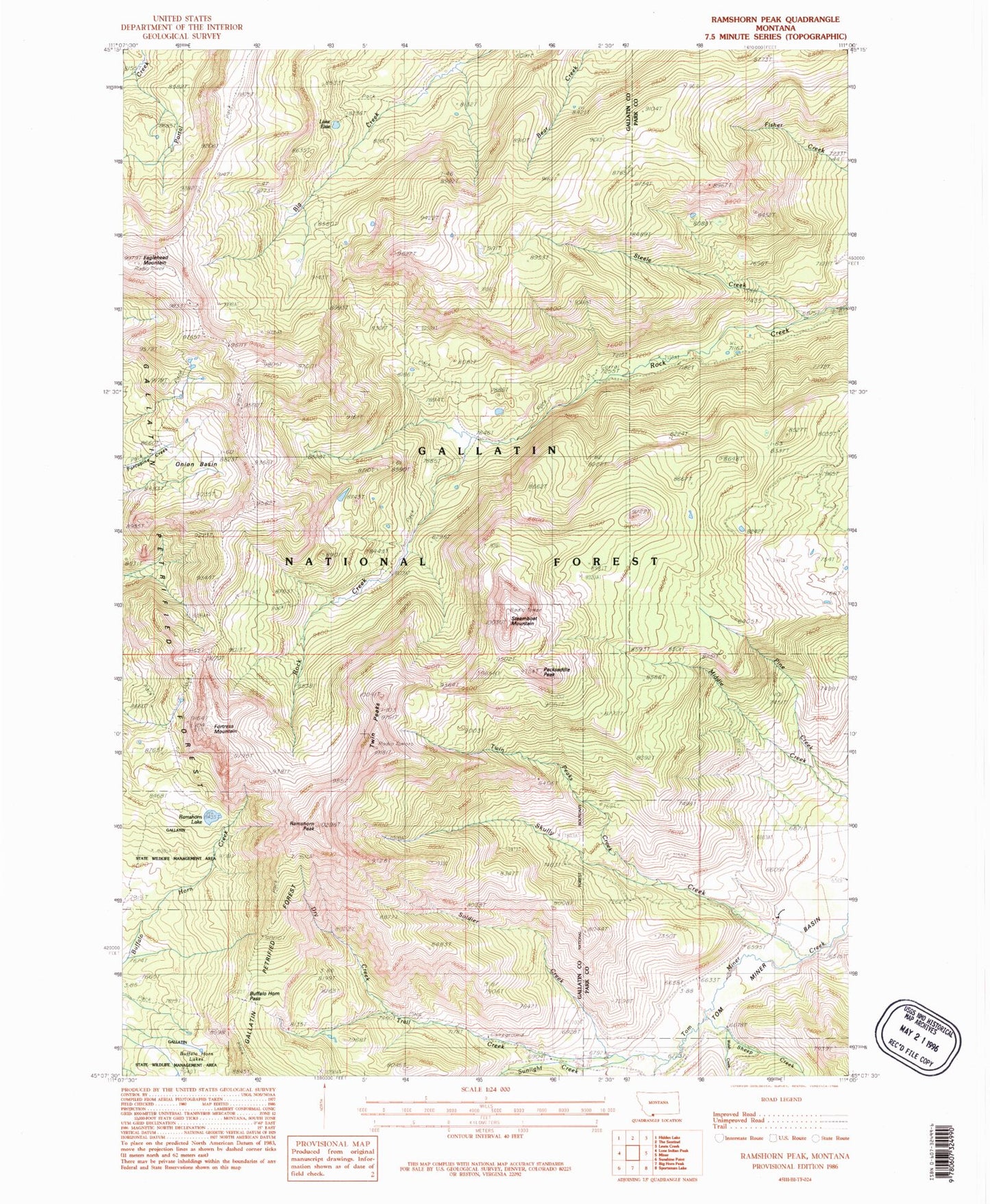
Classic USGS Ramshorn Peak Montana 7.5'x7.5' Topo Map
Couldn't load pickup availability
Historical USGS topographic quad map of Ramshorn Peak in the state of Montana. Typical map scale is 1:24,000, but may vary for certain years, if available. Print size: 24" x 27"
This quadrangle is in the following counties: Gallatin, Park.
The map contains contour lines, roads, rivers, towns, and lakes. Printed on high-quality waterproof paper with UV fade-resistant inks, and shipped rolled.
Contains the following named places: Buffalo Horn Pass, Dry Creek, Eaglehead Mountain, Lake Elsie, Fortress Mountain, Packsaddle Peak, Ramshorn Lake, Ramshorn Peak, Sheep Creek, Skully Creek, Soldier Creek, Steamboat Mountain, Steele Creek, Sunlight Creek, Trail Creek, Twin Peaks, Twin Peaks Creek, Walsh Creek, Tom Miner Campground, Onion Basin