MyTopo
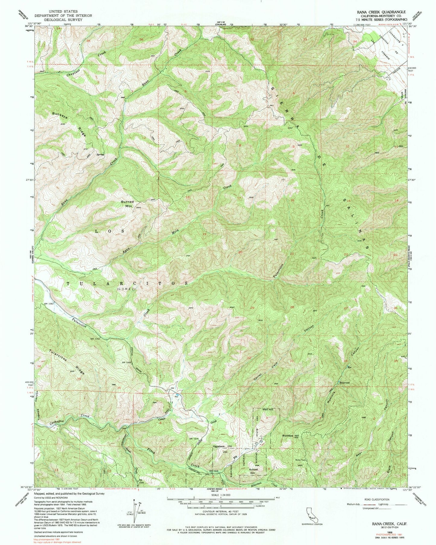
Classic USGS Rana Creek California 7.5'x7.5' Topo Map
Couldn't load pickup availability
Historical USGS topographic quad map of Rana Creek in the state of California. Map scale may vary for some years, but is generally around 1:24,000. Print size is approximately 24" x 27"
This quadrangle is in the following counties: Monterey.
The map contains contour lines, roads, rivers, towns, and lakes. Printed on high-quality waterproof paper with UV fade-resistant inks, and shipped rolled.
Contains the following named places: Big Creek, Buckeye Hill, Buckeye Ridge, Burned Mountain, Cachagua Fire Protection District Station 3 Tassajara Road, Casa Verde Gun Club, Conejo Creek, Corral Viejo Canyon, Finch Creek, Haystack Hill, James Creek, Los Tularcitos, Madrona Canyon, Red Hill, Robertson Creek, School Hill