MyTopo
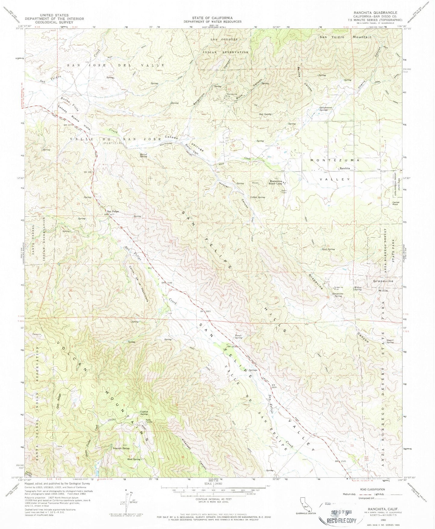
Classic USGS Ranchita California 7.5'x7.5' Topo Map
Couldn't load pickup availability
Historical USGS topographic quad map of Ranchita in the state of California. Typical map scale is 1:24,000, but may vary for certain years, if available. Print size: 24" x 27"
This quadrangle is in the following counties: San Diego.
The map contains contour lines, roads, rivers, towns, and lakes. Printed on high-quality waterproof paper with UV fade-resistant inks, and shipped rolled.
Contains the following named places: Barrel Spring, Bergstrom Canyon, Bertha Canyon, Buck Canyon, Canada Buena Vista, Canada Verruga, Catfish Spring, Cherry Canyon, Government Springs, Grapevine Spring, Hoover Canyon, Ironside Spring, Lithia Spring, Lost Spring, Montezuma Honor Camp, Montezuma Mine, Montezuma Valley, Oak Ridge, Oak Spring, Paroli Spring, Ranchita, Rock Spring, San Felipe Hills, Stuart Spring, Willow Spring, Teofulio Summit, San Felipe, Cerro de la Hechicera, Volcan Mountains, Camel Rock, KBNN-FM (Julian), Grapevine Mine, Long Mine, Rys Mine, Verruga Quarry, Volcan Ranch (historical), Montezuma Valley Volunteer Fire Department, San Diego County Sheriff's Office Ranchita Substation