MyTopo
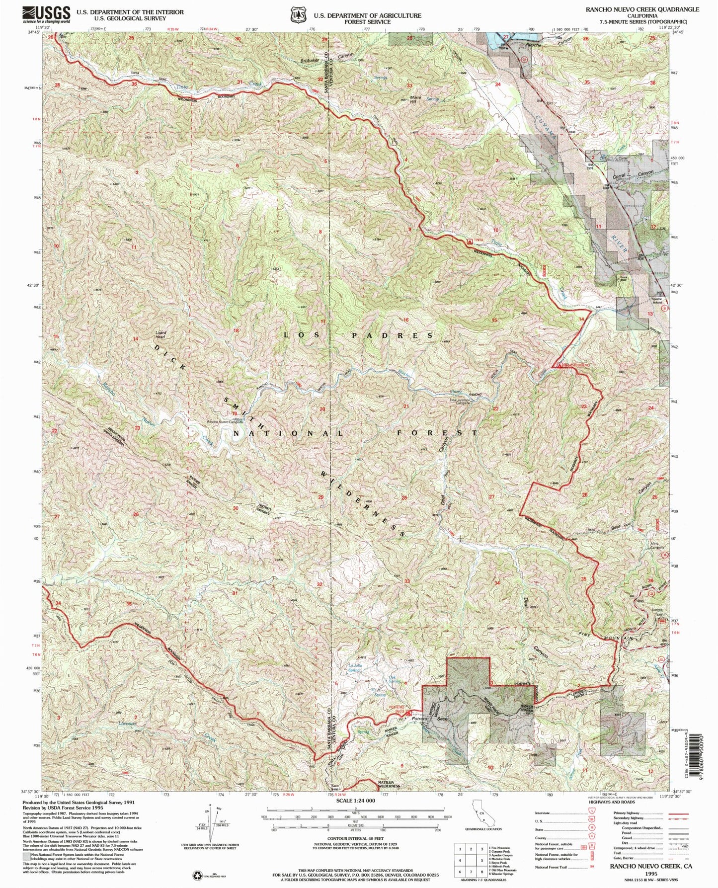
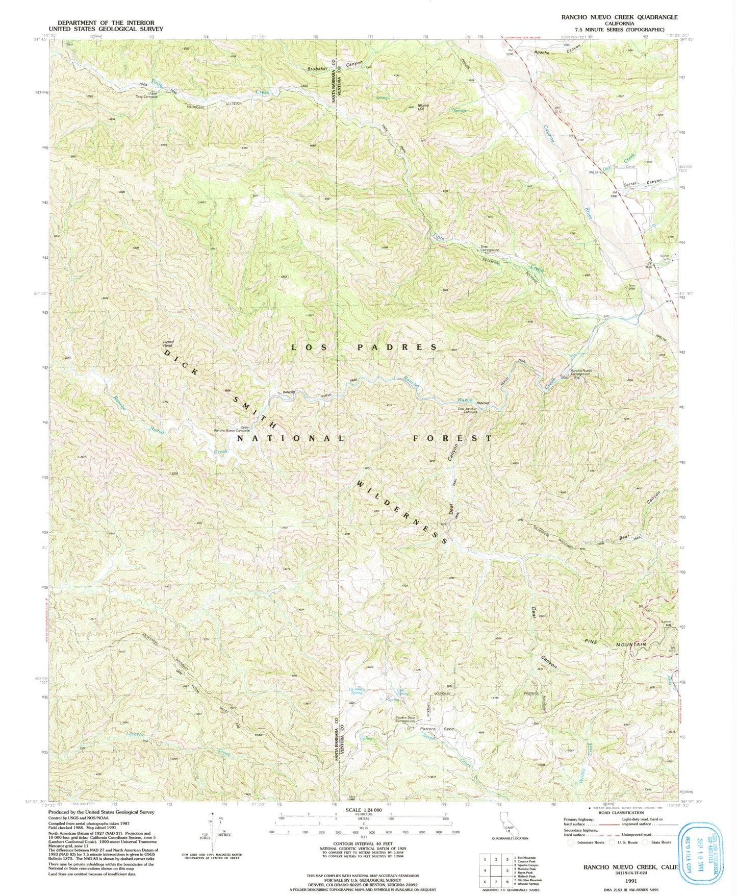
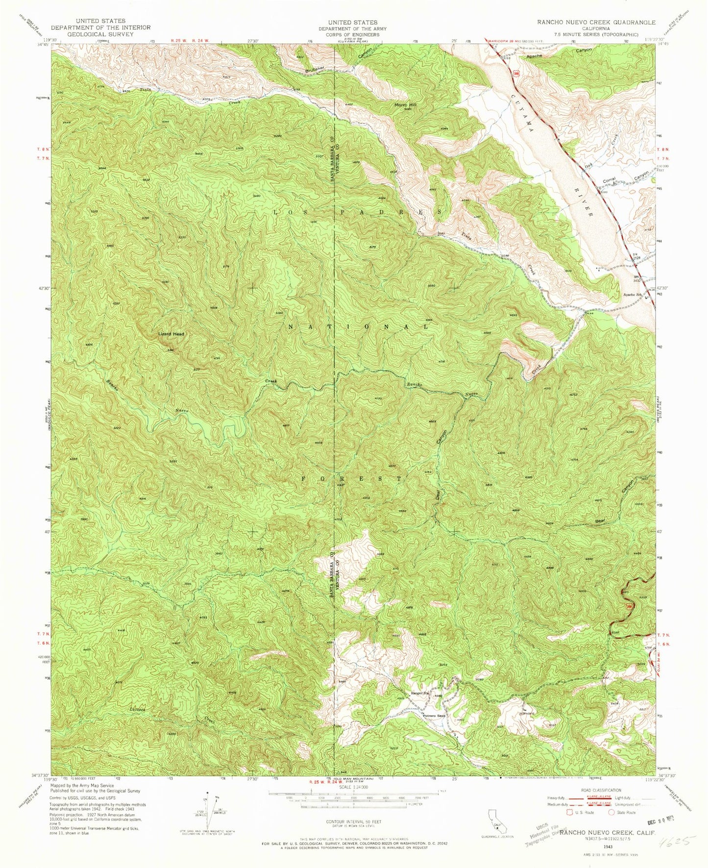
Classic USGS Rancho Nuevo Creek California 7.5'x7.5' Topo Map
Couldn't load pickup availability
Historical USGS topographic quad map of Rancho Nuevo Creek in the state of California. Typical map scale is 1:24,000, but may vary for certain years, if available. Print size: 24" x 27"
This quadrangle is in the following counties: Santa Barbara, Ventura.
The map contains contour lines, roads, rivers, towns, and lakes. Printed on high-quality waterproof paper with UV fade-resistant inks, and shipped rolled.
Contains the following named places: Rancho Nuevo Trail, Tinta Trail, Don Victor Valley Fire Trail, Potrero Seco Campground, Oak Spring, La Jolla Spring, Deal Junction Campsite, Deal Trail, Apache Canyon, Apache School, Corral Canyon, Deal Canyon, Lizard Head, Morro Hill, Oak Creek, Potrero Seco, Rancho Nuevo Creek, Round Spring Canyon, Tinta Creek, Dry Canyon, LaJolla Springs, Oak Springs, Upper Tinta Campground, Upper Rancho Nuevo Campground, Tinta Campground, Deal Campground, Rancho Nuevo Campground, Mine Campground, Potrero Seco Rustic Campsite, Potrero Seco Guard Station (historical), Rancho Nuevo Trail, Tinta Trail, Don Victor Valley Fire Trail, Potrero Seco Campground, Oak Spring, La Jolla Spring, Deal Junction Campsite, Deal Trail, Apache Canyon, Apache School, Corral Canyon, Deal Canyon, Lizard Head, Morro Hill, Oak Creek, Potrero Seco, Rancho Nuevo Creek, Round Spring Canyon, Tinta Creek, Dry Canyon, LaJolla Springs, Oak Springs, Upper Tinta Campground, Upper Rancho Nuevo Campground, Tinta Campground, Deal Campground, Rancho Nuevo Campground, Mine Campground, Potrero Seco Rustic Campsite, Potrero Seco Guard Station (historical)