MyTopo
Classic USGS Randall New York 7.5'x7.5' Topo Map
Couldn't load pickup availability
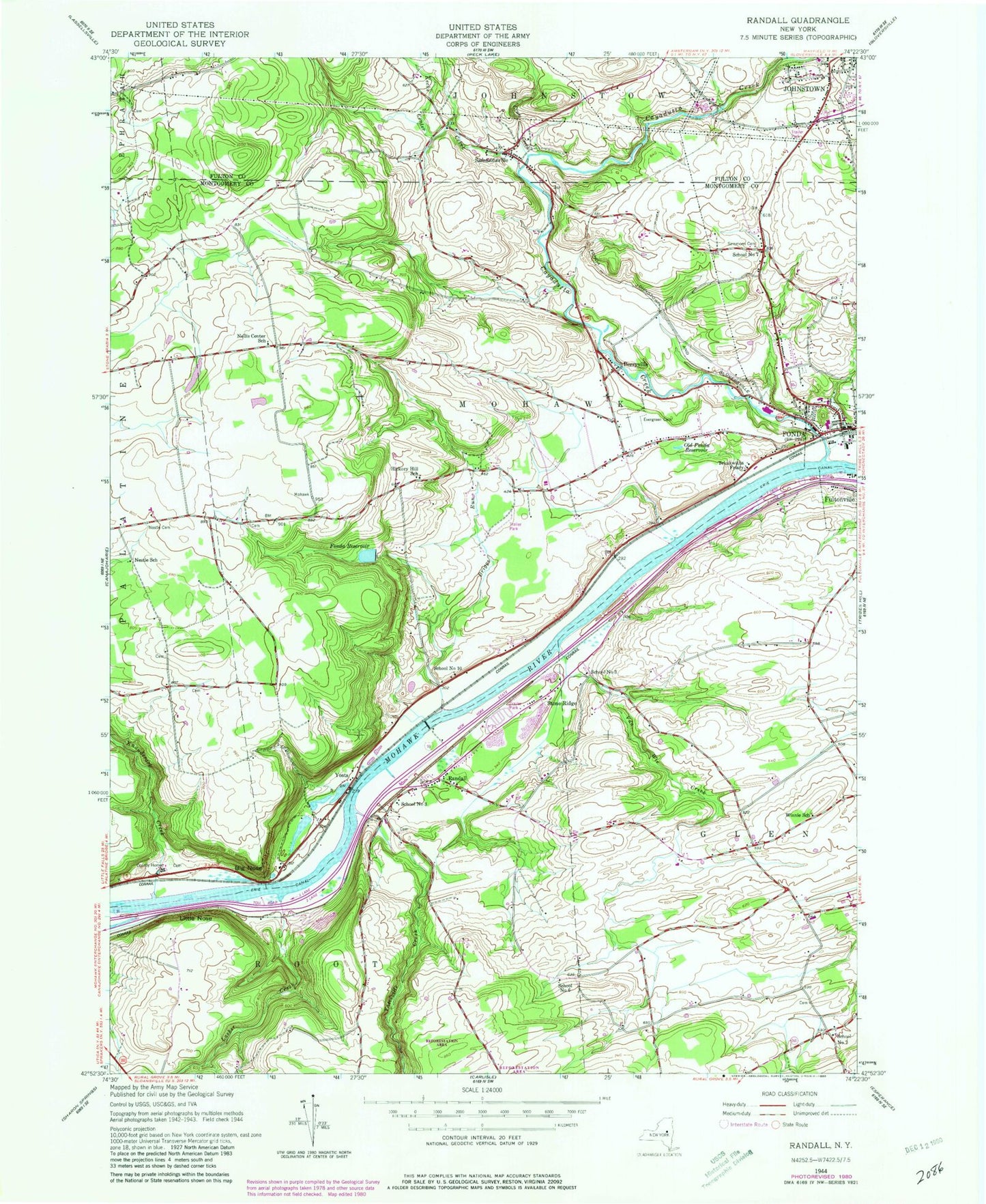
Historical USGS topographic quad map of Randall in the state of New York. Typical map scale is 1:24,000, but may vary for certain years, if available. Print size: 24" x 27"
This quadrangle is in the following counties: Fulton, Montgomery.
The map contains contour lines, roads, rivers, towns, and lakes. Printed on high-quality waterproof paper with UV fade-resistant inks, and shipped rolled.
Contains the following named places: Berryville, Big Nose, Briggs Run, Crum Creek, Evergreen Cemetery, Fonda, Fonda Reservoir, Hickory Hill School (historical), Kecks Center Creek, Lasher Creek, Little Nose, Nellis Center School (historical), Nestle School (historical), Old Fonda Reservoir, Randall, Sammons Cemetery, Sammonsville, Stone Ridge, Tekakwitha Friary, Van Wie Creek, Cayadutta Creek, Knauderack Creek, Winnie School (historical), Yatesville Creek, Yosts, Montgomery County, School Number 10 (historical), School Number 3 (historical), School Number 3 (historical), School Number 6 (historical), School Number 7 (historical), School Number 7 (historical), WSHQ-FM (Cobleskill), Town of Mohawk, Willing Helpers Home for Old Ladies (historical), Bellinger's Apple Orchard, Sand Flats Orchard, Montgomery County Home Cemetery, Montgomery County Home (historical), Cashins Farm, Longmeadow Farm, Appleridge Farm, Fonda Reformed Church, Saint Cecilia Church, Saving Grace Baptist Church, Frothingham Free Library, Shady Lane Mobile Home Park, Johnstown Industrial Park, Buckler Christian Academy, B and B Crop Farms, Mohawk Volunteer Fire Department