MyTopo
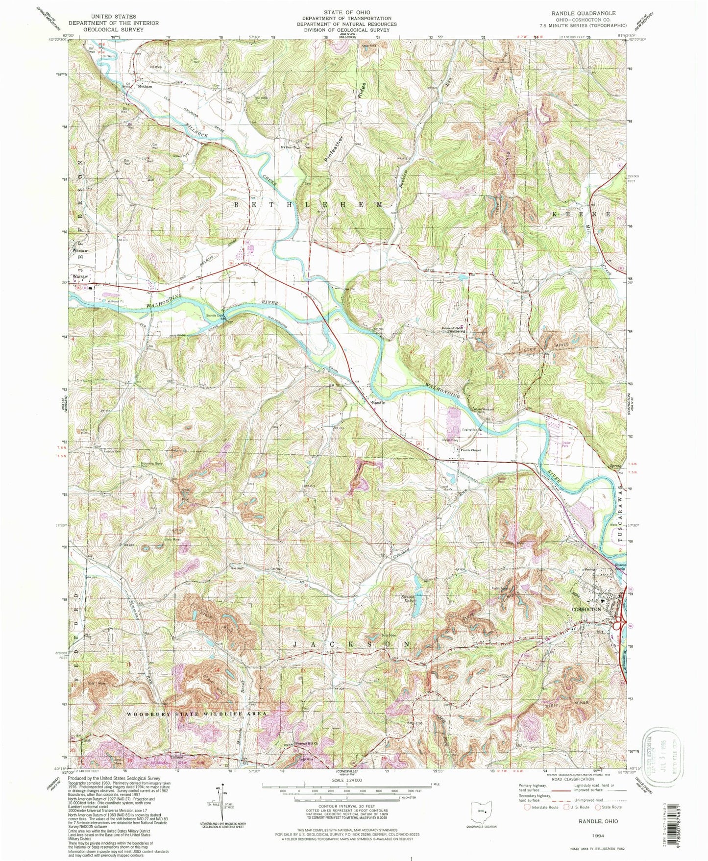
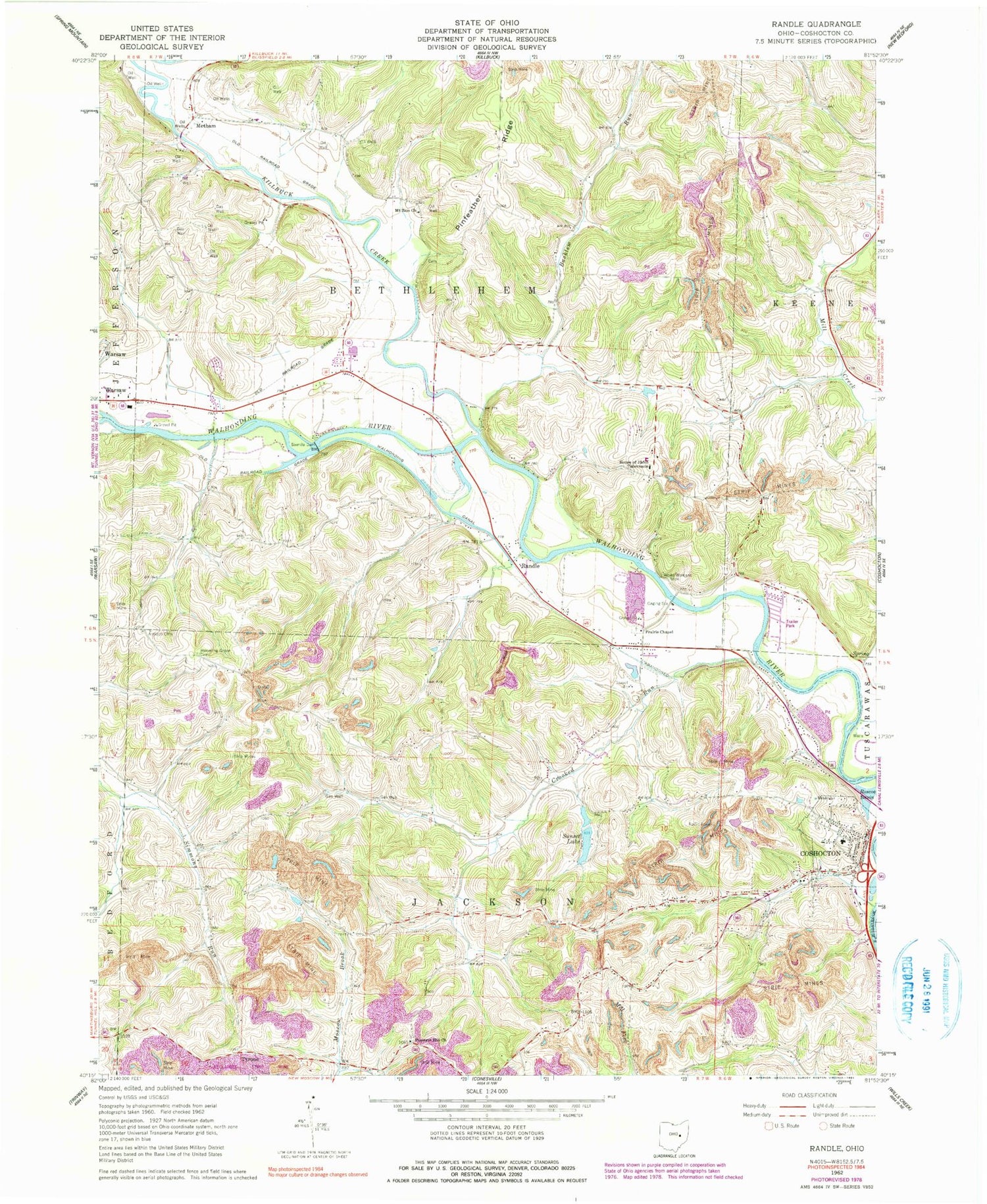
Classic USGS Randle Ohio 7.5'x7.5' Topo Map
Couldn't load pickup availability
Historical USGS topographic quad map of Randle in the state of Ohio. Typical map scale is 1:24,000, but may vary for certain years, if available. Print size: 24" x 27"
This quadrangle is in the following counties: Coshocton.
The map contains contour lines, roads, rivers, towns, and lakes. Printed on high-quality waterproof paper with UV fade-resistant inks, and shipped rolled.
Contains the following named places: Antioch Cemetery, Blooming Grove Cemetery, Mill Creek, Mount Zion Church, Pinfeather Ridge, Pleasant Hill Church, Walhonding Canal, Marshall School (historical), School Number 4 (historical), Soggy Hill School (historical), Bantum School (historical), River View High School, School Number 1 (historical), School Number 1 (historical), School Number 6 (historical), School Number 3 (historical), School Number 5 (historical), School Number 5 (historical), School Number 7 (historical), School Number 5 (historical), Roscoe Basin, Sixmile Dam, Randle, Metham, Tyrone, Prairie Chapel United Methodist Church, Roscoe, Bucklew Run, Crooked Run, Killbuck Creek, Simmons Run, White Womans Rock, Crooked Run Cross Roads, White Womans Town (historical), Roscoe United Methodist Church, Coshocton County, Sunset Lake Dam, Sunset Lake, Six Mile Reservoir, Three Rivers Heliport, Township of Bethlehem, Township of Jackson, Christian Apostolic Church, Johnson-Humrickhouse Museum, Roscoe School (historical), Warsaw Post Office, Pleasant Hill Baptist Cemetery, Prairie Chapel Cemetery, Roscoe Cemetery, Metham Post Office (historical), Tyrone Post Office (historical), Roscoe Post Office (historical), Jackson Township Fire Station, Apache Number 1 Pit, Dickerson Mobile Home Park, Edgewood Terrace