MyTopo
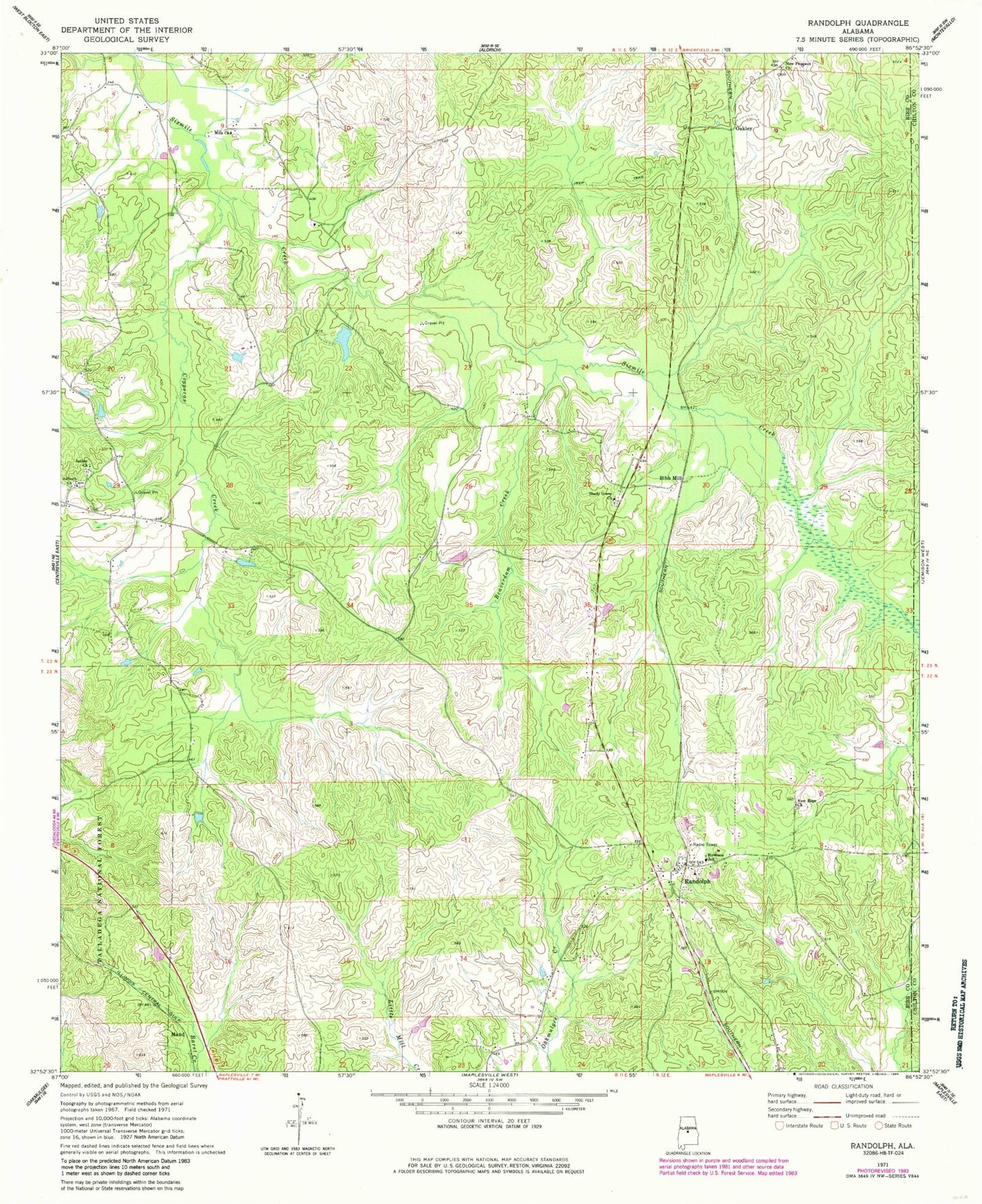
Classic USGS Randolph Alabama 7.5'x7.5' Topo Map
Couldn't load pickup availability
Historical USGS topographic quad map of Randolph in the state of Alabama. Map scale may vary for some years, but is generally around 1:24,000. Print size is approximately 24" x 27"
This quadrangle is in the following counties: Bibb, Chilton.
The map contains contour lines, roads, rivers, towns, and lakes. Printed on high-quality waterproof paper with UV fade-resistant inks, and shipped rolled.
Contains the following named places: Allen P Howison Elementary School, Antioch, Antioch Cemetery, Antioch Missionary Baptist Church, Beaverdam Creek, Bibb Mill, Bibb Old County Hall, Copperas Creek, Hammermill Paper Company Lake, Hammermill Paper Company Lake Dam, Maud, Mills Church, New Hope Baptist Church, New Prospect Methodist Church, Oakley, Pleasant Sabine Baptist Church, Randolph, Randolph Baptist Church, Randolph Cemetery, Randolph Post Office, Randolph Volunteer Fire Department, Shady Grove Cemetery, Shady Grove Missionary Baptist Church, Smelly Creek, Thomas Mill, Tucker, Union Baptist Church, Union Baptist Church Cemetery, Union School, ZIP Code: 36792