MyTopo
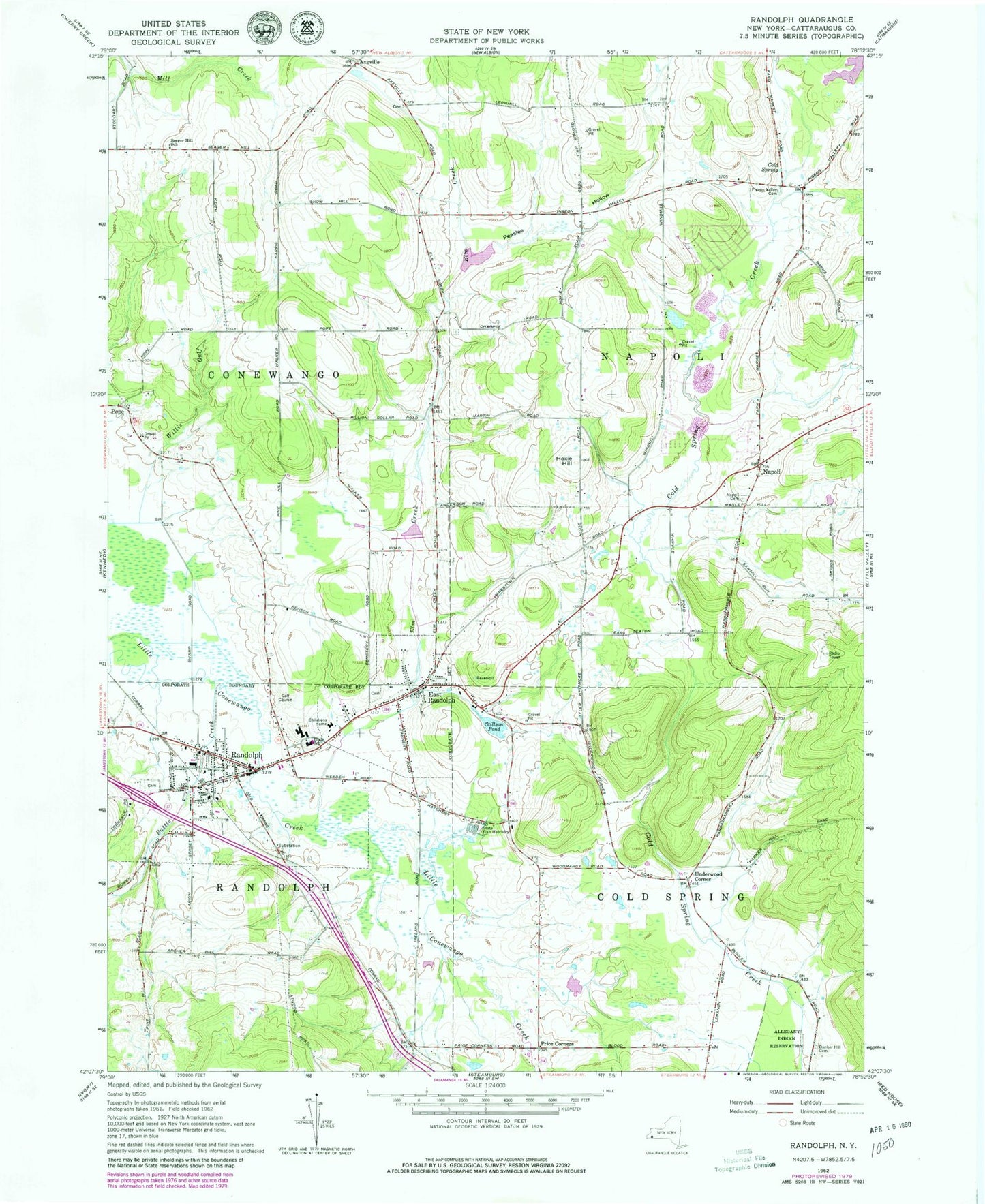
Classic USGS Randolph New York 7.5'x7.5' Topo Map
Couldn't load pickup availability
Historical USGS topographic quad map of Randolph in the state of New York. Map scale may vary for some years, but is generally around 1:24,000. Print size is approximately 24" x 27"
This quadrangle is in the following counties: Cattaraugus.
The map contains contour lines, roads, rivers, towns, and lakes. Printed on high-quality waterproof paper with UV fade-resistant inks, and shipped rolled.
Contains the following named places: Axeville, Axeville Cemetery, Battle Creek, Bunker Hill Cemetery, Cardinal Hills Golf Course, Cold Spring, Cowen's Flying Field, East Randolph, East Randolph Cemetery, East Randolph Census Designated Place, East Randolph Fire Company, East Randolph Post Office, East Randolph Reservoir, East Randolph United Methodist Church, Edwards Memorial Methodist Episcopal Church, Elm Creek, Faith Bible Chapel, Faith Lighthouse Chapel, First Baptist Church, First Congregational Church, First Presbyterian Church, Free Methodist Church, Gail N Chapman Elementary School, Grace Episcopal Church, Hoxie Hill, Legion Park, Napoli, Napoli United Methodist Church, Peaslee Hollow, Pigeon Valley Cemetery, Price Corners, Randolph, Randolph Academy, Randolph Cemetery, Randolph Census Designated Place, Randolph Fire Department, Randolph Fire Department Station 2, Randolph Free Library, Randolph Manor Assisted Living Center, Randolph Middle School, Randolph Post Office, Randolph Senior High School, Randolph United Presbyterian Church, Randolph Village Offices, Saint Patrick's Roman Catholic Church, School Street Building Randolph Central School, Seager Hill School, Seventh Day Adventist Church, South Napoli Cemetery, Stillson Pond, Town of Napoli, Underwood Corner, Village of East Randolph, Village of Randolph, Willis Gulf, ZIP Code: 14772