
MyTopo
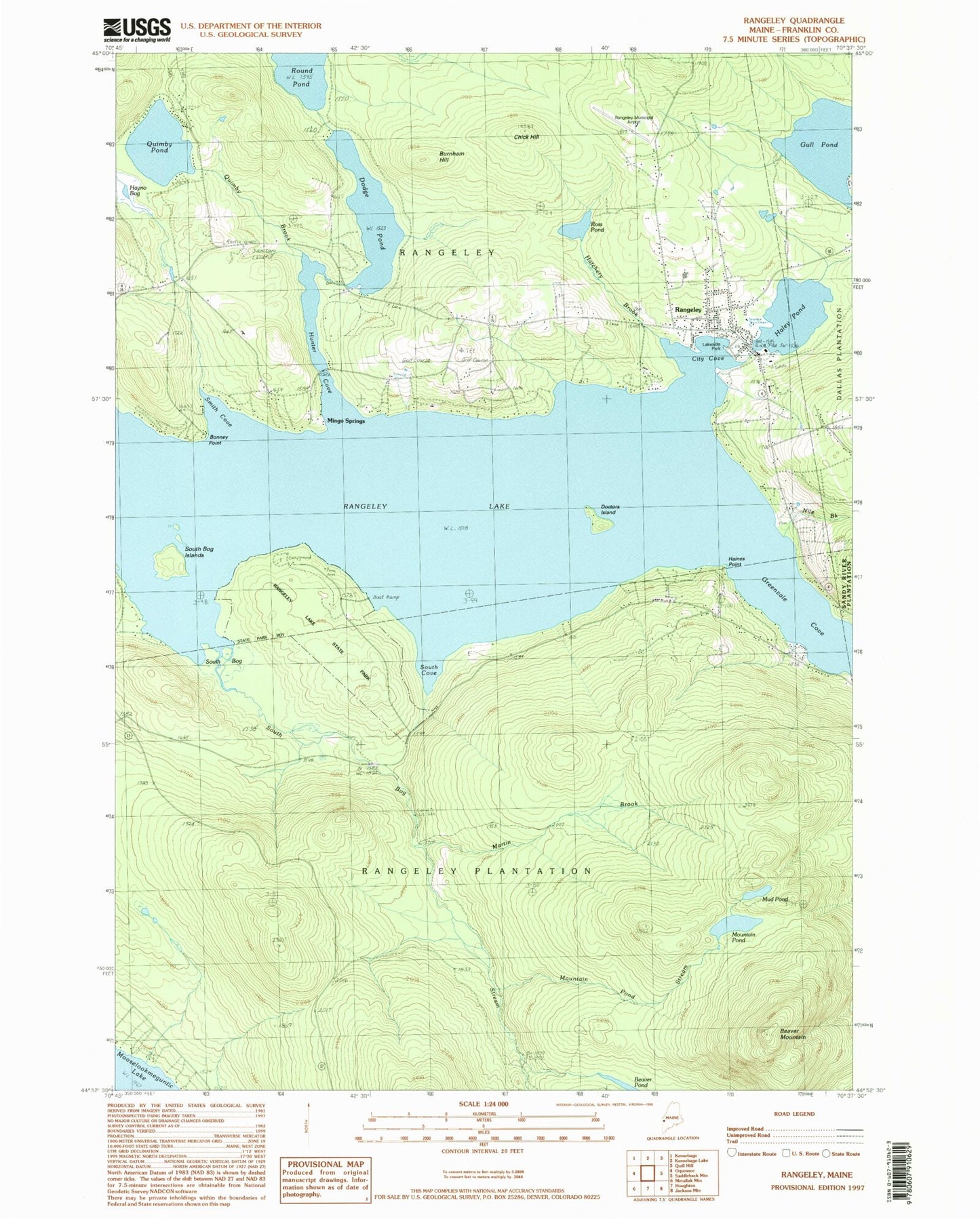
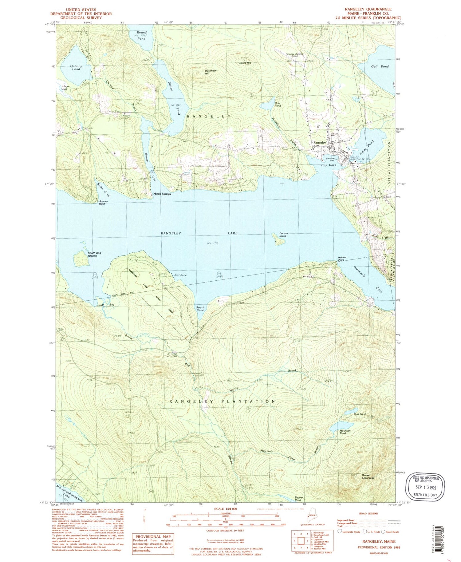
Classic USGS Rangeley Maine 7.5'x7.5' Topo Map
Couldn't load pickup availability
Historical USGS topographic quad map of Rangeley in the state of Maine. Typical map scale is 1:24,000, but may vary for certain years, if available. Print size: 24" x 27"
This quadrangle is in the following counties: Franklin.
The map contains contour lines, roads, rivers, towns, and lakes. Printed on high-quality waterproof paper with UV fade-resistant inks, and shipped rolled.
Contains the following named places: Beaver Mountain, Bonney Point, Burnham Hill, Chick Hill, City Cove, Maneskootuk Island, Dodge Pond, Greenvale Cove, Gull Pond, Haines Point, Haley Pond, Hatchery Brook, Hunter Cove, Martin Brook, Mingo Springs, Mountain Pond, Mountain Pond Stream, Mud Pond, Nile Brook, Quimby Brook, Quimby Pond, Rangeley, Rangeley Lake, Ross Pond, Round Pond, Smith Cove, South Bog, South Bog Islands, South Bog Stream, South Cove, Steven A. Bean Municipal Airport, Rangeley Lake Seaplane Base, Town of Rangeley, Plantation of Rangeley, Haley Pond Dam, Dodge Pond Dam, Church of the Good Shepherd, Hunter Cove Wildlife Sanctuary, Mingo Springs Golf Course, North Camps, Orgonon Museum, Rangeley Congregational Church, Rangeley Free Baptist Church, Rangeley Lakes Chamber of Commerce, Rangeley Lakes Region Historical Society, Rangeley Lakes Regional School, Rangeley Post Office, Rangeley Public Library, Rangeley Village Cemetery, Saint Luke Catholic Church, Sam-o-set Camps, Tranet Library, Wilhelm Reich Museum, Rangeley Fire Department, Northstar Emergency Medical Services Rangeley, Rangeley Police Department, Rangeley Census Designated Place, Beaver Mountain, Bonney Point, Burnham Hill, Chick Hill, City Cove, Maneskootuk Island, Dodge Pond, Greenvale Cove, Gull Pond, Haines Point, Haley Pond, Hatchery Brook, Hunter Cove, Martin Brook, Mingo Springs, Mountain Pond, Mountain Pond Stream, Mud Pond, Nile Brook, Quimby Brook, Quimby Pond, Rangeley, Rangeley Lake, Ross Pond, Round Pond, Smith Cove, South Bog, South Bog Islands, South Bog Stream, South Cove, Steven A. Bean Municipal Airport, Rangeley Lake Seaplane Base, Town of Rangeley, Plantation of Rangeley, Haley Pond Dam, Dodge Pond Dam, Church of the Good Shepherd, Hunter Cove Wildlife Sanctuary, Mingo Springs Golf Course, North Camps, Orgonon Museum, Rangeley Congregational Church, Rangeley Free Baptist Church, Rangeley Lakes Chamber of Commerce, Rangeley Lakes Region Historical Society, Rangeley Lakes Regional School, Rangeley Post Office, Rangeley Public Library, Rangeley Village Cemetery, Saint Luke Catholic Church, Sam-o-set Camps, Tranet Library, Wilhelm Reich Museum, Rangeley Fire Department, Northstar Emergency Medical Services Rangeley, Rangeley Police Department, Rangeley Census Designated Place