MyTopo
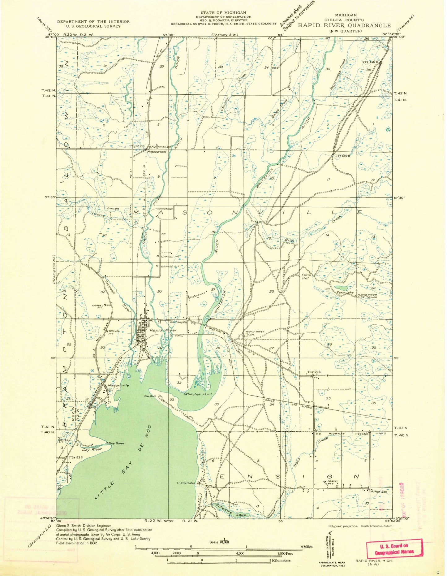
Classic USGS Rapid River Michigan 7.5'x7.5' Topo Map
Couldn't load pickup availability
Historical USGS topographic quad map of Rapid River in the state of Michigan. Map scale may vary for some years, but is generally around 1:24,000. Print size is approximately 24" x 27"
This quadrangle is in the following counties: Delta.
The map contains contour lines, roads, rivers, towns, and lakes. Printed on high-quality waterproof paper with UV fade-resistant inks, and shipped rolled.
Contains the following named places: Alton, Berg Creek, Bills Creek, Calvary Lutheran Church, Chippeny Creek, Congregational Church, Days River, Dillabough Creek, Ensign Township Fire Department, Farm Lake, Ferguson Creek, Garth, Garth Point, Garth Point Cemetery, Garth Post Office, Haymeadow Creek, Haymeadow Gravel Pit, Indian Trail Historical Marker, Inman Creek, Laraby Creek, Maplewood, Masonville, Masonville Emergency Medical Services, Masonville Post Office, Masonville Station, Masonville Township Volunteer Fire Department, McLeod Grave, Rapid River, Rapid River Cemetery, Rapid River Census Designated Place, Rapid River High School, Rapid River Lookout Tower, Rapid River Post Office, Rapid River Public Schools, Rapid River Station, Saint Charles Borromeo Church, Schaawe Lake, Tacoosh River, Ten Dollar Creek, Unites States Forest Service Hiawatha National Forest Rapid River Ranger Station, Vagabond Resort and Campground, Whispering Valley Camp Ground, Whitefish Hill RV and Mobile Home Park, Whitefish Point, Whitefish River