MyTopo
Classic USGS Raquette River New York 7.5'x7.5' Topo Map
Couldn't load pickup availability
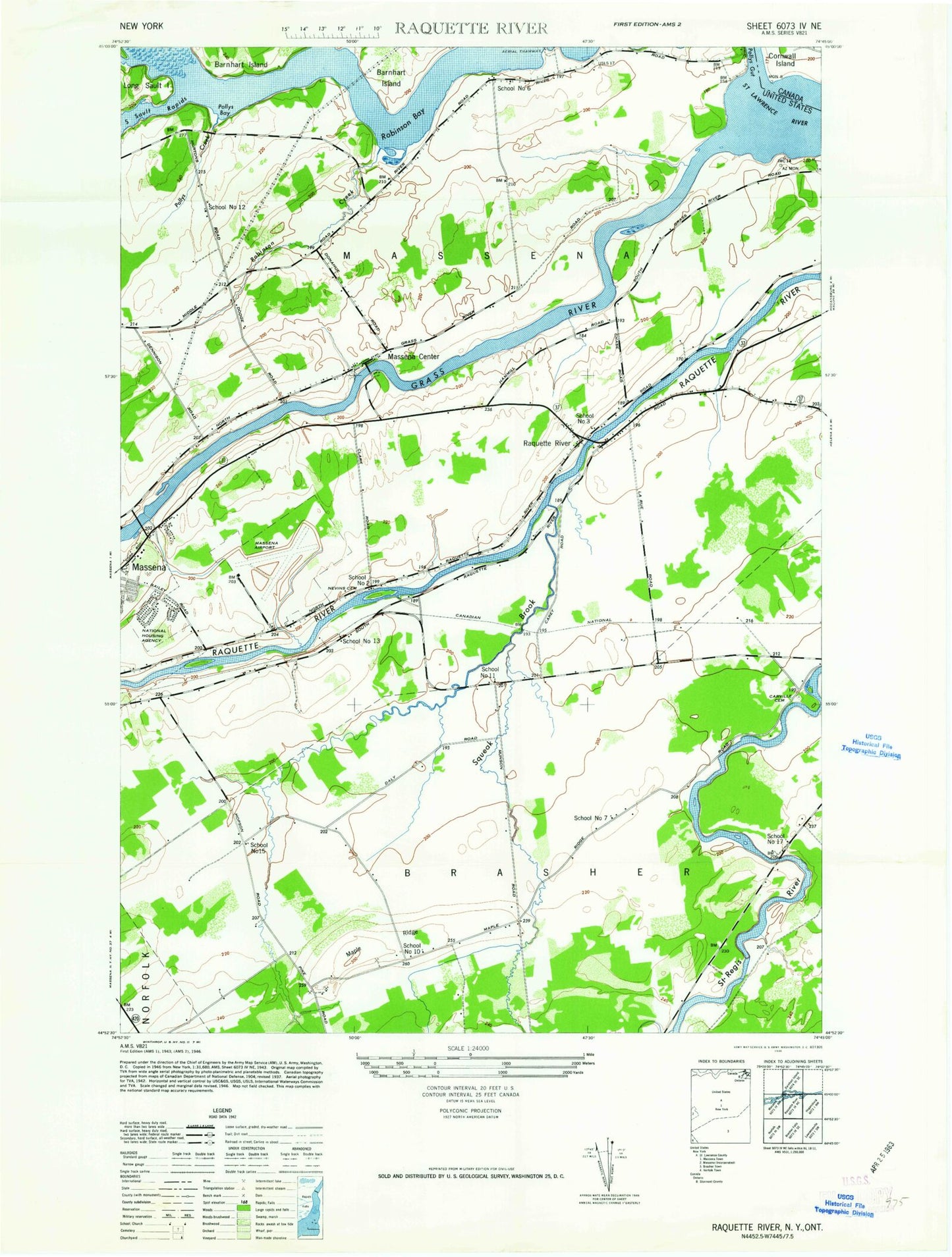
Historical USGS topographic quad map of Raquette River in the state of New York. Map scale may vary for some years, but is generally around 1:24,000. Print size is approximately 24" x 27"
This quadrangle is in the following counties: St. Lawrence.
The map contains contour lines, roads, rivers, towns, and lakes. Printed on high-quality waterproof paper with UV fade-resistant inks, and shipped rolled.
Contains the following named places: Barnhart Island Bridge, Carville Cemetery, Dike Number Four, Dike Number Three, Earls Creek, Eisenhower Lock, Fox Hill Golf and Country Club, Grass River, Hawkins Point Lookout, Highland Nursing Home, Jefferson Elementary School, Kingdom Hall of Jehovahs Witnesses, Long Sault Dam, Long Sault Islands, Long Sault Lookout, Maple Ridge, Massena Center, Massena Center Cemetery, Massena International Airport-Richards Field, Massena Rescue Squad, Massena Village Wastewater Treatment Plant, Massena Volunteer Emergency Unit, Nevins Cemetery, Polly Gut, Pollys Bay, Pollys Creek, Raquette River, Raquette River Bridge, Reed Cemetery, Robinson Bay, Robinson Creek, RT Seaway Eisenhower Vessel Traffic Control, Saint Joseph Roman Catholic Church, Saint Josephs School, Saint Lawrence Center Shopping Center, Saint Lawrence State Forest Number 10, Saint Lawrence State Forest Number 6, Saint Lawrence State Park, School Number 10, School Number 11, School Number 12, School Number 13, School Number 15, School Number 17, School Number 2, School Number 3, School Number 6, School Number 7, Snell Lock, Squeak Brook, Sunset Drive-In, Town of Massena, Twin River School, West Branch Squeak Brook, Wiley Dondero Canal