MyTopo
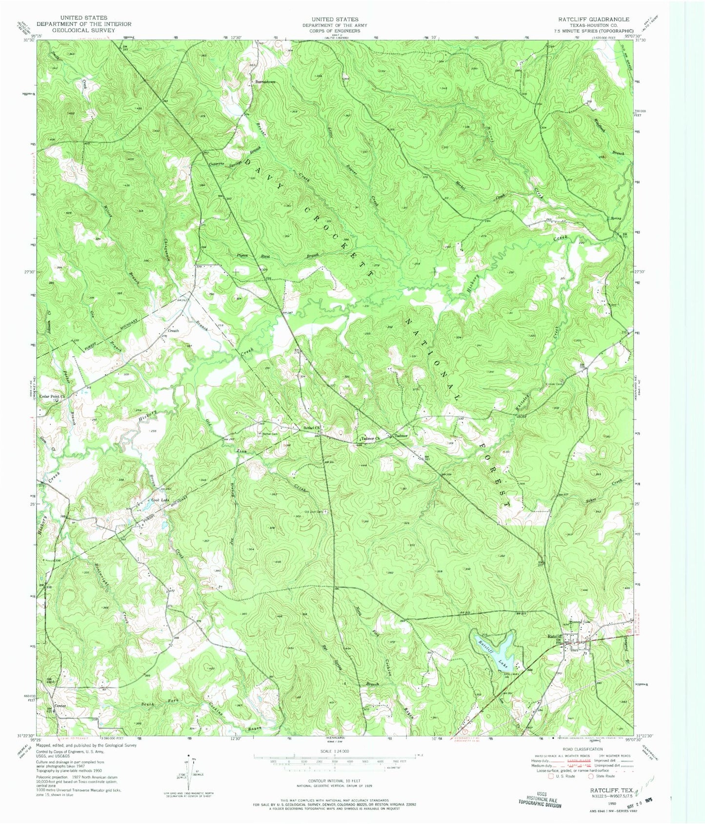
Classic USGS Ratcliff Texas 7.5'x7.5' Topo Map
Couldn't load pickup availability
Historical USGS topographic quad map of Ratcliff in the state of Texas. Typical map scale is 1:24,000, but may vary for certain years, if available. Print size: 24" x 27"
This quadrangle is in the following counties: Houston.
The map contains contour lines, roads, rivers, towns, and lakes. Printed on high-quality waterproof paper with UV fade-resistant inks, and shipped rolled.
Contains the following named places: Beaver Creek, Bethel Cemetery, Bethel Church, Boatwright Creek, Brown Creek, Burrantown, Cedar Point Church, Center, Chinguapin Branch, Conner Cemetery, Cook Lake, Copperas Springs Branch, Creath, Gin Branch, Joe Branch, Little Beaver Creek, Merkel Creek, Old Zion Cemetery, Old Zion Creek, Pigeon Roost Branch, Ratcliff, Ratcliff Lake, Rye Spring Branch, Sikes Creek, Tadmor, Tadmor Church, Whiteley Creek, Wilcox Branch, Windbush Branch, Smith Creek, Gum Creek, Johnson Creek, Parker Branch, Rosy Bayou, Walnut Creek, Camp Four (historical), Old Cemetery, Ratcliff Baptist Church, Mill School (historical), Ratcliff Depot (historical), Kennard Mills (historical), Sulphur Springs School Number 4 (historical), Center Hill Methodist Church, Tadmor School (historical), Blue Lake, Adeline Springs, Wallace Springs, Vaughn Family Graves, Cross Roads School (historical), Wilcox Branch and Chinquapin Merge, Moffit Creath Cemetery, Parker Private School (historical), Bethel Methodist Church, Lone Star Private School, Old Cemetery, Tadmor School, Red Lick Ford, Center Ridge School (historical), Brent Cemetery, Patton Family Graves, Copperas Spring School (historical), Copperas Springs Missionary Baptist Church, Old Patton Cemetery, W.D. McKinney Cotton Gin (historical), Center Hill, Harrison Town, Pond Camp, Ratcliff Lake Recreation Site, Walnut Creek Camp, Creath Post Office (historical), Ratcliff Dam, Ratcliff Lake Trail, Ratcliff Post Office, Beaver Creek, Bethel Cemetery, Bethel Church, Boatwright Creek, Brown Creek, Burrantown, Cedar Point Church, Center, Chinguapin Branch, Conner Cemetery, Cook Lake, Copperas Springs Branch, Creath, Gin Branch, Joe Branch, Little Beaver Creek, Merkel Creek, Old Zion Cemetery, Old Zion Creek, Pigeon Roost Branch, Ratcliff, Ratcliff Lake, Rye Spring Branch, Sikes Creek, Tadmor, Tadmor Church, Whiteley Creek, Wilcox Branch, Windbush Branch, Smith Creek, Gum Creek, Johnson Creek, Parker Branch, Rosy Bayou, Walnut Creek, Camp Four (historical), Old Cemetery, Ratcliff Baptist Church, Mill School (historical), Ratcliff Depot (historical), Kennard Mills (historical), Sulphur Springs School Number 4 (historical), Center Hill Methodist Church, Tadmor School (historical), Blue Lake, Adeline Springs, Wallace Springs, Vaughn Family Graves, Cross Roads School (historical), Wilcox Branch and Chinquapin Merge, Moffit Creath Cemetery, Parker Private School (historical), Bethel Methodist Church, Lone Star Private School, Old Cemetery, Tadmor School, Red Lick Ford, Center Ridge School (historical), Brent Cemetery, Patton Family Graves, Copperas Spring School (historical), Copperas Springs Missionary Baptist Church, Old Patton Cemetery, W.D. McKinney Cotton Gin (historical), Center Hill, Harrison Town, Pond Camp, Ratcliff Lake Recreation Site, Walnut Creek Camp, Creath Post Office (historical), Ratcliff Dam, Ratcliff Lake Trail, Ratcliff Post Office


