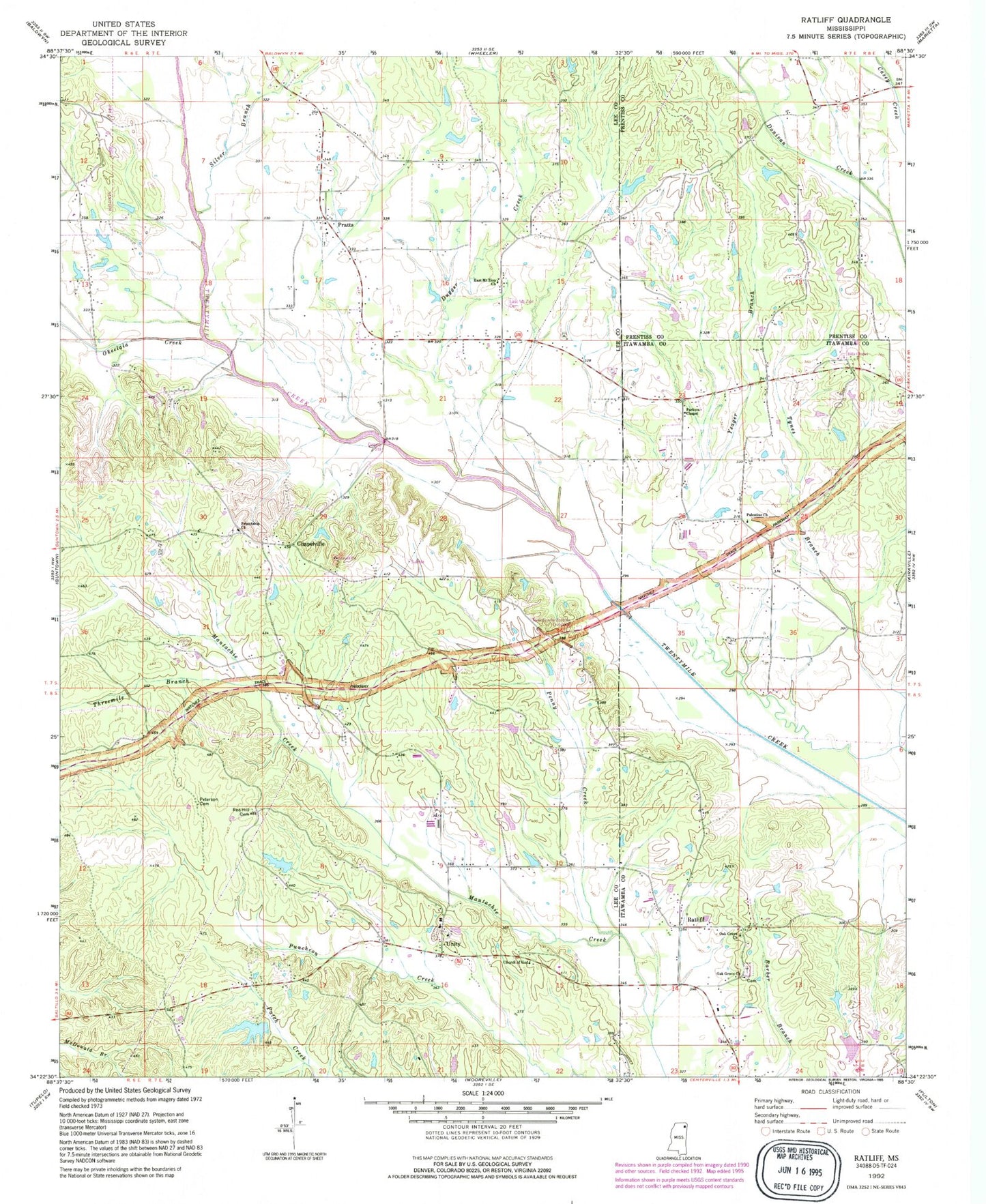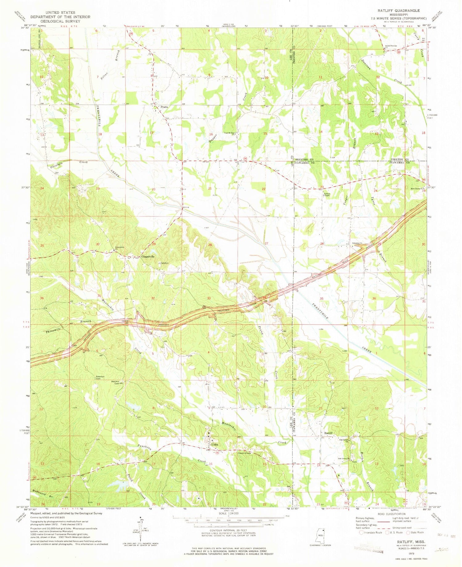
MyTopo
Classic USGS Ratliff Mississippi 7.5'x7.5' Topo Map
Couldn't load pickup availability
Historical USGS topographic quad map of Ratliff in the state of Mississippi. Map scale may vary for some years, but is generally around 1:24,000. Print size is approximately 24" x 27"
This quadrangle is in the following counties: Itawamba, Lee, Prentiss.
The map contains contour lines, roads, rivers, towns, and lakes. Printed on high-quality waterproof paper with UV fade-resistant inks, and shipped rolled.
Contains the following named places: Carnes School, Chapelville, Church of God, Dugger Creek, East Mount Zion Church, Franklin Nichols Pond Dam, Friendship Cemetery, Friendship Church, Horton-Bailey Cemetery, New Dawn Church, Oak Grove Cemetery, Oak Grove Church, Okeelala Creek, Old Friendship Cemetery, Palestine Church, Palestine School, Parkers Chapel, Penny Creek, Peterson Cemetery, Plumorchard Branch, Pratt School, Pratts, Pratts Cemetery, Pratts Church, Pritchard Lake Dam, Ratliff, Red Hill Cemetery, Red Hill School, Silver Branch, South Prentiss Church, South Prentiss School, Supervisor District 1, Tennelue Cemetery, Tennie Lou Church, Threemile Branch, Unity, Unity Cemetery, Unity Church, Whitley School, Yeager Branch