MyTopo
Classic USGS Rattle Run Michigan 7.5'x7.5' Topo Map
Couldn't load pickup availability
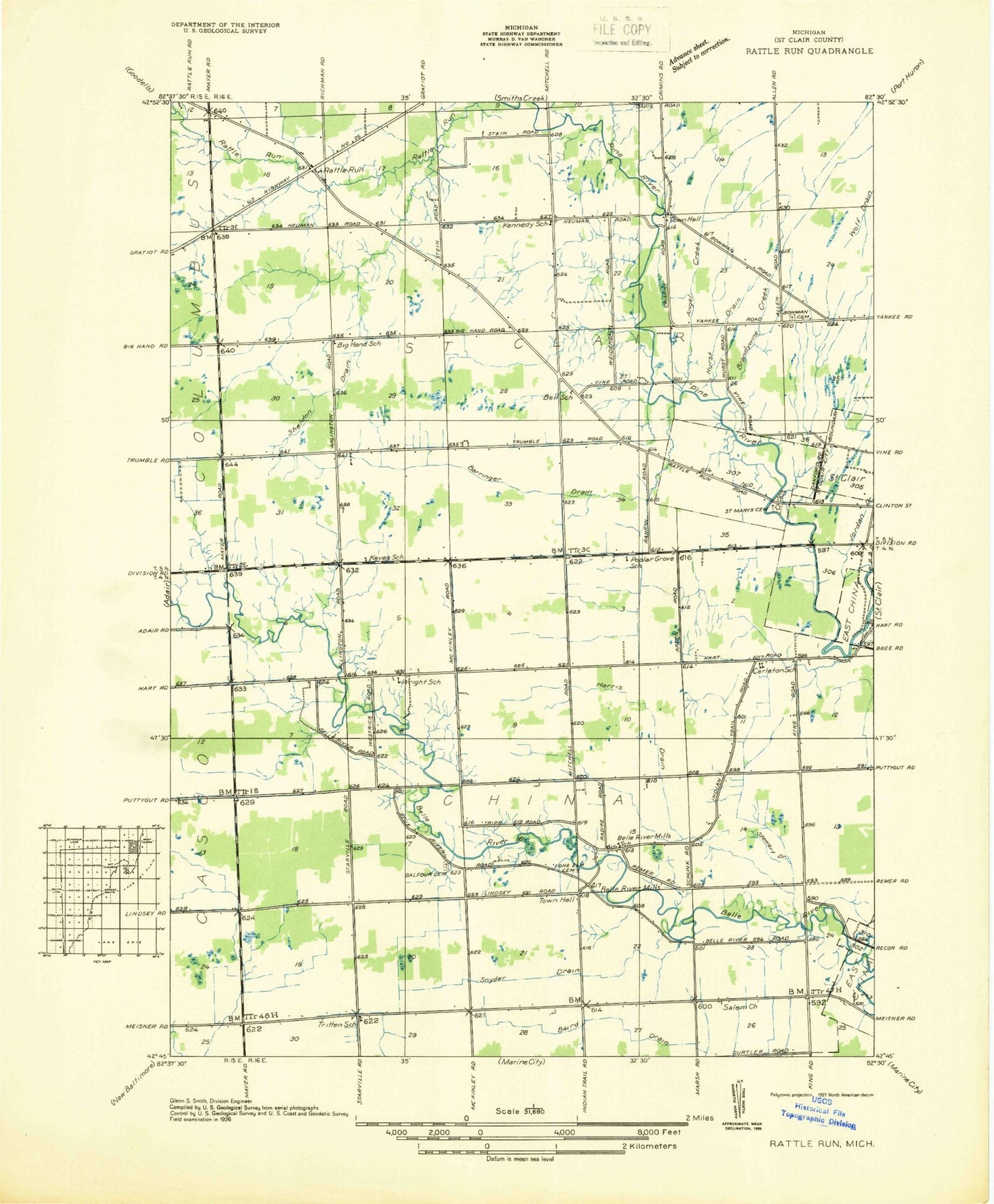
Historical USGS topographic quad map of Rattle Run in the state of Michigan. Map scale may vary for some years, but is generally around 1:24,000. Print size is approximately 24" x 27"
This quadrangle is in the following counties: St. Clair.
The map contains contour lines, roads, rivers, towns, and lakes. Printed on high-quality waterproof paper with UV fade-resistant inks, and shipped rolled.
Contains the following named places: Adair Gas and Oil Field, Angel Creek, Balfour Cemetery, Barringer Drain, Belle River Mills, Belle River Mills Gas Storage Area, Big Hand Drain, Bowman Cemetery, Bowman Drain, Brandywine Creek, Camp Hawthorn, Camp Otsikea, Cooper Drain, Crossroads Community Church, Crystal Airport, David's Landing, East China School, Eschenburg Drain, First Baptist Church, Gearing Elementary School, Harris Drain, Hextell Drain, Hurst Drain, Jehovah's Witnesses, Jordan Creek, Kreusel Drain, Layle Rabbins Drain, Mackley Drain, Milton J Gearing School, Moak Drain, Pauly Drain, Pine River School, Rattle Run, Rattle Run Cemetery, Rattlerun Post Office, Saint Clair High School, Saint Clair Landing Shopping Center, Saint Clair Place Mobile Home Park, Saint Clair Police Department, Saint Marys Cemetery, Salem Church, Schneider China Drain, Sheldon Drain, Township of China, Township of Saint Clair, Wenning Landing Area, Wolf Drain, ZIP Codes: 48054, 48079