MyTopo
Classic USGS Rattlesnake Springs Washington 7.5'x7.5' Topo Map
Regular price
$16.95
Regular price
Sale price
$16.95
Unit price
per
Couldn't load pickup availability
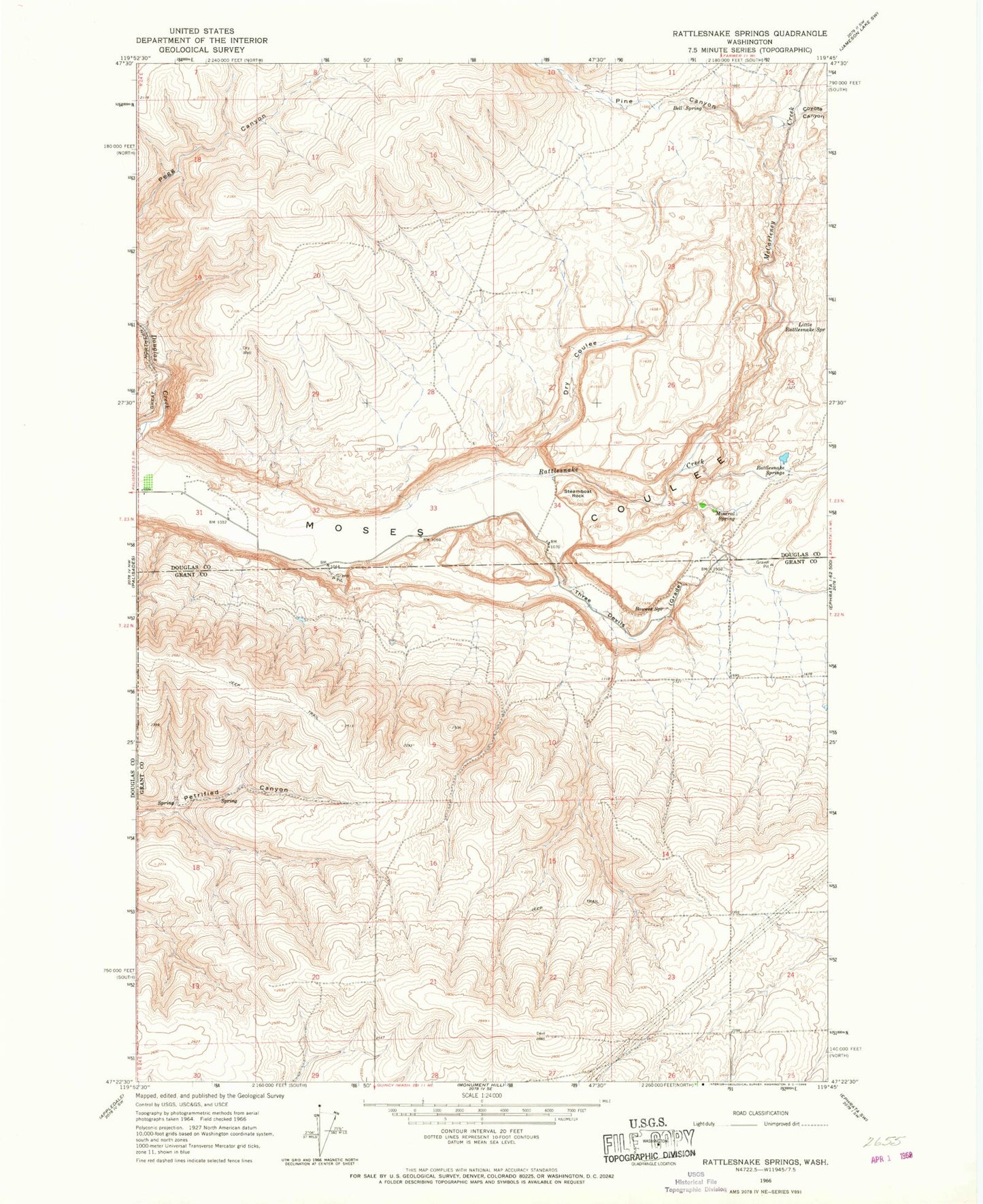
Historical USGS topographic quad map of Rattlesnake Springs in the state of Washington. Map scale may vary for some years, but is generally around 1:24,000. Print size is approximately 24" x 27"
This quadrangle is in the following counties: Douglas, Grant.
The map contains contour lines, roads, rivers, towns, and lakes. Printed on high-quality waterproof paper with UV fade-resistant inks, and shipped rolled.
Contains the following named places: Bell Spring, Billingsley Dam, Bowers Spring, Coyote Canyon, Dry Coulee, Little Rattlesnake Spring, Lower Rimrock Dam, McCarteney Creek, Mineral Spring, Pine Canyon, Pinto Ridge, Rattlesnake Creek, Rattlesnake Springs, Steamboat Rock, Three Devils