MyTopo
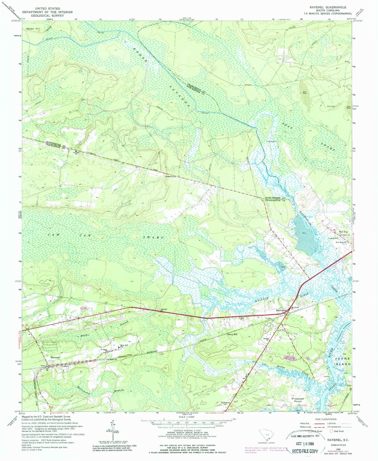
Classic USGS Ravenel South Carolina 7.5'x7.5' Topo Map
Couldn't load pickup availability
Historical USGS topographic quad map of Ravenel in the state of South Carolina. Map scale may vary for some years, but is generally around 1:24,000. Print size is approximately 24" x 27"
This quadrangle is in the following counties: Charleston, Dorchester.
The map contains contour lines, roads, rivers, towns, and lakes. Printed on high-quality waterproof paper with UV fade-resistant inks, and shipped rolled.
Contains the following named places: Bear Swamp, Berry Hill, Bethel Church, Caw Caw Swamp, Charleston County Sheriff's Office, Davidson-Moberry School, E B Ellington Elementary School, First Baptist Church of Ravenel, Fishburne Creek, Horse Savanna, Hughes Cemetery, Jordan Missionary Baptist Church, Log Bridge Creek, Mellichamp Branch, Middle Branch, Miley Hill School, Miller School, Mount Olivet Church, New Hope Church, Pentecostal Church, Pleasant Point, Point Pleasant, Rantowles, Rantowles School, Raven Hill, Ravenel Post Office, Ravenel School, Red Hill Church, Roper Run Church, Saint Johns Church, Saint Marks Church, Saint Matthews Church, Saint Pauls Church, Saint Paul's Fire Department, Saint Paul's Fire Department Station 2, Saint Paul's Fire Department Station 4, Sauldam Baptist Church, Stono Ferry Golf Course, Tomb of Colonel William Washington, Town of Hollywood, Town of Ravenel, Wallace Creek, WMGL-FM (Ravenel)