MyTopo
Classic USGS Rayo Hills New Mexico 7.5'x7.5' Topo Map
Regular price
$16.95
Regular price
Sale price
$16.95
Unit price
per
Couldn't load pickup availability
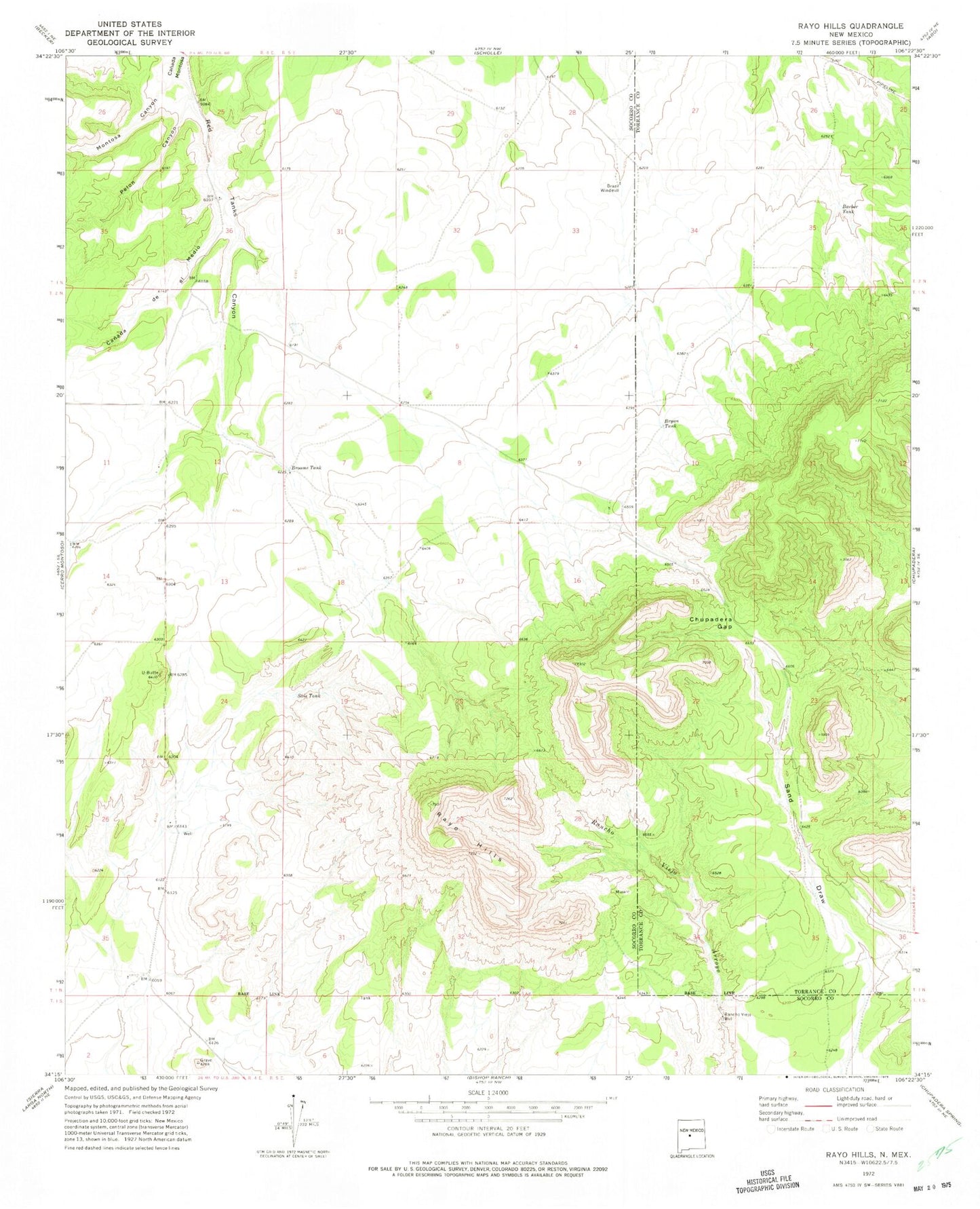
Historical USGS topographic quad map of Rayo Hills in the state of New Mexico. Map scale may vary for some years, but is generally around 1:24,000. Print size is approximately 24" x 27"
This quadrangle is in the following counties: Socorro, Torrance.
The map contains contour lines, roads, rivers, towns, and lakes. Printed on high-quality waterproof paper with UV fade-resistant inks, and shipped rolled.
Contains the following named places: Barber Tank, Brazil Windmill, Broome Tank, Bryan Tank, Canada de el Medio, Chupadera Gap, Iron King, Montosa Canyon, Pelon Canyon, Rancho Viejo Well, Rayo Hills, Red Tanks Canyon, Sais Tank, U-Butte