MyTopo
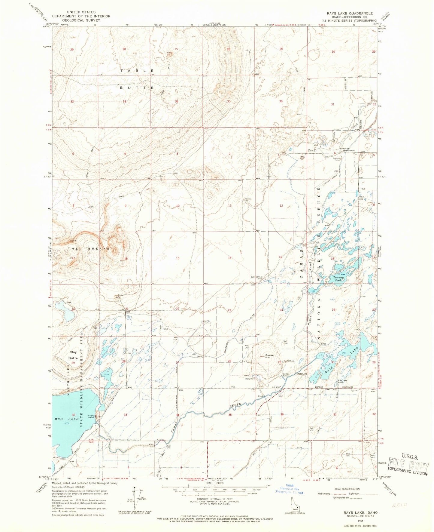
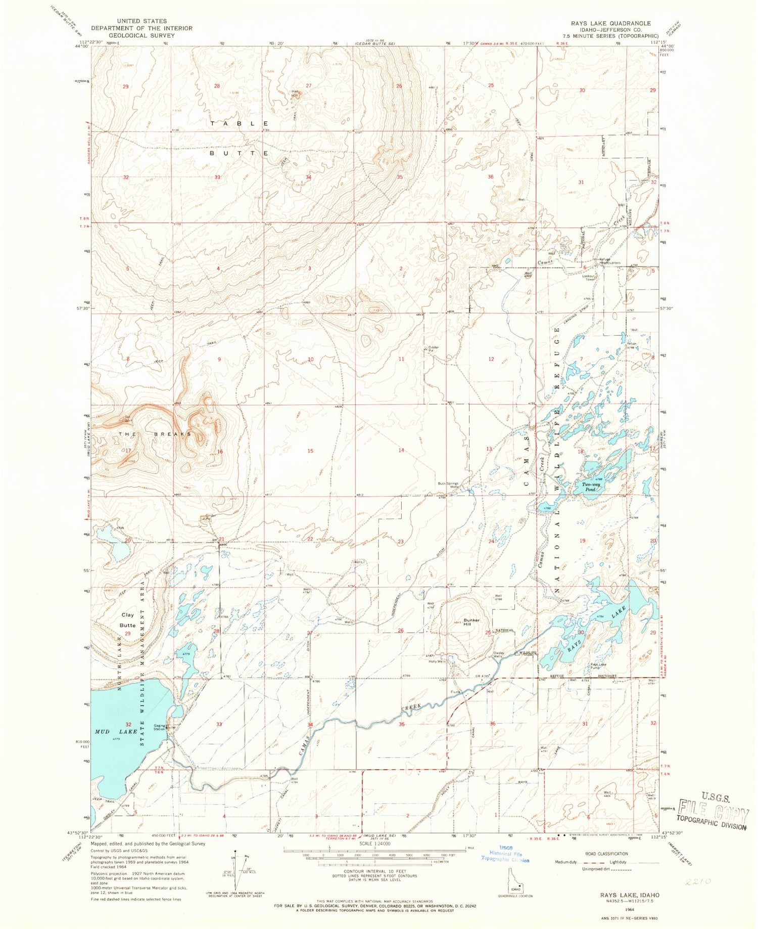
Classic USGS Rays Lake Idaho 7.5'x7.5' Topo Map
Couldn't load pickup availability
Historical USGS topographic quad map of Rays Lake in the state of Idaho. Map scale may vary for some years, but is generally around 1:24,000. Print size is approximately 24" x 27"
This quadrangle is in the following counties: Jefferson.
The map contains contour lines, roads, rivers, towns, and lakes. Printed on high-quality waterproof paper with UV fade-resistant inks, and shipped rolled.
Contains the following named places: Buck Springs Wells, Bunker Hill, Camas Creek, Camas National Wildlife Refuge, Camas National Wildlife Refuge Headquarters, Clay Butte, Holly Wells, Independent Ditch, Leavitz Pond, Mallard Slough, Muskrat Pond, Owsley Wells, Rays Lake, Rays Lake Canal, Rays Lake Pump, Table Butte, The Breaks, Two-way Pond