
MyTopo
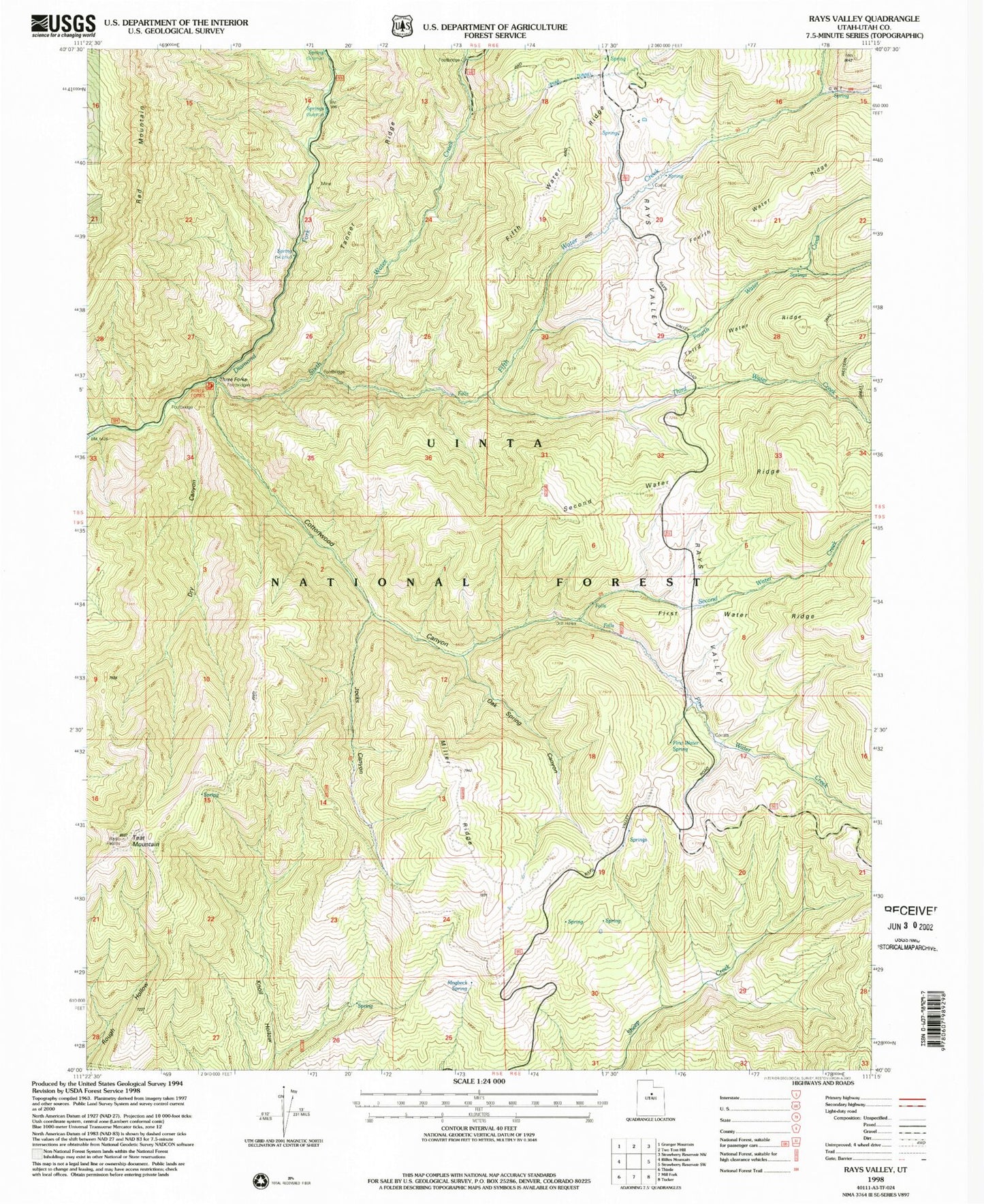
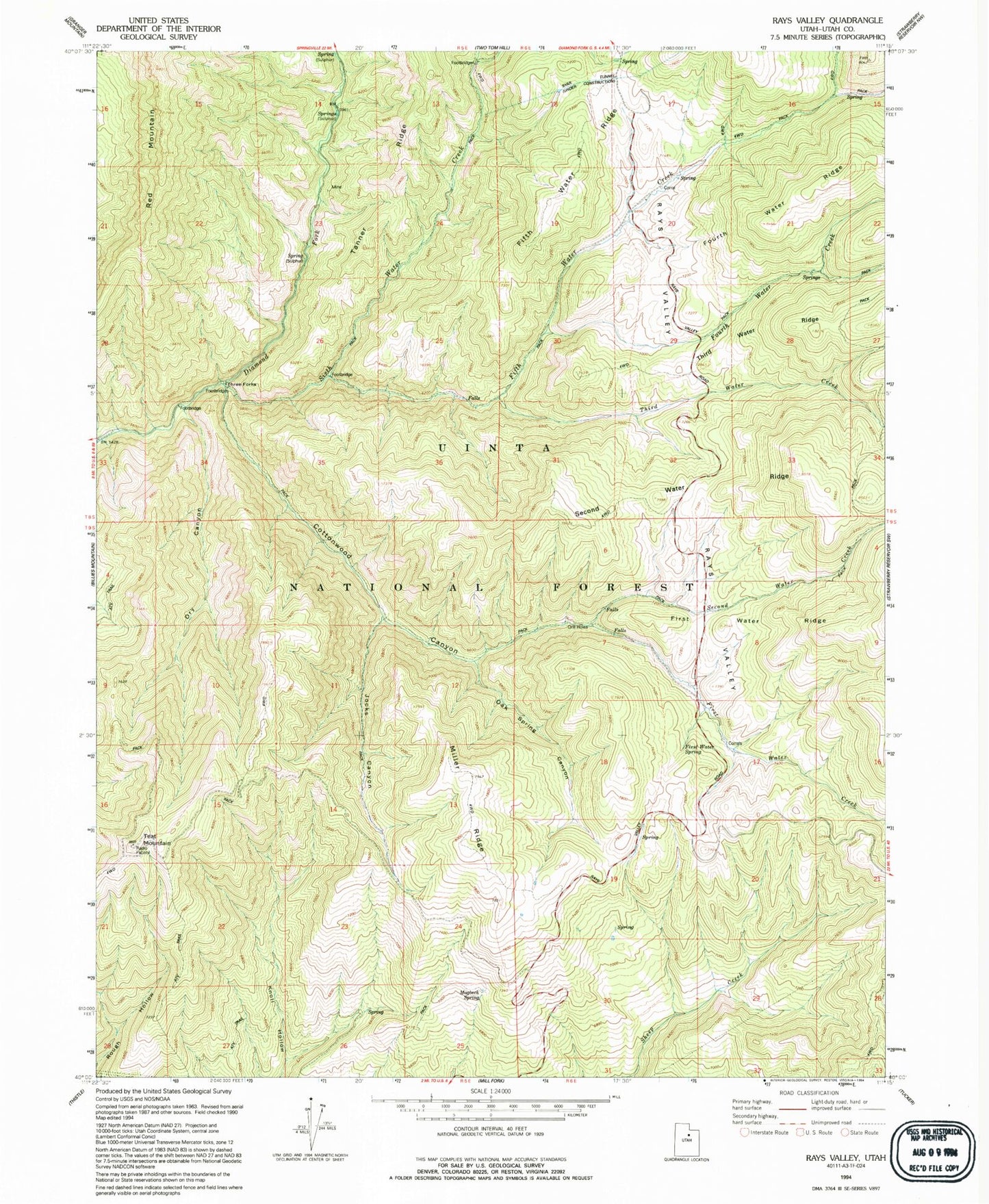
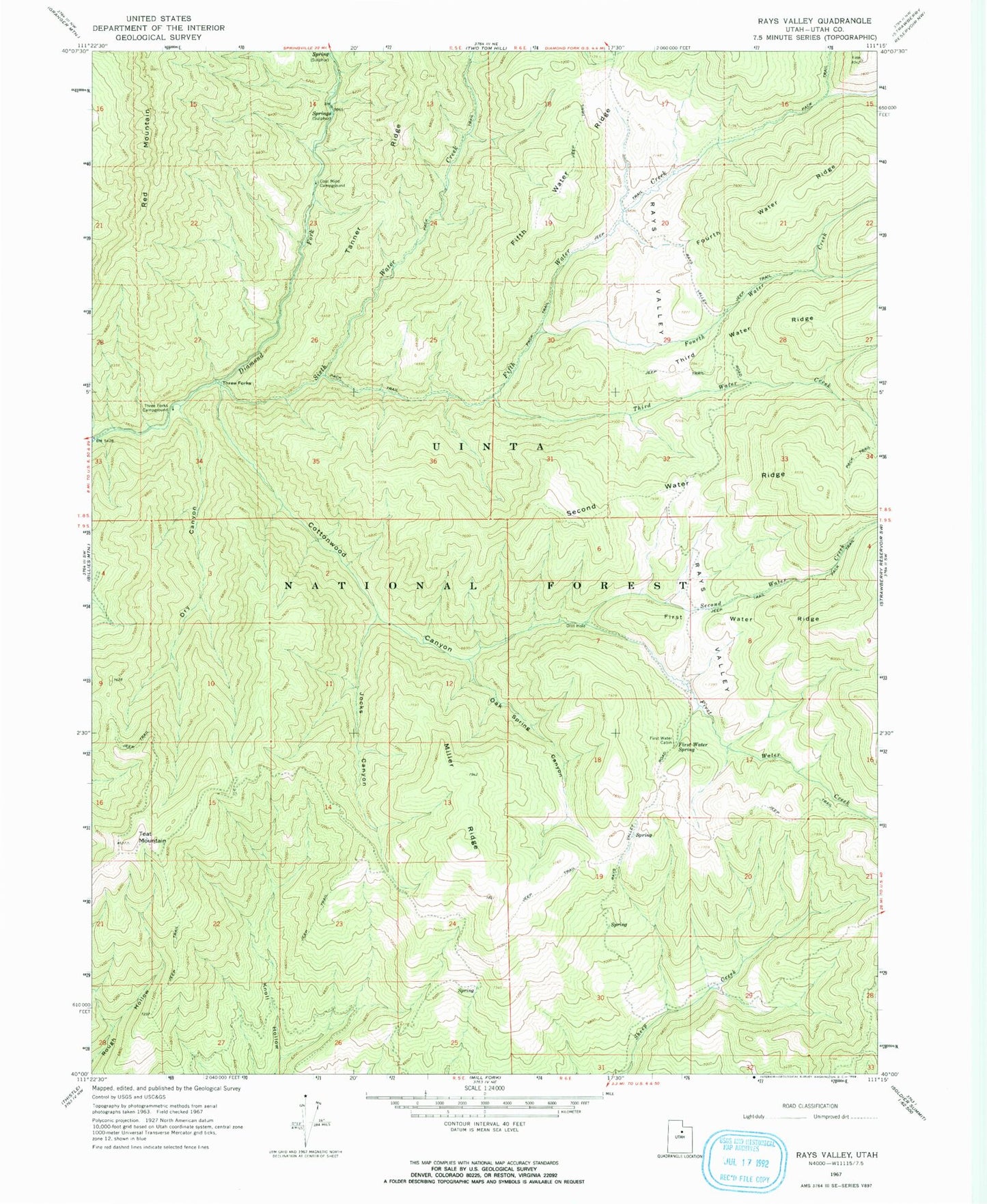
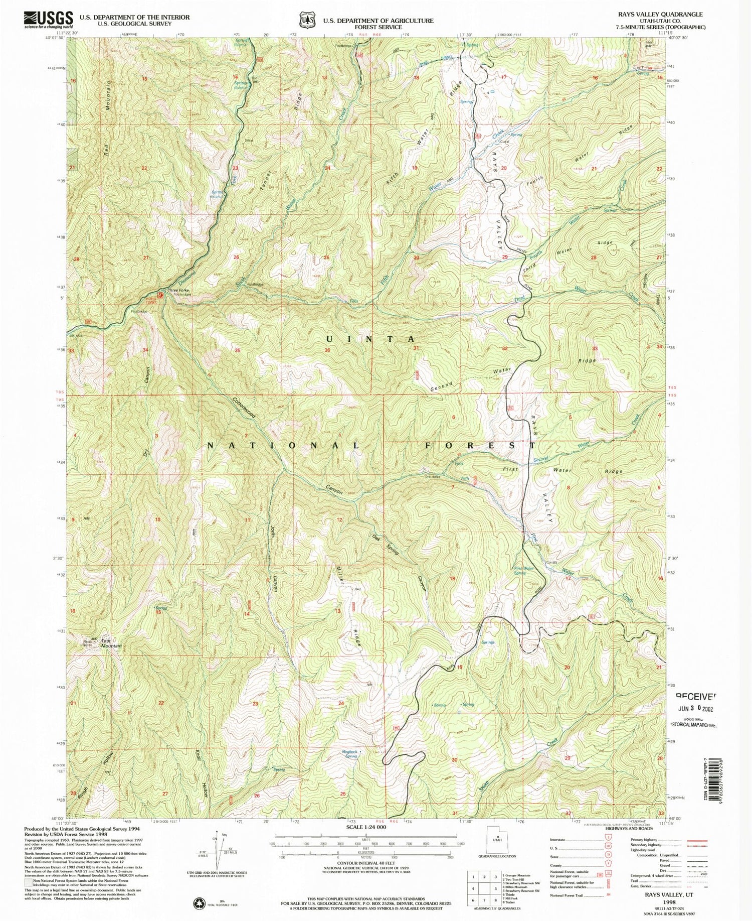
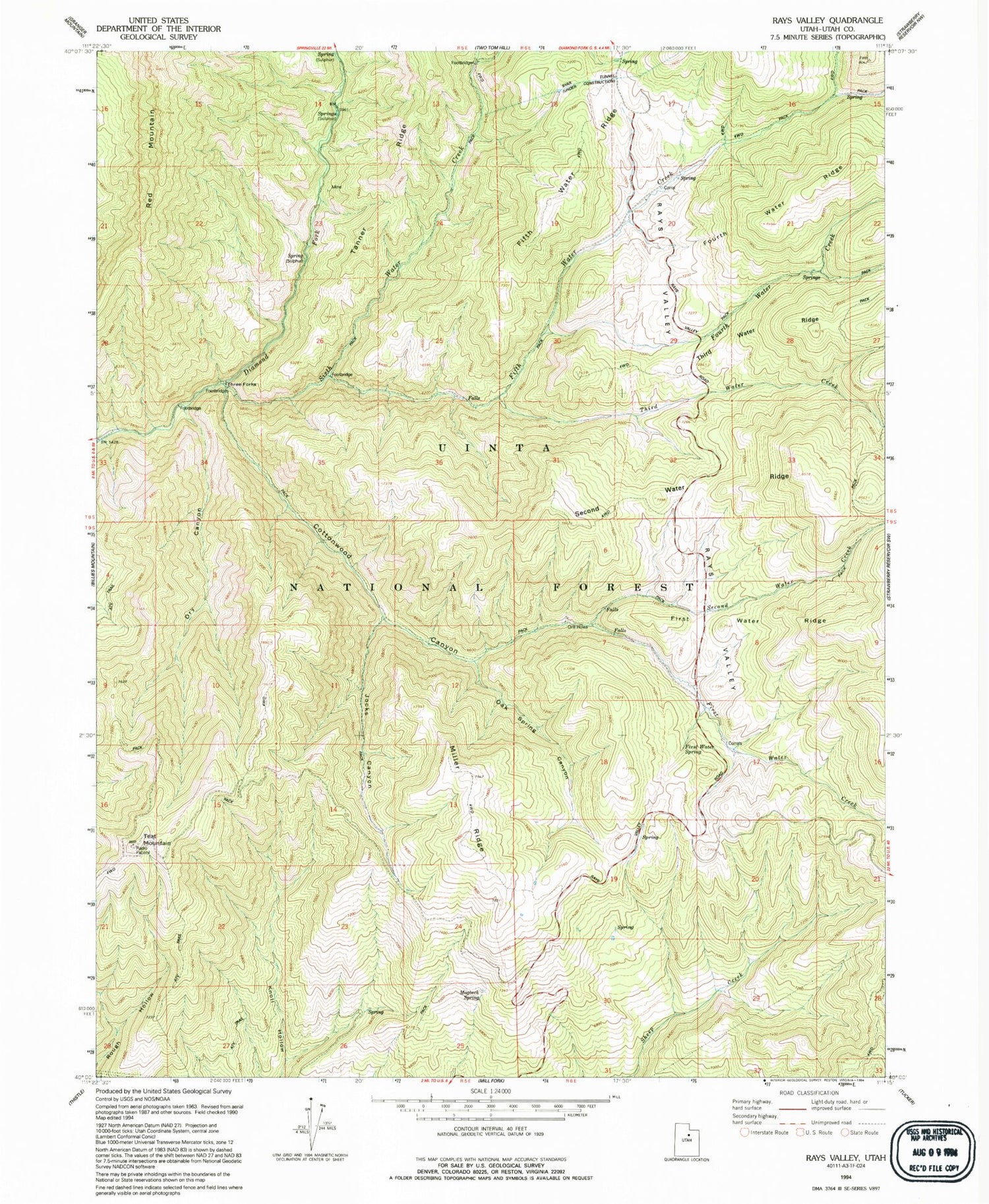
Classic USGS Rays Valley Utah 7.5'x7.5' Topo Map
Couldn't load pickup availability
Historical USGS topographic quad map of Rays Valley in the state of Utah. Map scale may vary for some years, but is generally around 1:24,000. Print size is approximately 24" x 27"
This quadrangle is in the following counties: Utah.
The map contains contour lines, roads, rivers, towns, and lakes. Printed on high-quality waterproof paper with UV fade-resistant inks, and shipped rolled.
Contains the following named places: Coal Mine Campground, Cottonwood Canyon, Dry Canyon, Fifth Water Creek, First Water Cabin, First Water Creek, First Water Ridge, First Water Spring, Fourth Water Creek, Jocks Canyon, Miller Ridge, Mogbeck Spring, Oak Spring Canyon, Rays Valley, Second Water Creek, Second Water Ridge, Sixth Water Creek, Springville-Mapleton Division, Teat Mountain, Third Water Creek, Three Forks, Three Forks Campground