MyTopo
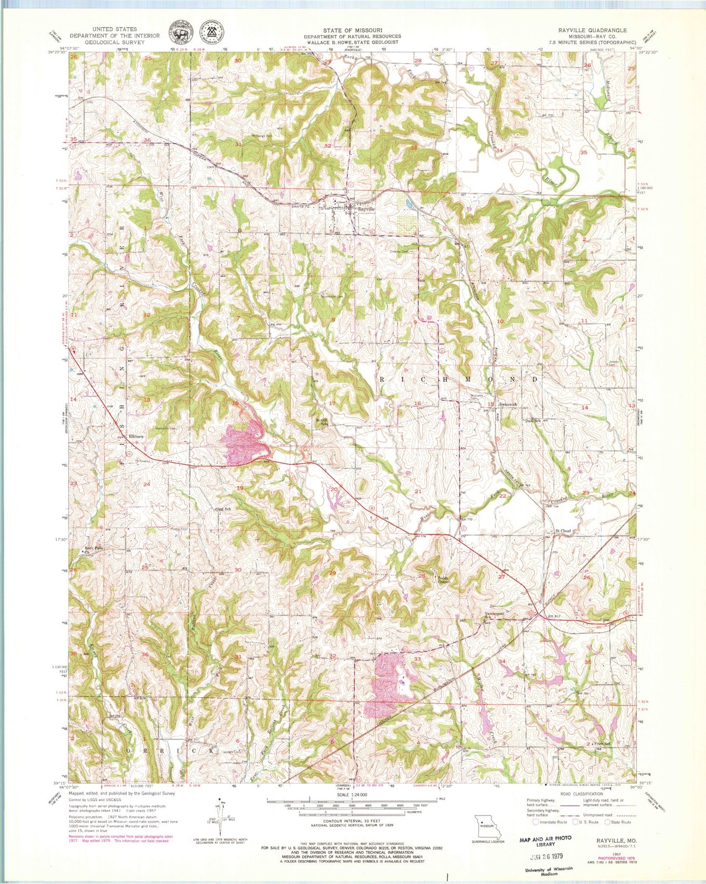
Classic USGS Rayville Missouri 7.5'x7.5' Topo Map
Couldn't load pickup availability
Historical USGS topographic quad map of Rayville in the state of Missouri. Typical map scale is 1:24,000, but may vary for certain years, if available. Print size: 24" x 27"
This quadrangle is in the following counties: Ray.
The map contains contour lines, roads, rivers, towns, and lakes. Printed on high-quality waterproof paper with UV fade-resistant inks, and shipped rolled.
Contains the following named places: Crowley Cemetery, Dale School, Fitch School, Gordan Cemetery, Hamilton Cemetery, Jacobs Cemetery, McGaugh Cemetery, McGill School, Ogg School, Pettus Cemetery, Rock Falls Church, Sanderson Cemetery, Todds Chapel, Vanderpool School, Williams Cemetery, Elkhorn, Rayville, Rocky Fork, Saint Cloud, Swanwick, Turnage School (historical), Sanderson School (historical), Oggs Mill, Willow Creek Watershed Dam A-30, Ray A-246 Lake, Willow Creek Watershed Dam A-22, Swofford Lake, Willow Creek Watershed Dam A-24b, Ray County Number A-24b Lake, Willow Creek Watershed Dam A-23, Vandiver and Barchers Number A-2 Reservoir, Willow Creek Watershed Dam A-28, Willow Creek Watershed Dam A-24a, Willow Creek Watershed Dam A-26, Willow Creek Watershed Dam B-22, Village of Rayville (historical), Elkhorn Elementary School, Rayville Census Designated Place, Rayville Post Office