MyTopo
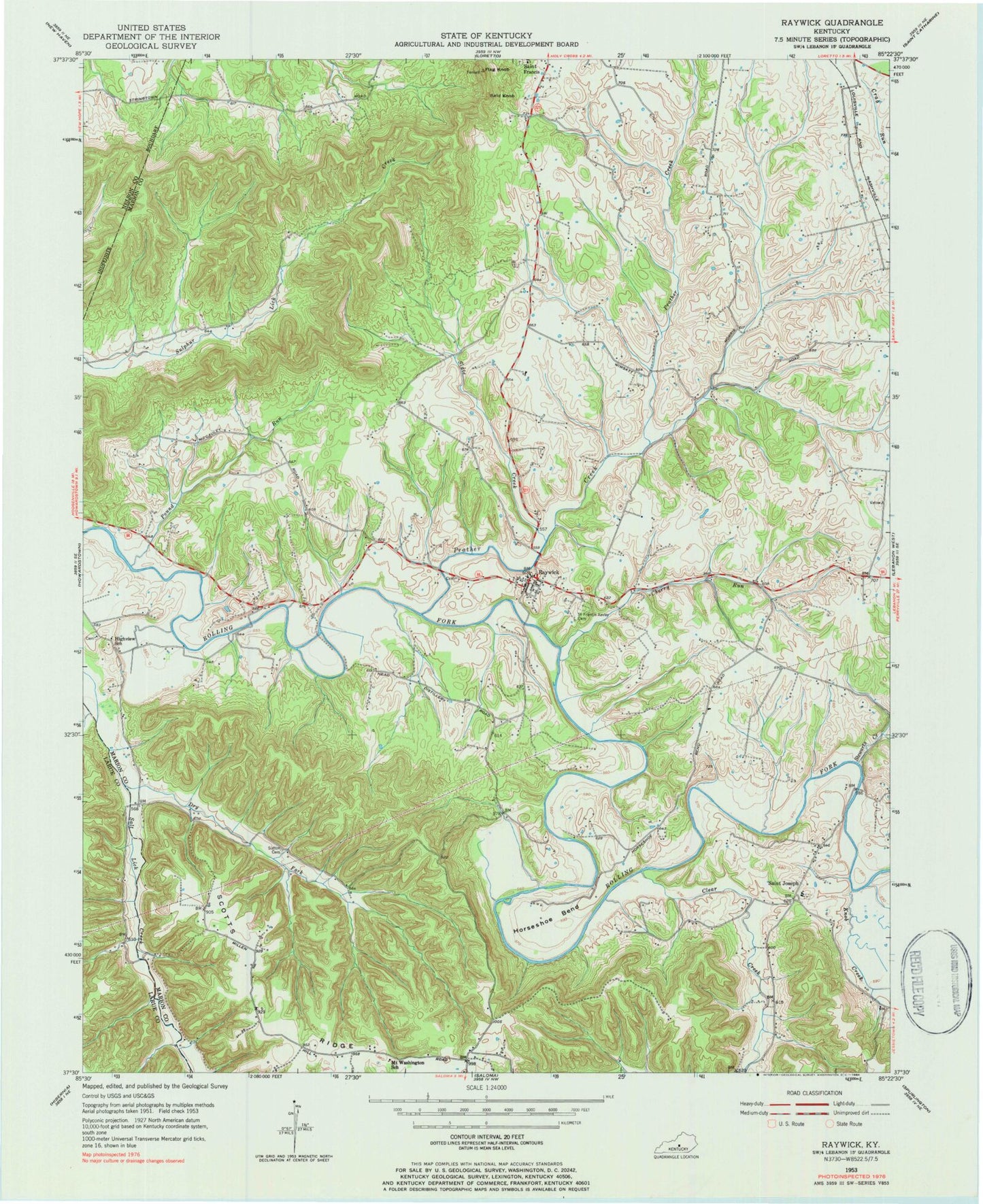
Classic USGS Raywick Kentucky 7.5'x7.5' Topo Map
Couldn't load pickup availability
Historical USGS topographic quad map of Raywick in the state of Kentucky. Map scale may vary for some years, but is generally around 1:24,000. Print size is approximately 24" x 27"
This quadrangle is in the following counties: Larue, Marion, Nelson.
The map contains contour lines, roads, rivers, towns, and lakes. Printed on high-quality waterproof paper with UV fade-resistant inks, and shipped rolled.
Contains the following named places: Bald Knob, Cherry Run, City of Raywick, Clear Creek, Downs, Dry Fork, Flag Knob, Harcourt Post Office, Highview School, Horseshoe Bend, Knob Creek, McCauley, Mount Washington School, Pound Run, Prather Creek, Raywick, Raywick Division, Raywick Elementary School, Raywick Fire Department, Raywick Historical Marker, Raywick Post Office, Saint Francis Xavier Cemetery, Saint Francis Xavier Church, Saint Joseph, Saint Joseph Church, Saint Joseph School, Scotts Ridge, Slate Creek, Stewarts Creek, Sulpher Lick Creek, Sutton Cemetery, ZIP Codes: 40052, 40060, 40062