
MyTopo
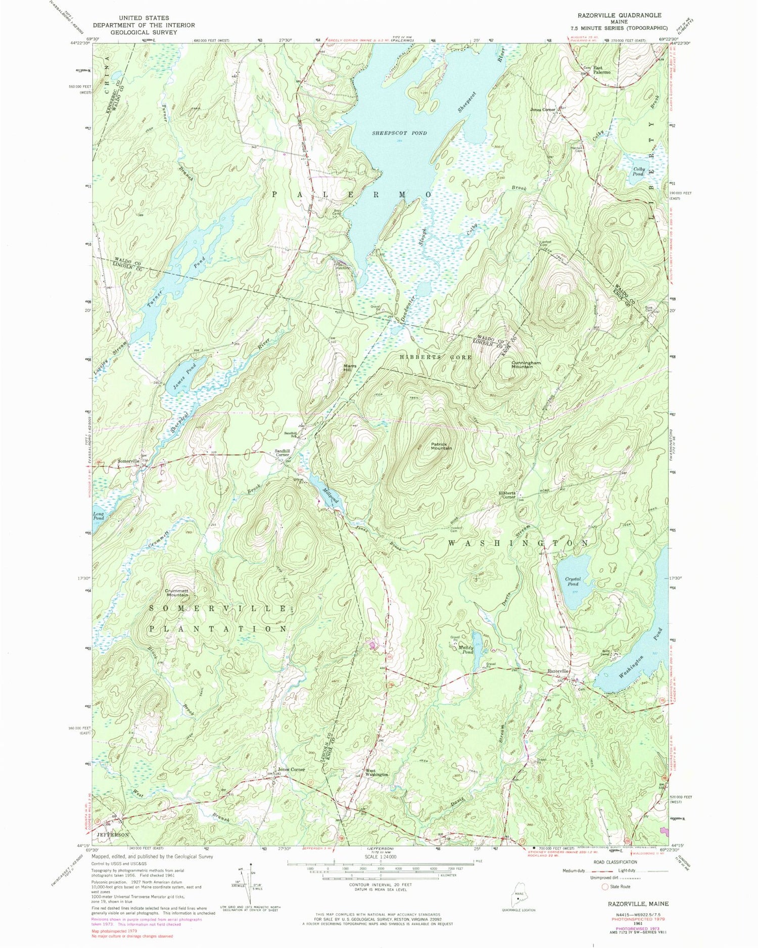
Classic USGS Razorville Maine 7.5'x7.5' Topo Map
Couldn't load pickup availability
Historical USGS topographic quad map of Razorville in the state of Maine. Typical map scale is 1:24,000, but may vary for certain years, if available. Print size: 24" x 27"
This quadrangle is in the following counties: Kennebec, Knox, Lincoln, Waldo.
The map contains contour lines, roads, rivers, towns, and lakes. Printed on high-quality waterproof paper with UV fade-resistant inks, and shipped rolled.
Contains the following named places: Colby Brook, Colby Pond, Crummett Brook, Crummett Mountain, Crystal Pond, Cunningham Mountain, Deadwater Slough, Gove Cemetery, Hannan Cemetery, Howard Cemetery, James Pond, Jones Brook, Lenfest Cemetery, Linscott Branch, Marrs Hill, Muddy Pond, Patrick Mountain, Razorville, Sandhill School, Sheepscot Pond, Somerville, Turner Branch, Turner Pond, East Palermo, Hibberts Corner, Jones Corner, Jones Corner, Sandhill Corner, West Washington, Hibberts Gore, Town of Somerville, Town of Washington, Colby Mills Dam, Sheepscot Pond Dam, Eastman Cemetery, Sheepscot Valley School, Palermo Volunteer Fire Department East Palermo Station, Somerville Fire Station, Sand Hill Cemetery, East Palermo Cemetery, Somerville Town Library, Palermo Community Library


