MyTopo
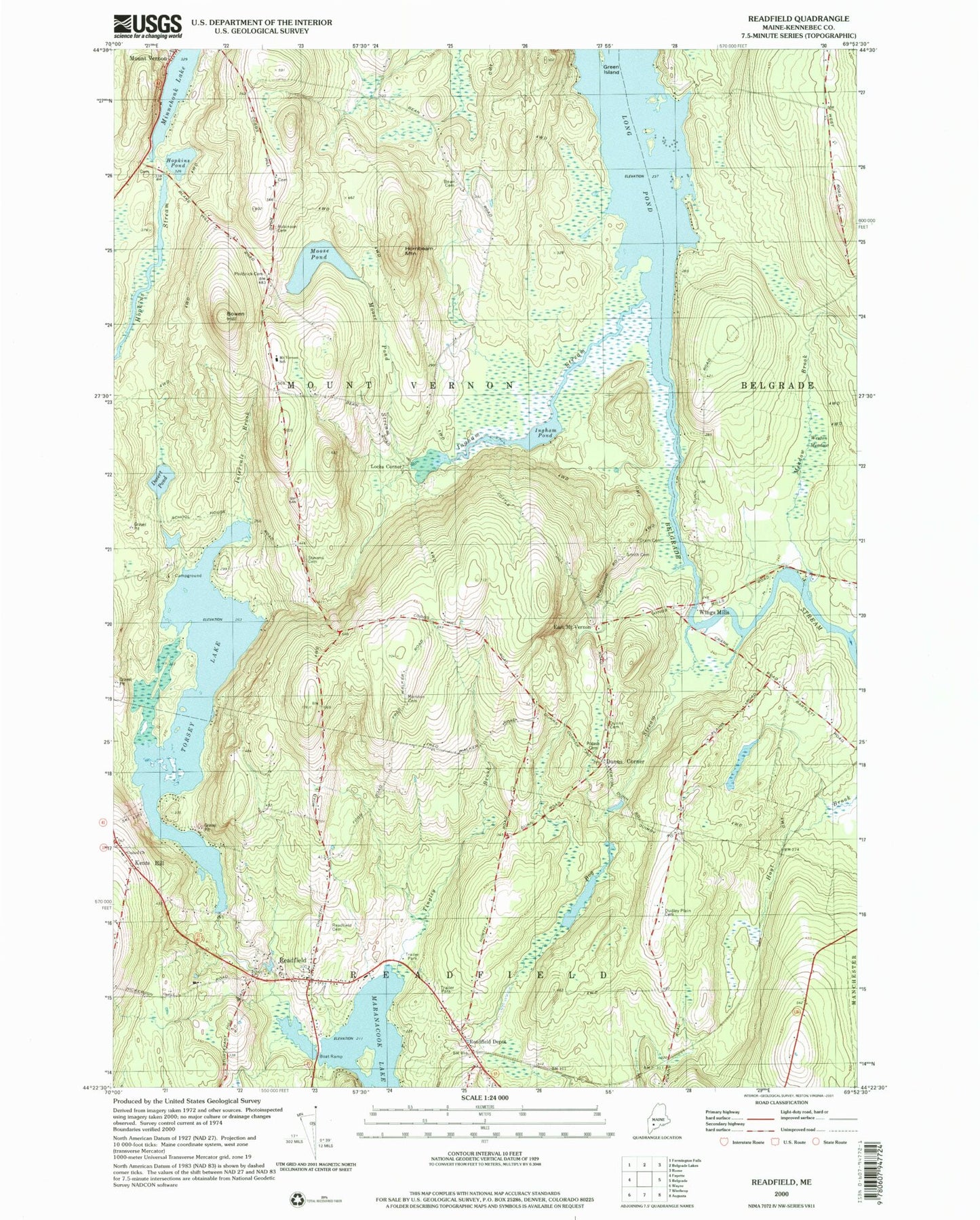
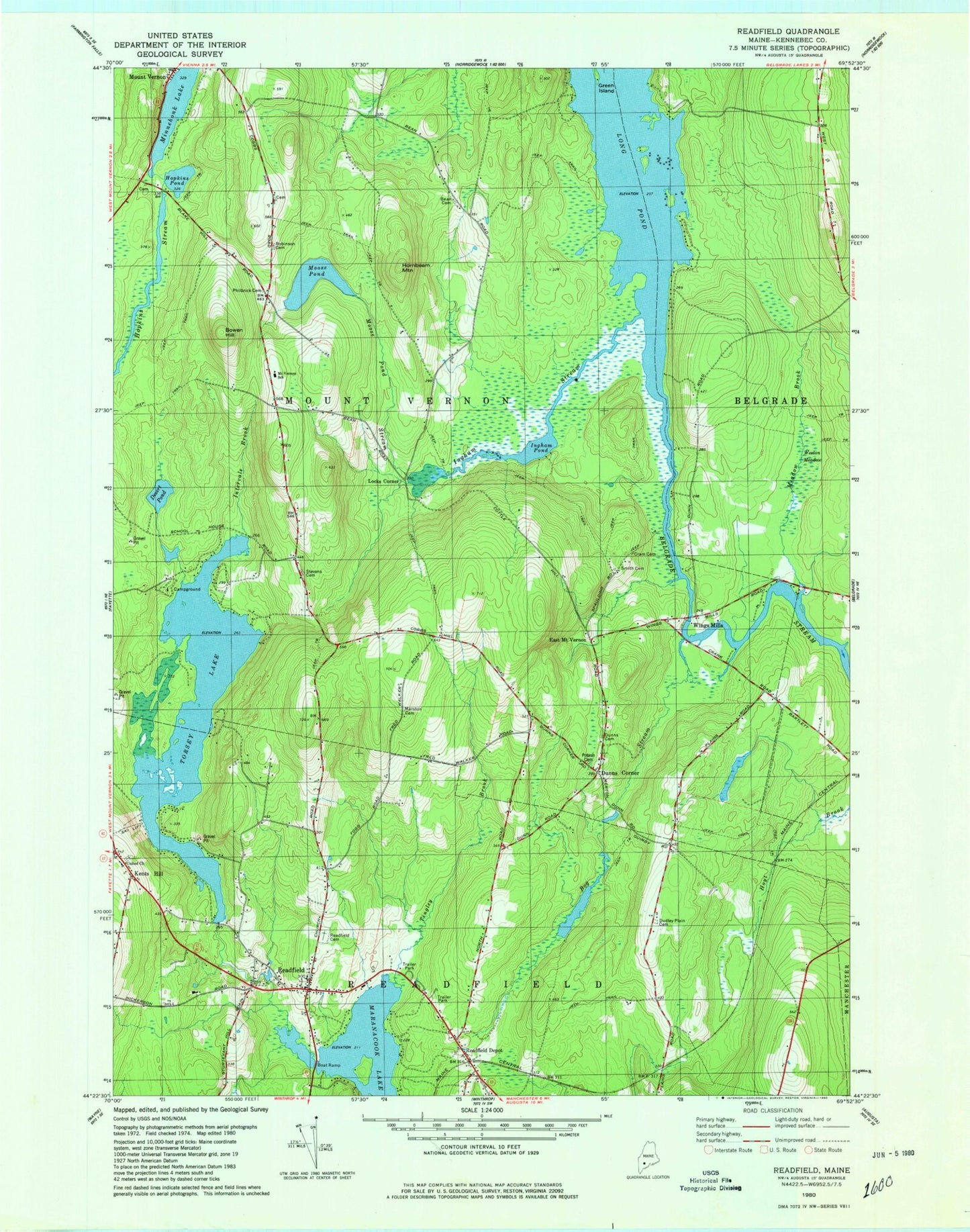
Classic USGS Readfield Maine 7.5'x7.5' Topo Map
Couldn't load pickup availability
Historical USGS topographic quad map of Readfield in the state of Maine. Typical map scale is 1:24,000, but may vary for certain years, if available. Print size: 24" x 27"
This quadrangle is in the following counties: Kennebec.
The map contains contour lines, roads, rivers, towns, and lakes. Printed on high-quality waterproof paper with UV fade-resistant inks, and shipped rolled.
Contains the following named places: Beam Cemetery, Bog Stream, Bowen Hill, Desert Pond, Dudley Plains Cemetery, Dunns Cemetery, Green Island, Hopkins Pond, Hornbeam Mountain, Ingham Stream, Inghan Pond, Intervale Brook, Marston Cemetery, Meadow Brook, Minnehonk Lake, Moose Pond, Moose Pond Stream, Philbrick Cemetery, Potash Cemetery, Readfield, Readfield Cemetery, Robinson Cemetery, Smith Cemetery, Stevens Cemetery, Tingley Brook, Torsey Lake, Weston Meadow, Dunns Corners, Locks Corner, Readfield Depot, Wings Mills, WABK-FM (Gardiner), Seven G's Seaplane Base (historical), Town of Mount Vernon, Town of Readfield, Grist Mill Pond Dam, Grist Mill Pond, Torsey Lake Dam, Long Pond Storage Dam, Readfield Fire Department, Hopkins Cemetery, Kents Hill Cemetery, Maranacook Community High School, Mount Vernon Elementary School, Maranacook Community Middle School, Readfield Community Library, Readfield Post Office