MyTopo
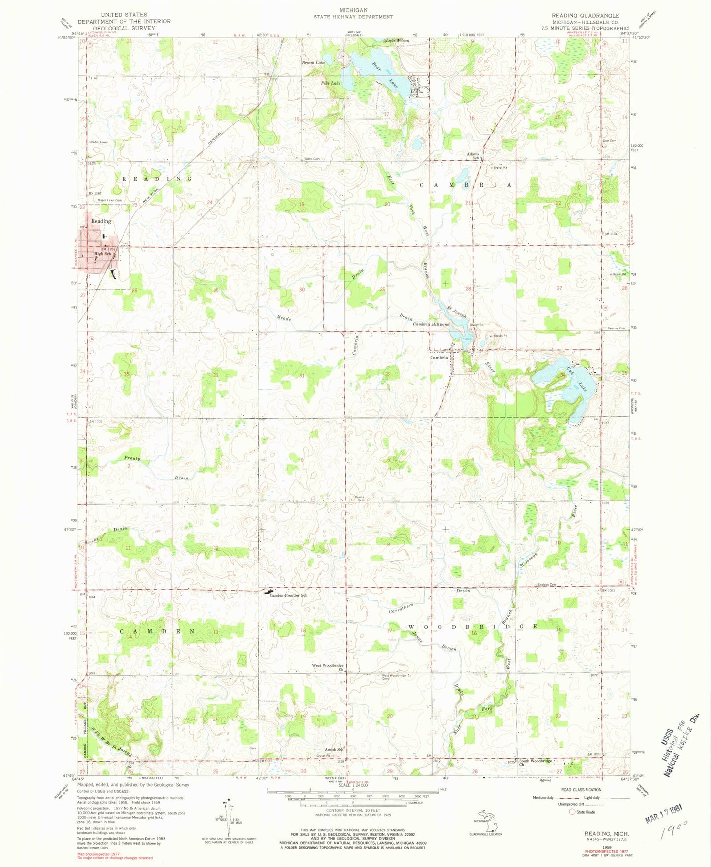
Classic USGS Reading Michigan 7.5'x7.5' Topo Map
Couldn't load pickup availability
Historical USGS topographic quad map of Reading in the state of Michigan. Map scale may vary for some years, but is generally around 1:24,000. Print size is approximately 24" x 27"
This quadrangle is in the following counties: Hillsdale.
The map contains contour lines, roads, rivers, towns, and lakes. Printed on high-quality waterproof paper with UV fade-resistant inks, and shipped rolled.
Contains the following named places: Adams School, Amish Cemetery, Amish School, Bear Lake, Broom Lake, Cambria, Cambria Baptist Church, Cambria Census Designated Place, Cambria Drain, Cambria Millpond, Cambria Post Office, Camden-Frontier School, Carruthers Drain, Church of the Nazarene, City of Reading, Cub Lake, Devine Cemetery, Dow Cemetery, Jonas Brown Drain, Maple Lawn Cemetery, Meade Drain, New Cambria Cemetery, New Hope Church, Old Cambria Cemetery, Old Sebring Cemetery, Pike Lake, Reading, Reading City Hall, Reading Community Fire Department, Reading Community Library, Reading Elementary School, Reading Emergency Unit Station 1, Reading Health Clinic, Reading High School, Reading Police Department, Reading Post Office, Reading Station, Reading United Methodist Church, Rotary Park, Sebring Cemetery, Sheldon Cemetery, South Woodbridge Church, Township of Cambria, Township of Woodbridge, Water Works Park, West Woodbridge Cemetery, West Woodbridge Church, Willits Cemetery