MyTopo
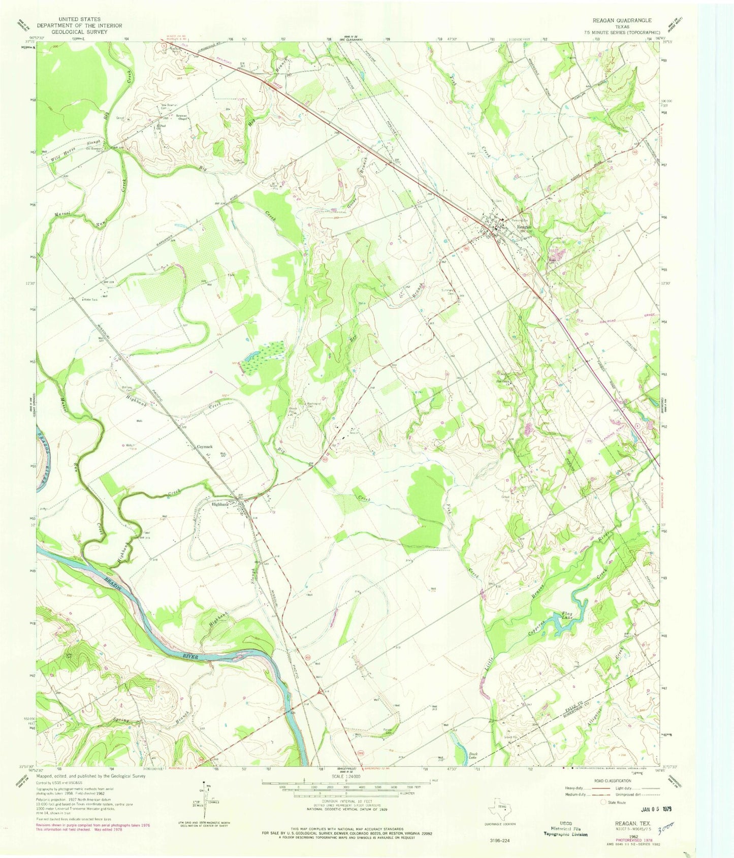
Classic USGS Reagan Texas 7.5'x7.5' Topo Map
Couldn't load pickup availability
Historical USGS topographic quad map of Reagan in the state of Texas. Map scale may vary for some years, but is generally around 1:24,000. Print size is approximately 24" x 27"
This quadrangle is in the following counties: Falls, Robertson.
The map contains contour lines, roads, rivers, towns, and lakes. Printed on high-quality waterproof paper with UV fade-resistant inks, and shipped rolled.
Contains the following named places: Beacon, Bee Branch, Bethany Cemetery, Big Creek, Bowman Chapel, Copperas Creek, Coymack, Facieo Cemetery, Fish Creek, Fish Creek Church, Flag Lake, Goose Branch, Highbank, Highbank Creek, Highbank Slough, Hog Branch, New Bowman Cemetery, Old Bowman Cemetery, Reagan, Reagan Division, Reagan Post Office, Reagan Volunteer Fire Department, Saint Paul Church, Shilo Cemetery, Spring Branch, Waite Cemetery, Washington Cemetery, ZIP Code: 76680