MyTopo
Classic USGS Reas Pass Idaho 7.5'x7.5' Topo Map
Regular price
$16.95
Regular price
Sale price
$16.95
Unit price
per
Couldn't load pickup availability
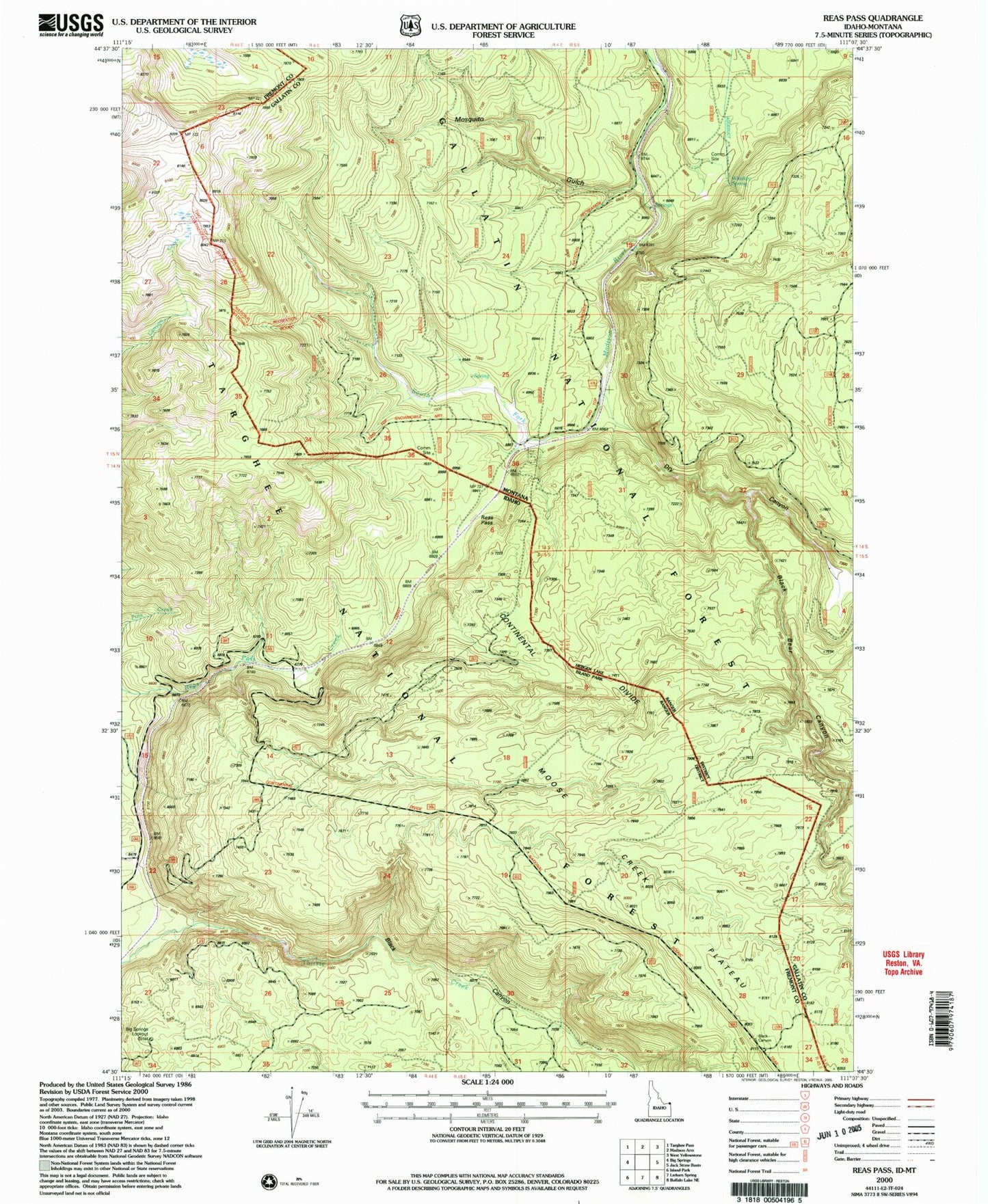
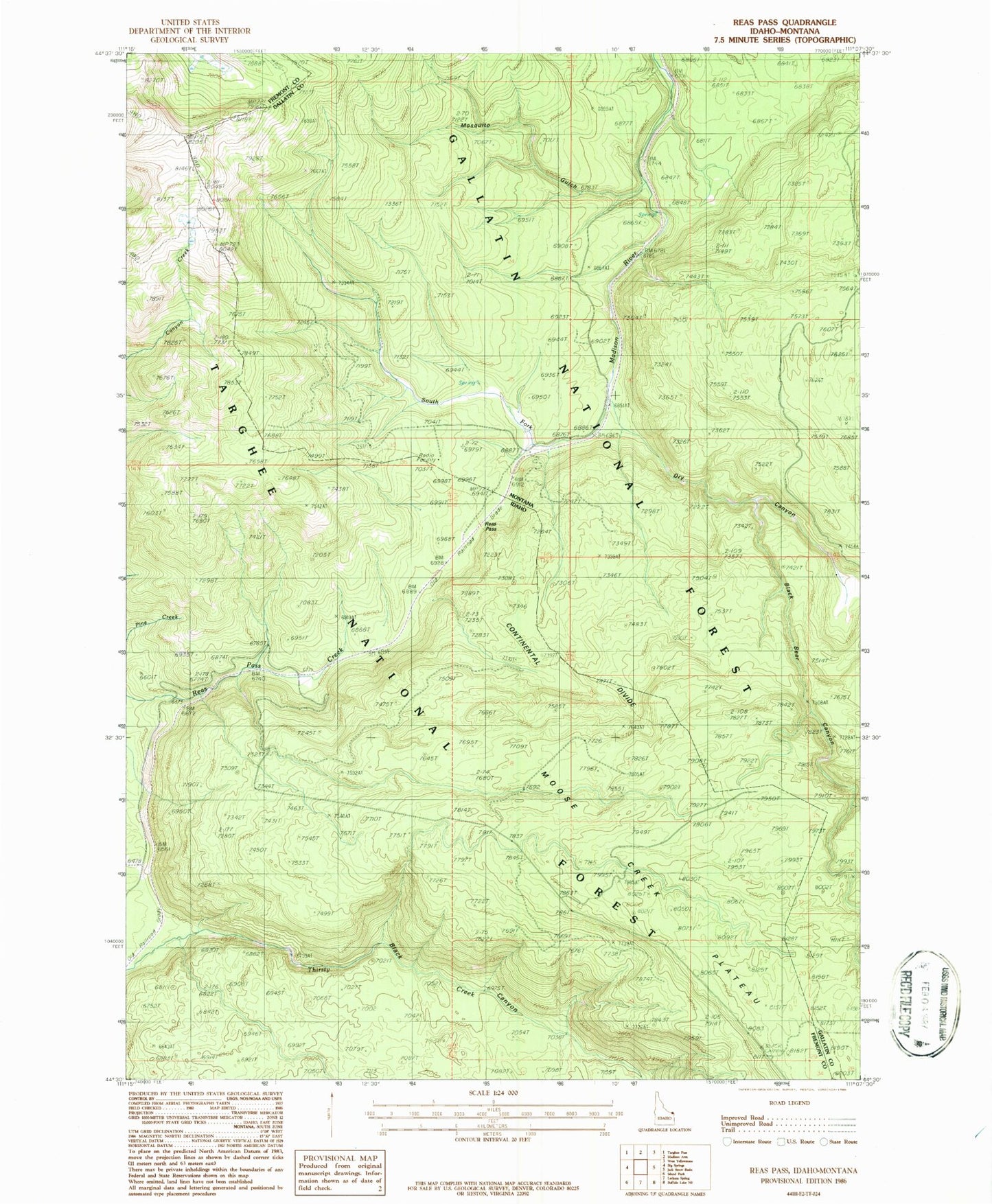
Historical USGS topographic quad map of Reas Pass in the states of Idaho, Montana. Map scale may vary for some years, but is generally around 1:24,000. Print size is approximately 24" x 27"
This quadrangle is in the following counties: Fremont, Gallatin.
The map contains contour lines, roads, rivers, towns, and lakes. Printed on high-quality waterproof paper with UV fade-resistant inks, and shipped rolled.
Contains the following named places: Big Springs Lookout, Black Bear Canyon, Black Canyon, Dry Canyon, Johnson Mine, Moose Creek Plateau, Mosquito Gulch, Reas Pass, Timber, Whitmans Cabin