MyTopo
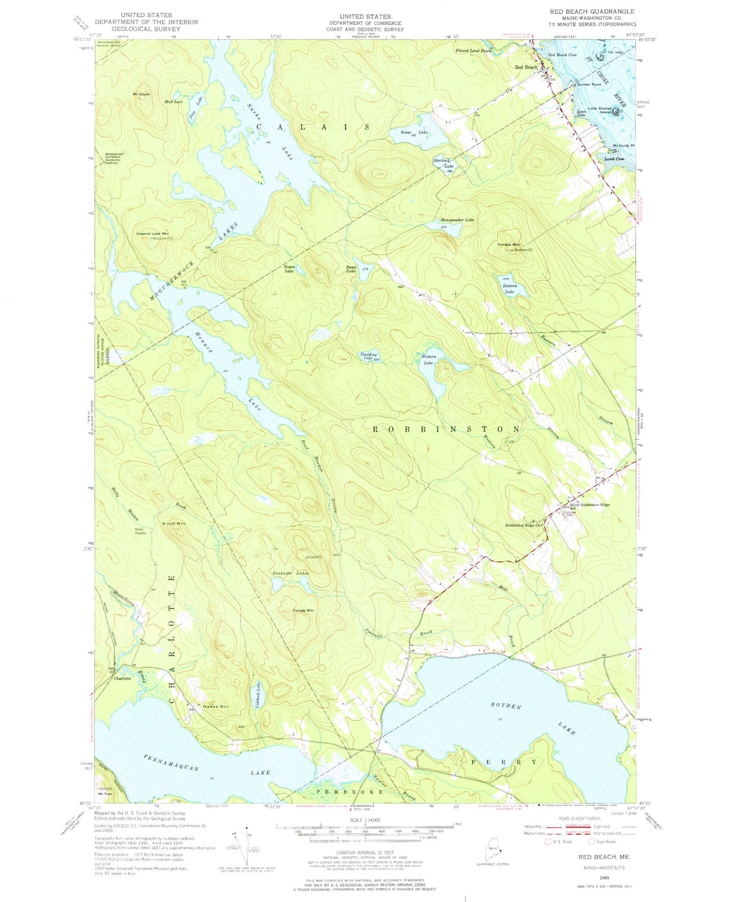
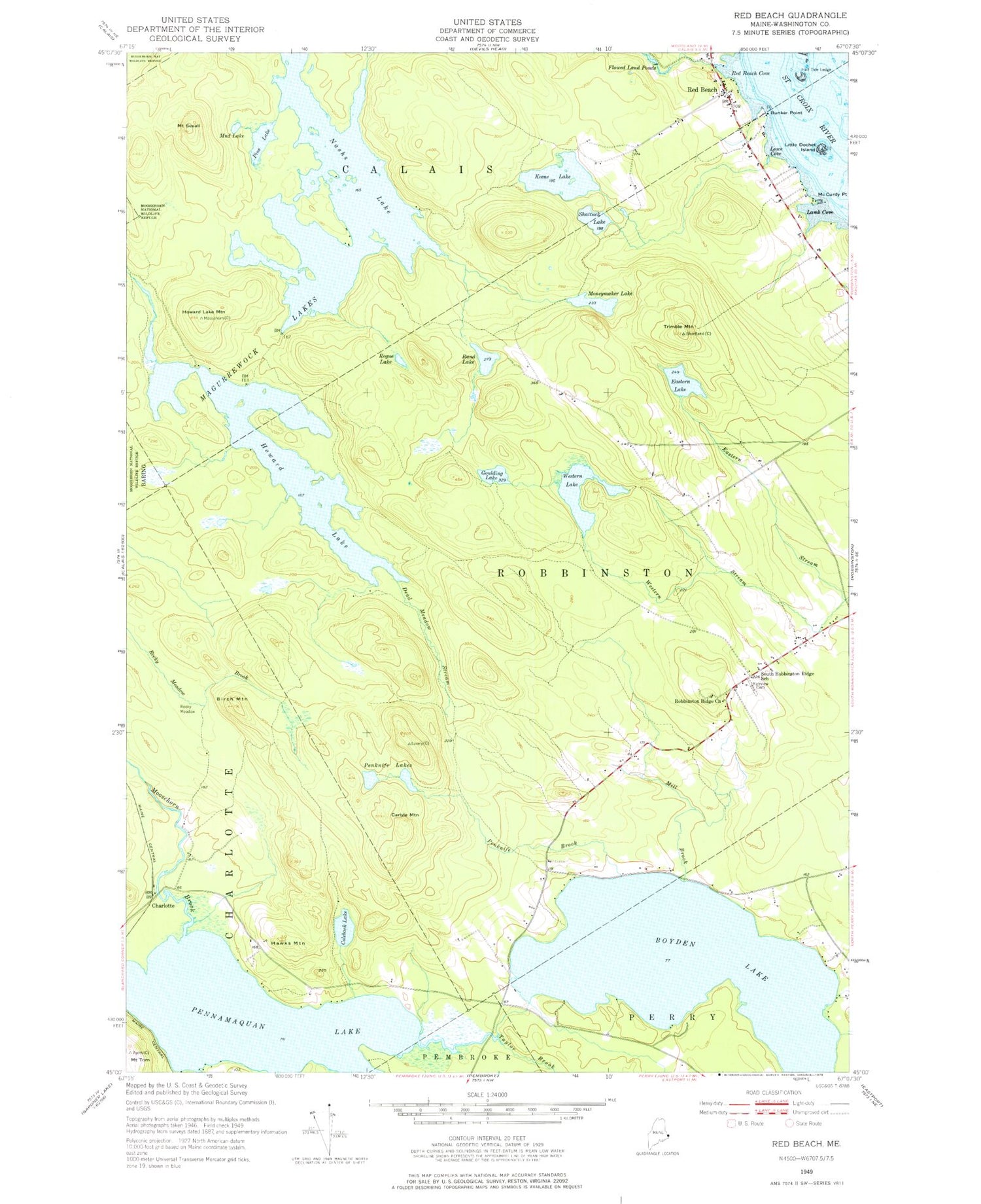
Classic USGS Red Beach Maine 7.5'x7.5' Topo Map
Couldn't load pickup availability
Historical USGS topographic quad map of Red Beach in the state of Maine. Map scale may vary for some years, but is generally around 1:24,000. Print size is approximately 24" x 27"
This quadrangle is in the following counties: Washington.
The map contains contour lines, roads, rivers, towns, and lakes. Printed on high-quality waterproof paper with UV fade-resistant inks, and shipped rolled.
Contains the following named places: Beaver Brook, Birch Mountain, Boyden Lake, Bunker Point, Calais Fire Department Station 2, Carlisle Mountain, Charlotte, Coleback Lake, Dead Meadow Stream, Eastern Lake, Eastern Stream, Fairview Cemetery, Goulding Lake, Half Tide Ledge, Hawks Mountain, Hilltop Campground, Howard Lake, Howard Lake Mountain, Keene Lake, Keenes Lake Campground, Lamb Cove, Little Dochet Island, Lowe Cove, Magurrewock Lakes, McCurdy Point, Mill Brook, Moneymaker Lake, Moosehorn Brook, Mount Seeall, Mud Lake, Nashs Lake, Ohio Brook, Penknife Brook, Penknife Lakes, Pennamaquan River Reservoir, Pine Lake, Rand Lake, Red Beach, Red Beach Cove, Robbinston Ridge Church, Rocky Meadow, Rogue Lake, Shattuck Lake, South Robbinston Ridge School, Taylor Brook, Town of Robbinston, Trimble Mountain, Western Lake, ZIP Code: 04671