MyTopo
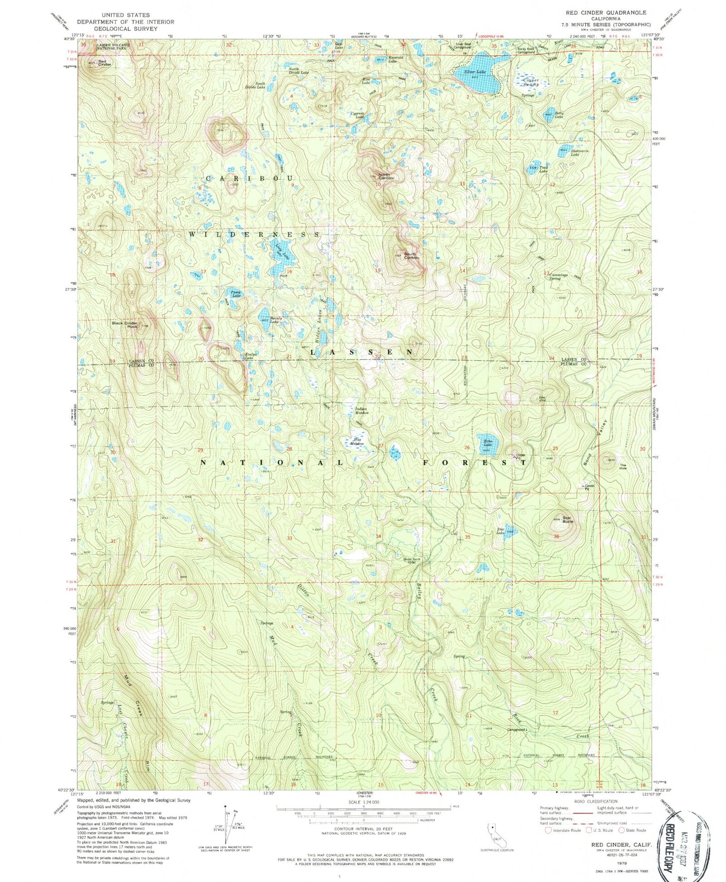
Classic USGS Red Cinder California 7.5'x7.5' Topo Map
Couldn't load pickup availability
Historical USGS topographic quad map of Red Cinder in the state of California. Typical map scale is 1:24,000, but may vary for certain years, if available. Print size: 24" x 27"
This quadrangle is in the following counties: Lassen, Plumas.
The map contains contour lines, roads, rivers, towns, and lakes. Printed on high-quality waterproof paper with UV fade-resistant inks, and shipped rolled.
Contains the following named places: Beauty Lake, Betty Lake, Black Cinder Rock, Bond Valley, Cummings Spring, Cypress Lake, Dillon Creek, Echo Lake, Emerald Lake, Evelyn Lake, Hay Meadow, Heckle Ranch, Hidden Lakes, Indian Meadow, Long Lake, North Caribou, North Divide Lake, Posey Lake, Rim Lake, Robbers Spring, Rocky Knoll Campground, Shotoverin Lake, South Caribou, South Divide Lake, Star Butte, Star Lake, Trail Lake, Cooper Swamp, The Hole, Red Cinder, Rock Spring, Silver Lake, Caribou Wilderness, Silver Bowl Campground, Silver Beach Picnic Area