MyTopo
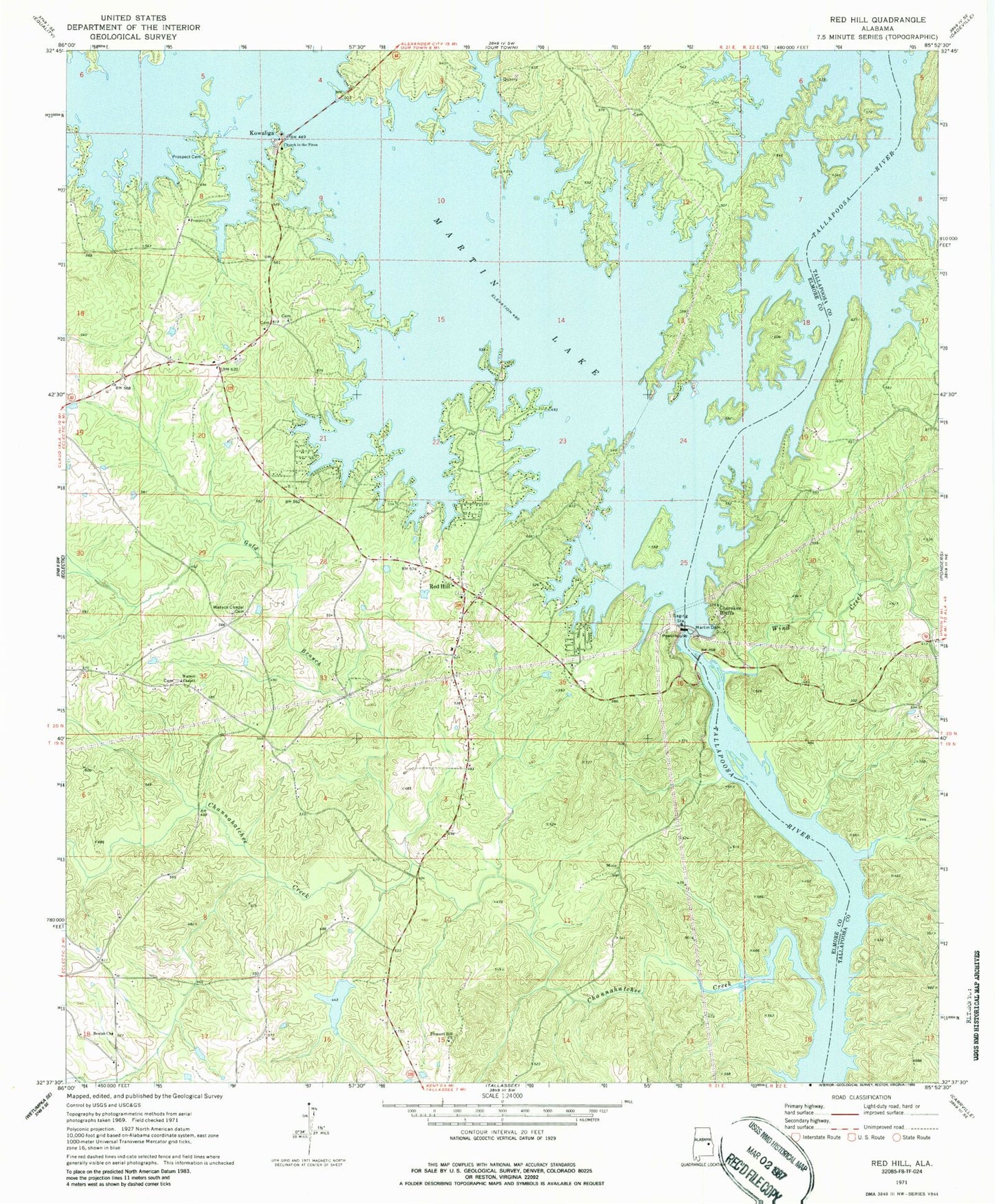
Classic USGS Red Hill Alabama 7.5'x7.5' Topo Map
Couldn't load pickup availability
Historical USGS topographic quad map of Red Hill in the state of Alabama. Map scale may vary for some years, but is generally around 1:24,000. Print size is approximately 24" x 27"
This quadrangle is in the following counties: Elmore, Tallapoosa.
The map contains contour lines, roads, rivers, towns, and lakes. Printed on high-quality waterproof paper with UV fade-resistant inks, and shipped rolled.
Contains the following named places: Asbury School, Bethlehem, Beulah Baptist Church, Camp Dixie, Camp Exchange, Channahatchee Creek, Channahatchee Hunting Club, Cherokee Bluffs, Church in the Pines, County Line Cemetery, Crystal Island Marina, Dixie Sailing Club, Double Bridges Ferry, Gold Branch, Irma, Kailaidshi, Kelsey School, Kowaliga, Kowaliga Marina, Kowaliga Volunteer Fire Department, Lovejoy Cemetery, Martin Dam, Martin Lake, McCarty Ferry, Meltons Mill, Pleasant Hill Church, Prospect Cemetery, Prospect Methodist Church, Red Hill, Red Hill School, Red Hill Volunteer Fire Department, Refuge Baptist Church, Rock Hill School, Rocky Point, Shiloh Baptist Church, Watson Chapel, Watson Chapel Cemetery, Whispering Springs Campground, Wind Creek