MyTopo
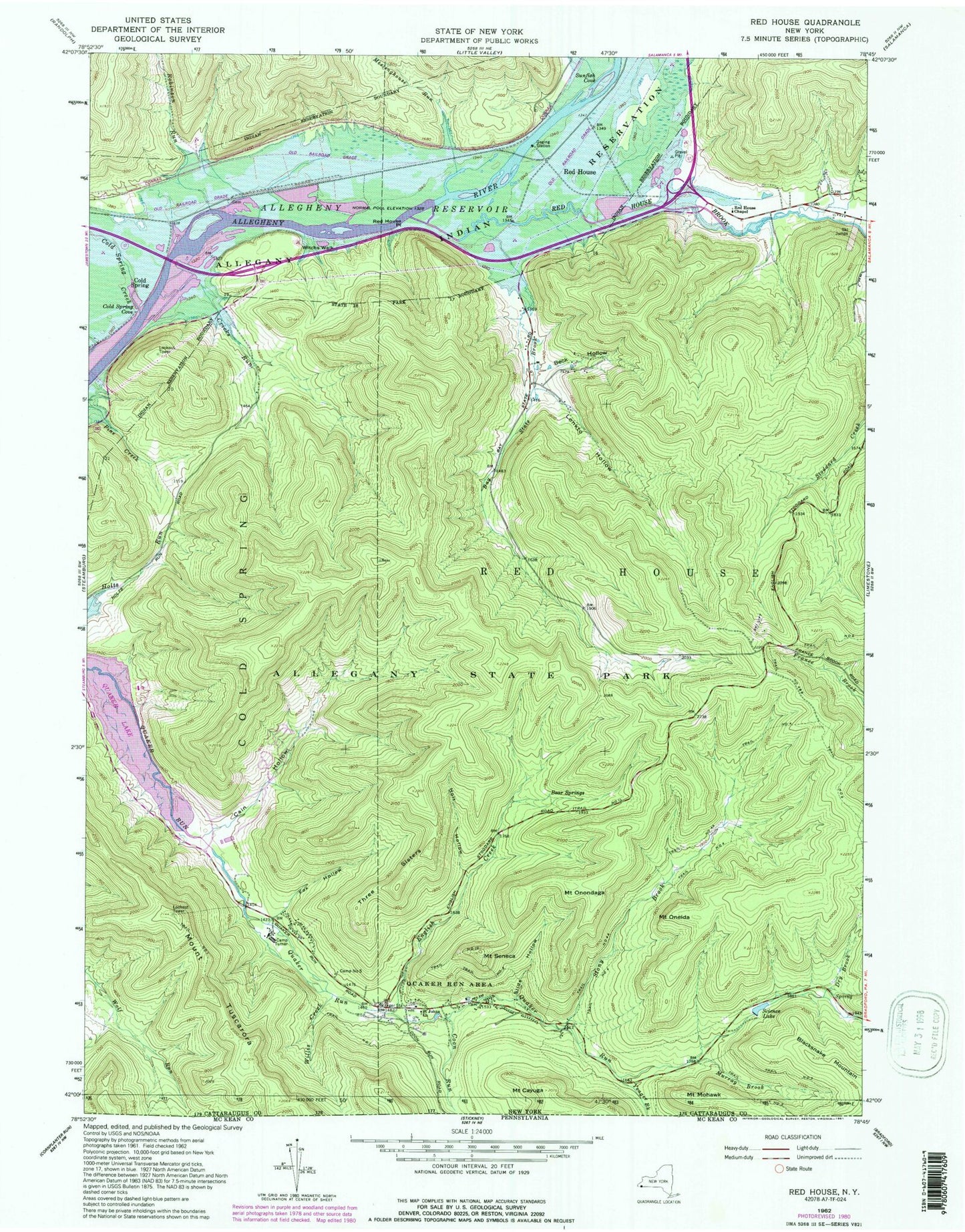
USGS Classic Red House New York 7.5'x7.5' Topo Map
Couldn't load pickup availability
Historical USGS topographic quad map of Red Housein the states of New York, Pennsylvania. Scale: 1:24000. Print size: 24" x 27"
This quadrangle is in the following counties: Cattaraugus.
The map contains contour lines, roads, rivers, towns, lakes, and grids including latitude / longitude and UTM / MGRS. Printed on high-quality waterproof paper with UV fade-resistant inks.
Contains the following named places: Bay State Brook, Bear Springs, Beck Hollow, Blacksnake Mountain, Cain Hollow, Camp Number Five, Camp Turner, Mount Cayuga, Cold Spring, Cold Spring Cove, Cold Spring Creek, Coon Run, Cricks Run, Dry Brook, English Creek, Fox Hollow, Holt Hollow, Lonkto Hollow, Meetinghouse Run, Mount Mohawk, Murray Brook, Mount Oneida, Mount Onondaga, Quaker Run Area, Quaker Run Chapel, Red House, Red House Brook, Red House Chapel, Red House Free Church, Red House Point, Robinson Run, Saint Johns Church, Science Lake, Seneca Church, Mount Seneca, Slide Hollow, Stony Brook, Sunfish Cove, Sunfish Run, Three Sisters, Trail Number 1, Trail Number 10, Trail Number 2, Trail Number 4, Trail Number 4, Trail Number 4 A, Trail Number 5, Trail Number 9, Mount Tuscarora, Allegany State Park, Willis Creek, Witchs Walk, Yeager Brook, Black School, Allegany Reservation, Town of Red House, Willis Creek, Wolf Run, Coon Run, Willis Creek, Yeager Brook, Willis Creek, Wolf Run