MyTopo
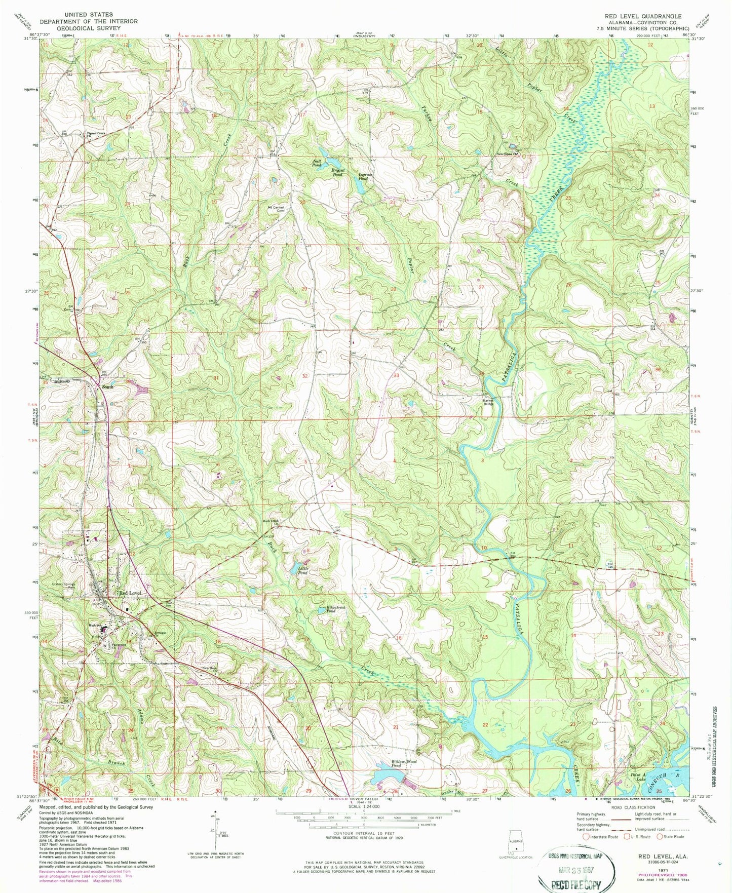
Classic USGS Red Level Alabama 7.5'x7.5' Topo Map
Couldn't load pickup availability
Historical USGS topographic quad map of Red Level in the state of Alabama. Map scale may vary for some years, but is generally around 1:24,000. Print size is approximately 24" x 27"
This quadrangle is in the following counties: Covington.
The map contains contour lines, roads, rivers, towns, and lakes. Printed on high-quality waterproof paper with UV fade-resistant inks, and shipped rolled.
Contains the following named places: Barnes Bridge, Bryant Pond, Buck Creek, Buck Creek Church, Buck Creek Volunteer Fire Department, Chesser School, Corinth Church, Crystal Springs Park, Fairmount Cemetery, Fairmount Missionary Baptist Church, Ingram Pond, Ingram Pond Number Two, J Rudolphs Mill, James Ingram Lake Dam, Jernigan Church, Kilpatrick Pond, Little Pond, Little Poplar Creek, Mallels Mill, Mason School, Mount Carmel Cemetery, Nall Pond, New Home Church, New Hope Church, Pigeon Creek Church, Poplar Creek, Red Level, Red Level High School, Red Level Police Department, Red Level Post Office, Red Level Volunteer Fire Department, Rhump, Rita Branch, South, South Church, Town of Red Level, Turkey Creek, W C Huggins Dam, Willow Wood Pond