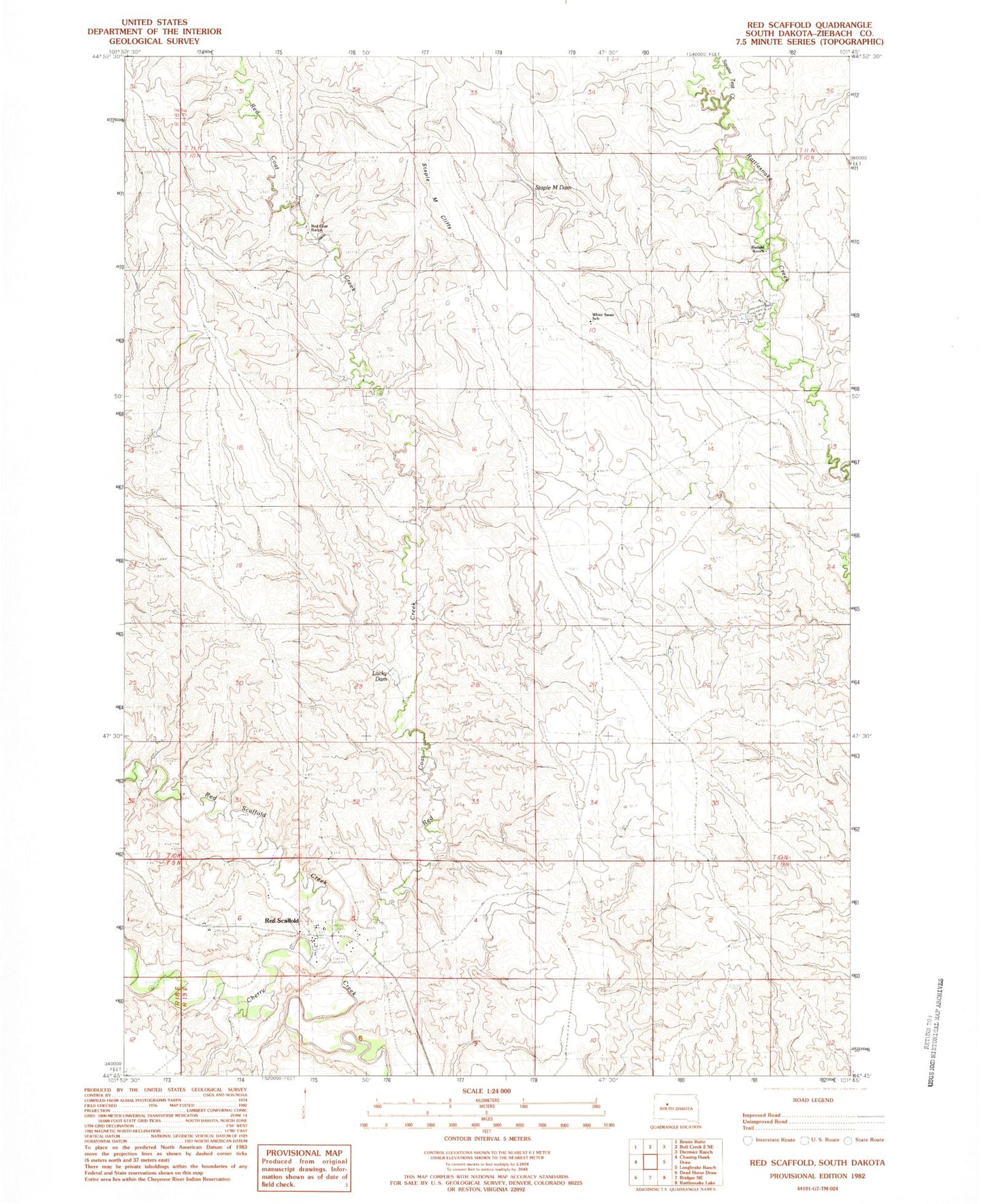
MyTopo
Classic USGS Red Scaffold South Dakota 7.5'x7.5' Topo Map
Regular price
$16.95
Regular price
Sale price
$16.95
Unit price
per
Couldn't load pickup availability
Historical USGS topographic quad map of Red Scaffold in the state of South Dakota. Map scale may vary for some years, but is generally around 1:24,000. Print size is approximately 24" x 27"
This quadrangle is in the following counties: Ziebach.
The map contains contour lines, roads, rivers, towns, and lakes. Printed on high-quality waterproof paper with UV fade-resistant inks, and shipped rolled.
Contains the following named places: Budahl Dam, Budahl Ranch, East Rattlesnake Creek, Jack Freeman Dam, Lacky Dam, Red Coat Creek, Red Coat Ranch, Red Scaffold, Red Scaffold Creek, Sacred Heart Catholic Cemetery, Staple M Cliffs, Staple M Dam, T Trent Number 1 Dam, Tribe Number 1 Dam, White Swan School