MyTopo
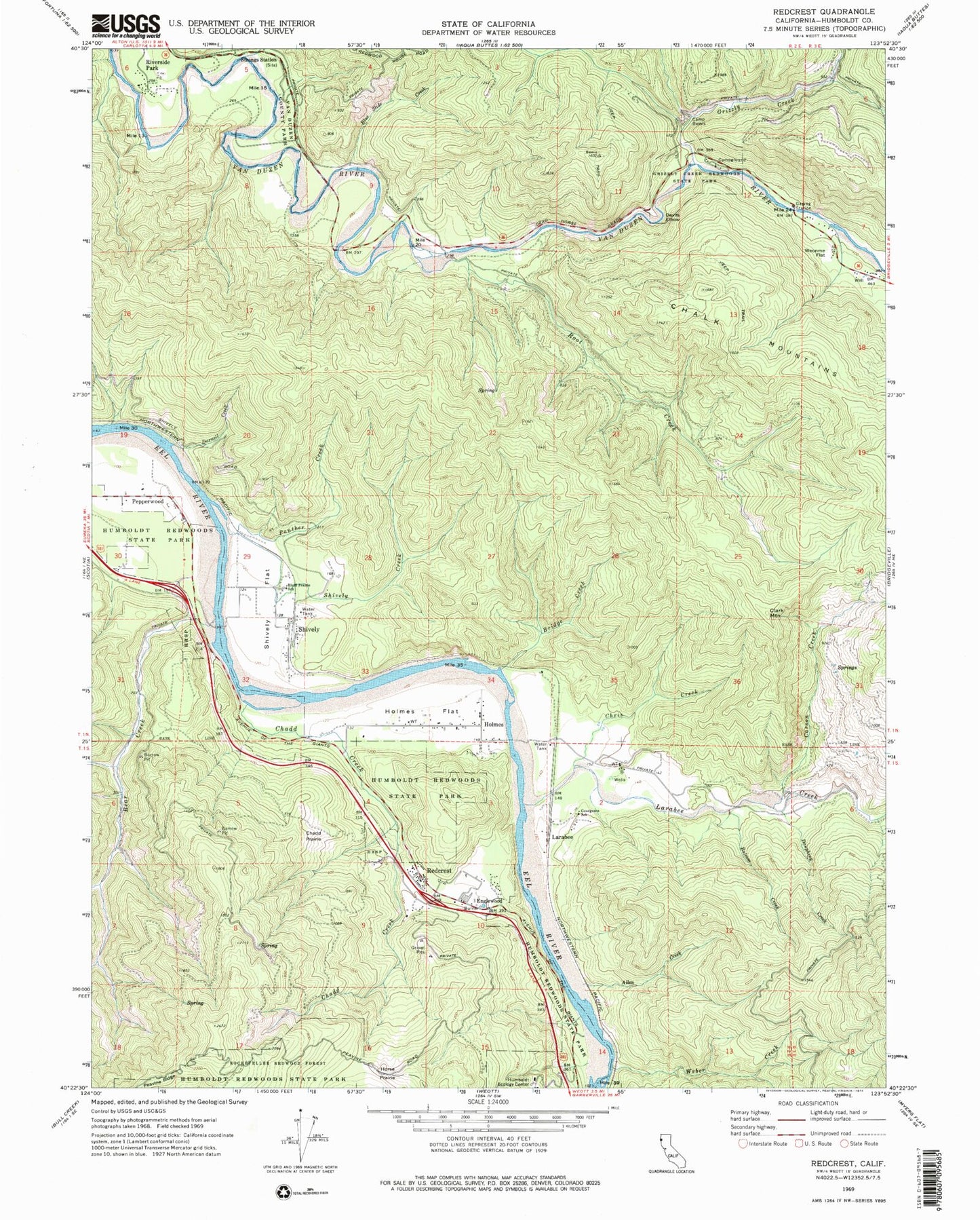
Classic USGS Redcrest California 7.5'x7.5' Topo Map
Couldn't load pickup availability
Historical USGS topographic quad map of Redcrest in the state of California. Map scale may vary for some years, but is generally around 1:24,000. Print size is approximately 24" x 27"
This quadrangle is in the following counties: Humboldt.
The map contains contour lines, roads, rivers, towns, and lakes. Printed on high-quality waterproof paper with UV fade-resistant inks, and shipped rolled.
Contains the following named places: Allen Creek, Balcom Creek, Bear Creek, Blue Slide Creek, Bluff Prairie School, Bridge Creek, Camp Bemis, Carson Creek, Chadd Creek, Chadd Prairie, Chris Creek, Clark Mountain, Darnell Creek, Dauphiny Creek, Devils Elbow, Englewood, Georgeson School, Grizzly Creek, Grizzly Creek Redwoods State Park, Hely Creek, Holmes, Holmes Flat, Horse Prairie, Larabee, Larabee Creek, P L Ranch, Panther Creek, Pepperwood, Redcrest, Redcrest Census Designated Place, Redcrest Post Office, Redcrest Volunteer Fire Department, Riverside Park, Root Creek, Shively, Shively Creek, Shively Flat, Stevens Creek, Stretter Ranch, Strongs Station, Van Duzen County Park, Weber Creek, Weonme Flat, ZIP Code: 95528