MyTopo
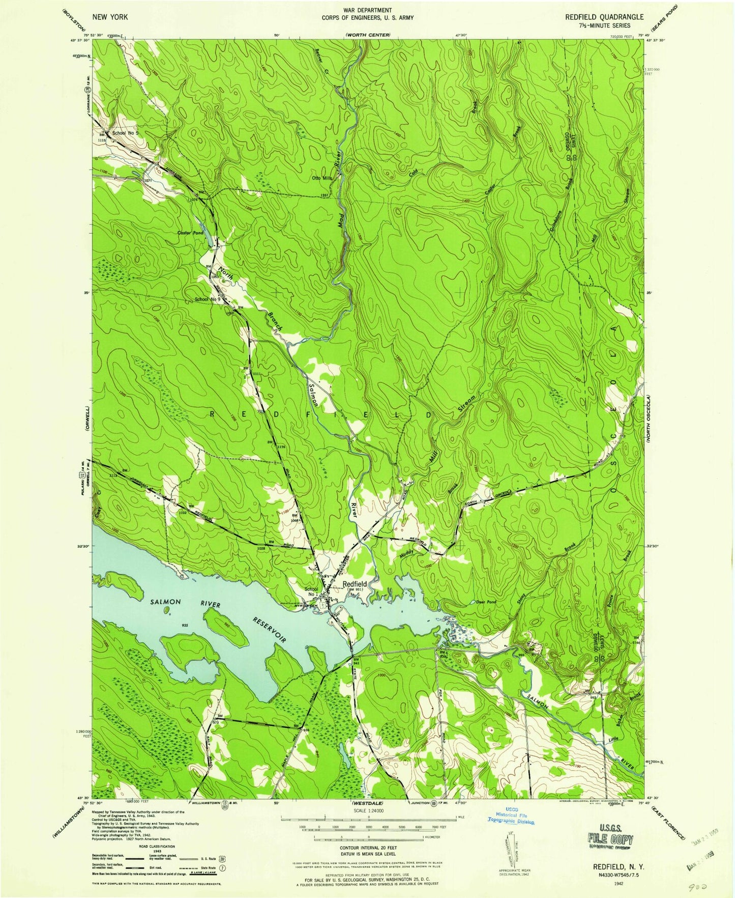
Classic USGS Redfield New York 7.5'x7.5' Topo Map
Couldn't load pickup availability
Historical USGS topographic quad map of Redfield in the state of New York. Typical map scale is 1:24,000, but may vary for certain years, if available. Print size: 24" x 27"
This quadrangle is in the following counties: Lewis, Oswego.
The map contains contour lines, roads, rivers, towns, and lakes. Printed on high-quality waterproof paper with UV fade-resistant inks, and shipped rolled.
Contains the following named places: Beaver Creek, Burdick Island, Castor Brook, Castor Pond, Coey Creek, Cold Brook, Deer Pond, Fox Brook, Grindstone Brook, Horseshoe Bend, Huckleberry Island, Kenny Brook, Line Brook, Mad River, Mad River Falls, Mill Stream, Muddy Brook, Myrtle Cemetery, North Branch Salmon River, Prince Brook, Rat Creek, Redfield, Salmon River, Stony Brook, Little Baker Brook, Otto Mills, Town of Redfield, School Number 1 (historical), School Number 5 (historical), School Number 9 (historical), Redfield Volunteer Fire Department, Redfield Post Office, Beaver Creek, Burdick Island, Castor Brook, Castor Pond, Coey Creek, Cold Brook, Deer Pond, Fox Brook, Grindstone Brook, Horseshoe Bend, Huckleberry Island, Kenny Brook, Line Brook, Mad River, Mad River Falls, Mill Stream, Muddy Brook, Myrtle Cemetery, North Branch Salmon River, Prince Brook, Rat Creek, Redfield, Salmon River, Stony Brook, Little Baker Brook, Otto Mills, Town of Redfield, School Number 1 (historical), School Number 5 (historical), School Number 9 (historical), Redfield Volunteer Fire Department, Redfield Post Office