MyTopo
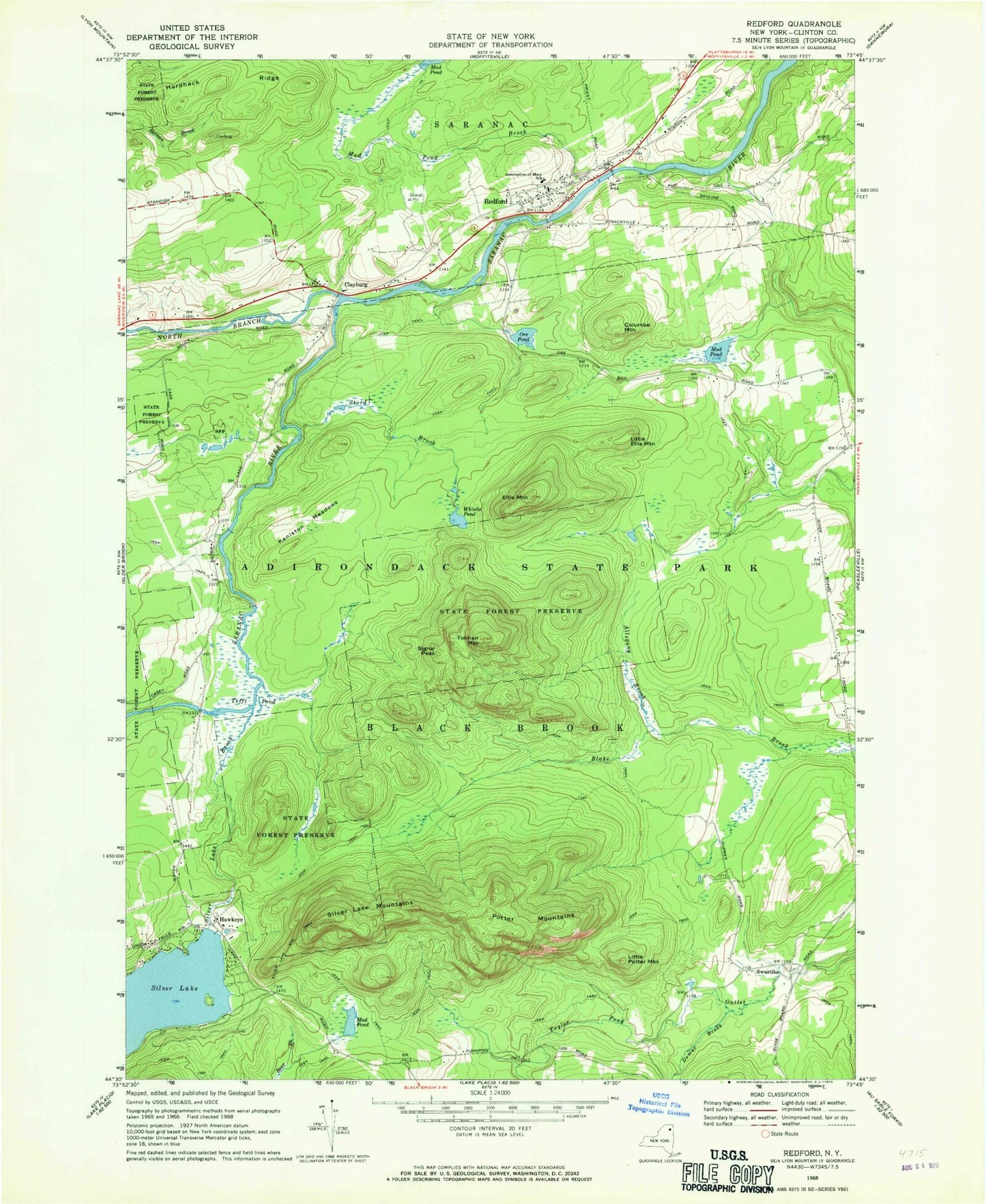
Classic USGS Redford New York 7.5'x7.5' Topo Map
Couldn't load pickup availability
Historical USGS topographic quad map of Redford in the state of New York. Map scale may vary for some years, but is generally around 1:24,000. Print size is approximately 24" x 27"
This quadrangle is in the following counties: Clinton.
The map contains contour lines, roads, rivers, towns, and lakes. Printed on high-quality waterproof paper with UV fade-resistant inks, and shipped rolled.
Contains the following named places: Adirondack Airpark Estates Airport, Allegany Brook, Assumption of Mary Church, Assumption of Mary School, Clayburg, Columbe Mountain, Demar Brook, Ellis Mountain, Hardhack Ridge, Hawkeye, Keniston Meadows, Little Ellis Mountain, Little Potter Mountain, Mud Pond, Mud Pond Brook, North Branch Saranac River, Ore Pond, Potter Mountains, Redford, Redford Census Designated Place, Redford Post Office, Signal Peak, Silver Lake Brook, Silver Lake Mountain Trail, Silver Lake Mountains, Stord Brook, Swastika, Taylor Pond Outlet, Tefft Pond, Tolman Mountain, Town of Black Brook, Whistle Pond, ZIP Code: 12978