MyTopo
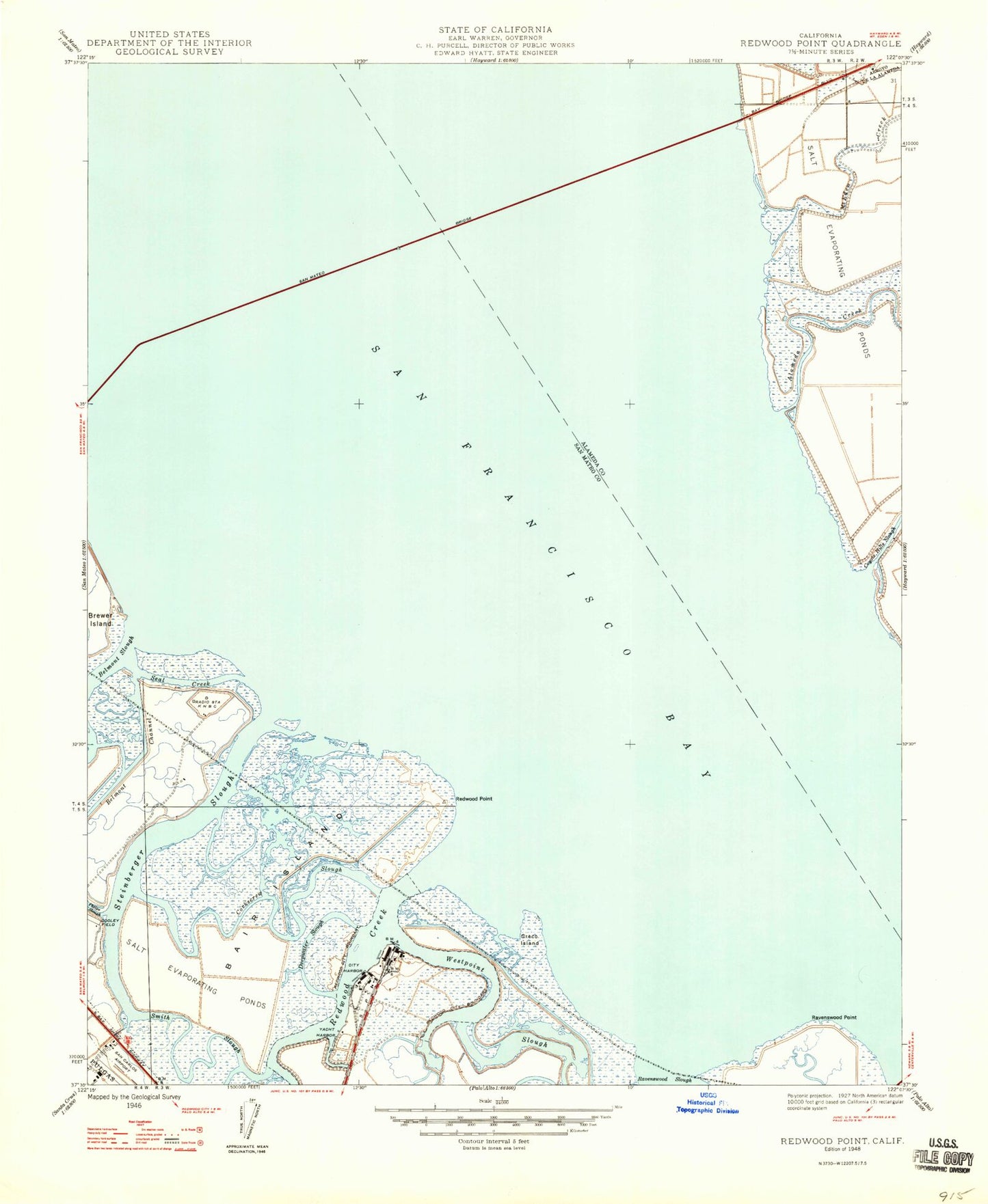
Classic USGS Redwood Point California 7.5'x7.5' Topo Map
Couldn't load pickup availability
Historical USGS topographic quad map of Redwood Point in the state of California. Map scale may vary for some years, but is generally around 1:24,000. Print size is approximately 24" x 27"
This quadrangle is in the following counties: Alameda, San Mateo.
The map contains contour lines, roads, rivers, towns, and lakes. Printed on high-quality waterproof paper with UV fade-resistant inks, and shipped rolled.
Contains the following named places: Alameda Creek, Bair Island, Bay Slough, Bayside Community Church, Belmont Slough, Bird Island, Bowditch Middle School, Christ the Victor Lutheran Church, City of Foster City, City of Redwood City, Corkscrew Slough, Fire Station Number 2, First Slough, Greco Island, KNBR-AM (San Francisco), Mariner Park, Marlin Park, Mount Eden Creek, Petes Harbor, Port of Redwood City, Press Wireless Radio Station, Pulgas Creek, Ravenswood Point, Redwood City Fire Department Station 20, Redwood Creek, Redwood Point, Redwood Shores, Saint Lukes Catholic Church, San Mateo Bridge, Sandpiper School, Seaport Village North Shopping Center, Shannon Park, Smith Slough, South Bay Sewer Authority Treatment Plant, Steinberger Slough, Westpoint Slough, ZIP Codes: 94065, 94545