MyTopo
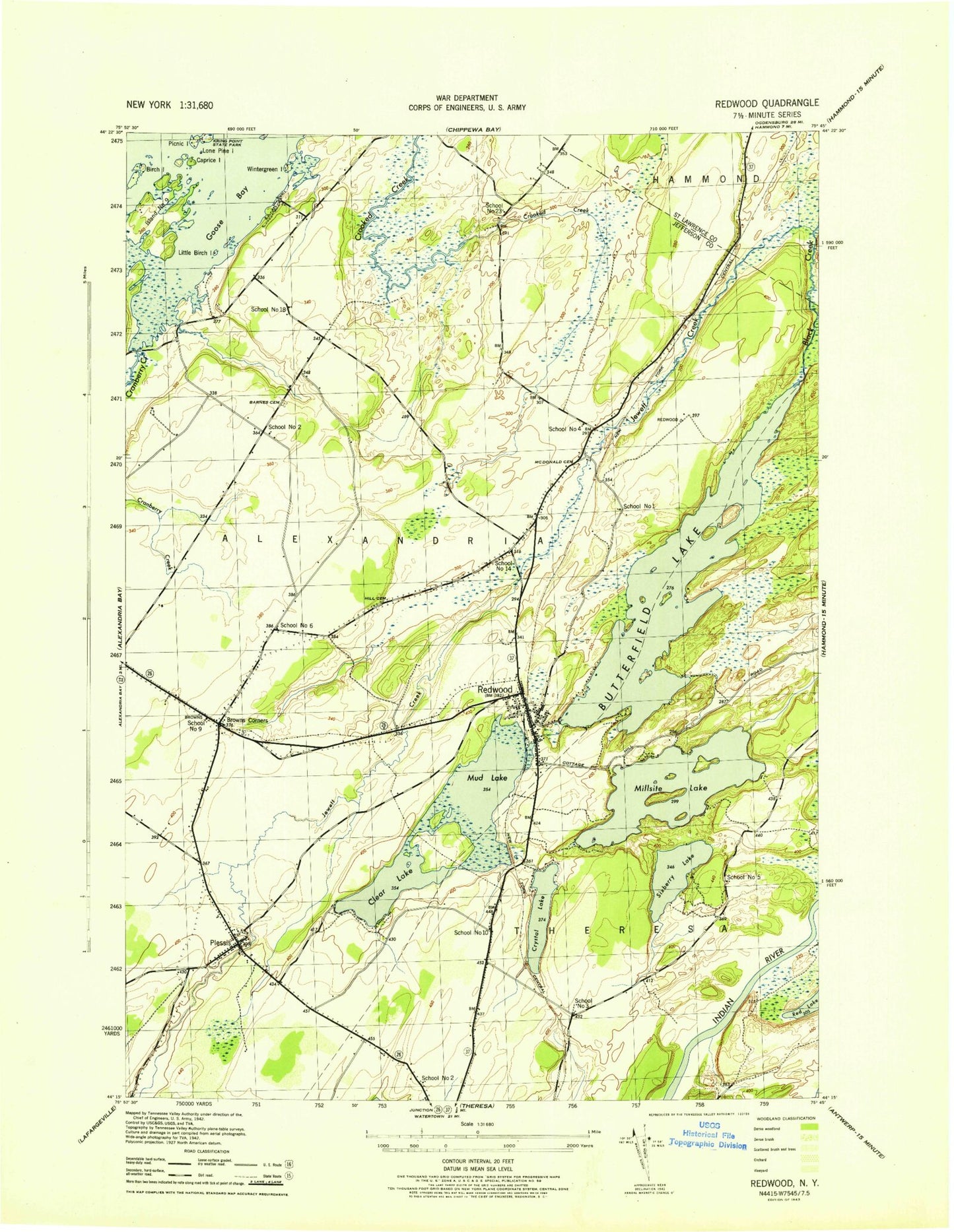
Classic USGS Redwood New York 7.5'x7.5' Topo Map
Couldn't load pickup availability
Historical USGS topographic quad map of Redwood in the state of New York. Typical map scale is 1:24,000, but may vary for certain years, if available. Print size: 24" x 27"
This quadrangle is in the following counties: Jefferson, St. Lawrence.
The map contains contour lines, roads, rivers, towns, and lakes. Printed on high-quality waterproof paper with UV fade-resistant inks, and shipped rolled.
Contains the following named places: Barnes Cemetery, Bean Hill, Birch Island, Browns Corners, Butterfield Lake, Caprice Island, Clear Lake, Cranberry Creek, Crystal Lake, Goose Bay, Goose Bay, Hill Cemetery, Island Number Nine, Little Birch Island, Lone Pine Island, McDonald Cemetery, Millsite Lake, Mud Lake, Picnic Island, Plessis, Redwood, Redwood Cemetery, Sixberry Lake, Skinners Corners, Jewett Creek, Wintergreen Island, Cork Island, Portage Island, Three Sisters, Bean Hill Crossing, Indian River Wildlife Management Area, School Number 1 (historical), School Number 4 (historical), School Number 6 (historical), School Number 9 (historical), School Number 14 (historical), Redwood Census Designated Place, Plessis Census Designated Place, Thousand Islands Christian Church, Saint Paul's Lutheran Church, Redwood Sewage District Wastewater Treatment Plant, Redwood Post Office, Plessis Fire District, Redwood Volunteer Fire Department