MyTopo
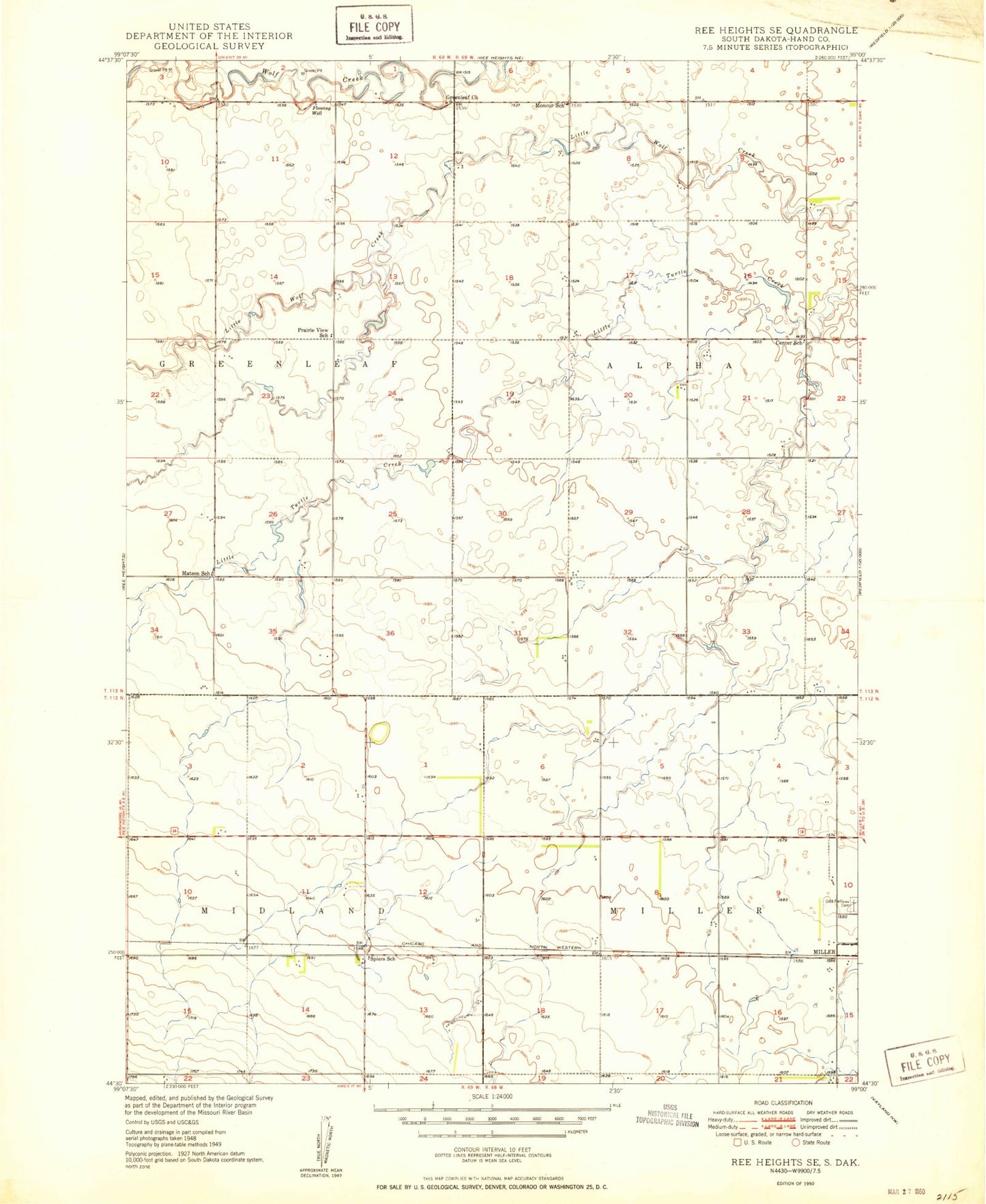
Classic USGS Ree Heights SE South Dakota 7.5'x7.5' Topo Map
Regular price
$16.95
Regular price
Sale price
$16.95
Unit price
per
Couldn't load pickup availability
Historical USGS topographic quad map of Ree Heights SE in the state of South Dakota. Map scale may vary for some years, but is generally around 1:24,000. Print size is approximately 24" x 27"
This quadrangle is in the following counties: Hand.
The map contains contour lines, roads, rivers, towns, and lakes. Printed on high-quality waterproof paper with UV fade-resistant inks, and shipped rolled.
Contains the following named places: Center School, Greenleaf Church, Hand County, IOOF Hillcrest Cemetery, Matson School, Moncur School, Prairie View School, Spiers School, Township of Alpha, Township of Midland, Township of Miller