MyTopo
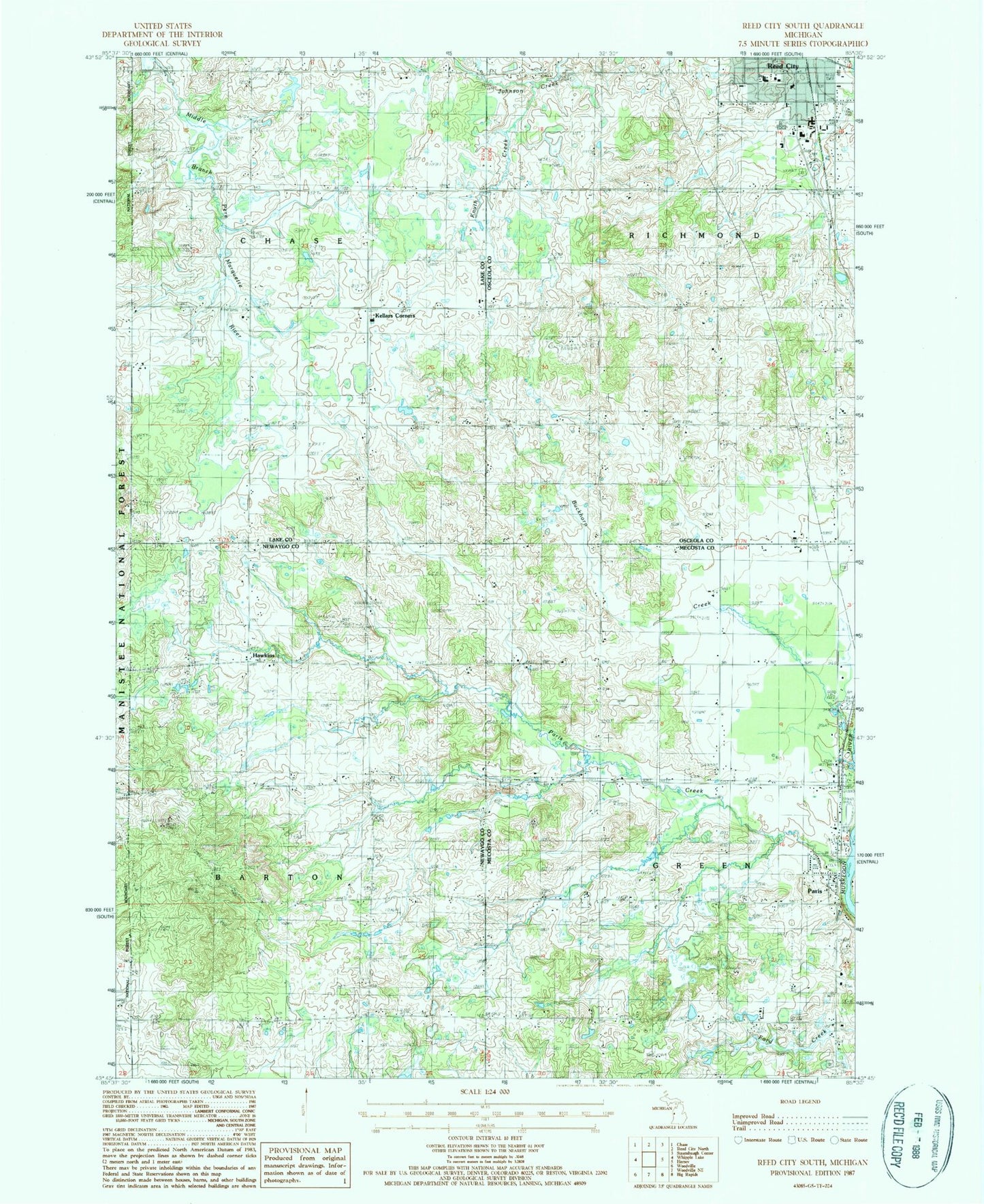
Classic USGS Reed City South Michigan 7.5'x7.5' Topo Map
Couldn't load pickup availability
Historical USGS topographic quad map of Reed City South in the state of Michigan. Map scale may vary for some years, but is generally around 1:24,000. Print size is approximately 24" x 27"
This quadrangle is in the following counties: Lake, Mecosta, Newaygo, Osceola.
The map contains contour lines, roads, rivers, towns, and lakes. Printed on high-quality waterproof paper with UV fade-resistant inks, and shipped rolled.
Contains the following named places: Barton Township Cemetery, Barton Township Park, Booth School, Buckhorn Creek, Calvary Baptist Church, Charity Baptist Church, Chase Township Cemetery, Church of Antioch, Church of Christ of Big Rapids, City of Reed City, Cornell School, Country Mobile Home Park, Davenport School, Davis School, Donley School, GT Norman Elementary School, Hawkins, Hawkins Post Office, Haymarsh Lake State Game Area-Paris Unit, Kellars Corners, Knuth Creek, Liberty Baptist Church, Mennonite Cemetery, Michigan State Police Department Reed City Detachment, Morris School, Paris, Paris Census Designated Place, Paris Creek, Paris Fish Hatchery Historical Marker, Paris Park, Paris Post Office, Paris Station, Paris United Methodist Church, Parkhill Cemetery, Reed City Fire Department, Reed City High School, Reed City Police Department, Saint Ann Church, Saint Anne's Cemetery, Saint Paul Lutheran Church, Saint Paul's Evangelical Lutheran Cemetery, Saint Philip Neri Catholic Church, Samis School, Sanders Creek, Seventh-Day Adventist Church, Shepherd Church, Township of Barton, Township of Chase, Township of Richmond, Trinity Lutheran Church, Trinity Lutheran School, United Methodist Church, Upper Elementary School, White Birch Estates Mobile Home Park, Woodland Cemetery, Youngs Trailer Park, ZIP Code: 49338