MyTopo
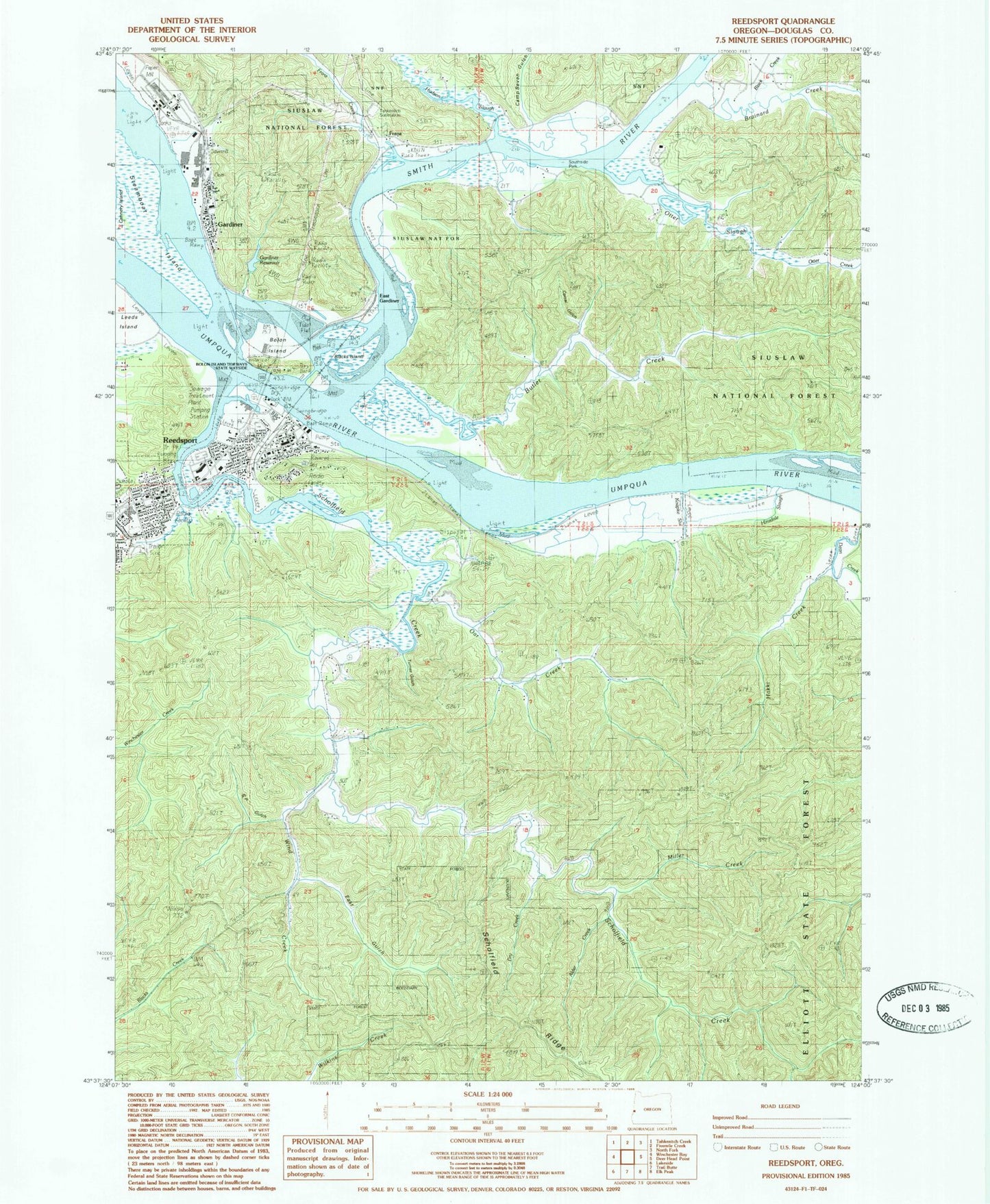
Classic USGS Reedsport Oregon 7.5'x7.5' Topo Map
Couldn't load pickup availability
Historical USGS topographic quad map of Reedsport in the state of Oregon. Map scale may vary for some years, but is generally around 1:24,000. Print size is approximately 24" x 27"
This quadrangle is in the following counties: Douglas.
The map contains contour lines, roads, rivers, towns, and lakes. Printed on high-quality waterproof paper with UV fade-resistant inks, and shipped rolled.
Contains the following named places: Alder Creek, Beautiful Savior Lutheran Church, Blacks Island, Bolon Island, Bolon Island State Park Boat Ramp, Bolon Island Tideways State Scenic Corridor, Brainard Creek, Brandy Bar Landing Wastewater Treatment Facility, Butler Creek, Camp Seven Gulch, Cannery Island, Champion Park, City of Reedsport, Corral Gulch, Dean Creek, Dean Creek Elk Viewing Area, Douglas County Deputy Sheriff Reedsport, Dry Creek, East Gardiner, East Gulch, Frantz Creek, Franz, Gardiner, Gardiner Cemetery, Gardiner Census Designated Place, Gardiner Reservoir, Gardiner Rural Fire Protection District, Gardner Post Office, Hakki Creek, Hinsdale Slough, Hudson Slough, Ivy, Jack Franz Bridge, KDUN-AM, Kennedy Slough, Koepke Slough, Leeds Island, Lions Park, McIntosh Slough, Miller Creek, Oar Creek, Oregon Dunes National Recreation Area Visitors Center, Otter Creek, Otter Slough, Reedsport, Reedsport Branch Library, Reedsport City Hall, Reedsport Community Charter School, Reedsport Junior/High School, Reedsport Justice Court, Reedsport Municipal Court, Reedsport Police Department, Reedsport Post Office, Reedsport Rainbow Plaza Boat Ramp, Reedsport Volunteer Fire Department Station 1, Reedsport Wastewater Treatment Plant, Reesport Public Works, S P Gulch, Sampson Post Office, Scholfield Creek, School, Smith River, Smith River Light, Smith River Ranger Station, South Fork Wind Creek, Southside County Park, Steamboat Island, STEP Creek, Stout Lumber Company, Tahkenitch substation, Tharp, Triangle Park, Turner Gulch, Umpqua Discovery Center, Umpqua River, Wind Creek


