MyTopo
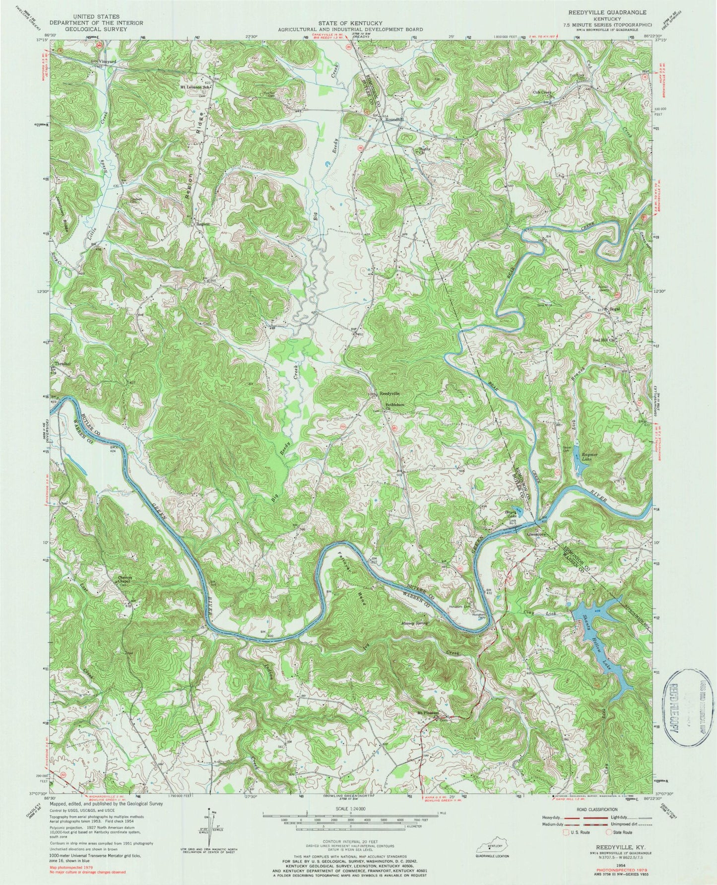
Classic USGS Reedyville Kentucky 7.5'x7.5' Topo Map
Couldn't load pickup availability
Historical USGS topographic quad map of Reedyville in the state of Kentucky. Map scale may vary for some years, but is generally around 1:24,000. Print size is approximately 24" x 27"
This quadrangle is in the following counties: Butler, Edmonson, Warren.
The map contains contour lines, roads, rivers, towns, and lakes. Printed on high-quality waterproof paper with UV fade-resistant inks, and shipped rolled.
Contains the following named places: Bear Creek, Bethlehem Church of Christ, Big Reedy Creek, Caney Hollow, Cardwell Cemetery, Cherrys Chapel, Clay Lick, Cub Creek Cemetery, Cub Creek Church, Fallover Bend, Glenmore, Gravil Cemetery, Greenfield Branch, Honakers Cemetery, Honakers Ferry, Hunts Church, Indian Creek, Ivy Creek, Lick Branch, Massey Spring, Mount Lebanon School, Mount Pleasant Church, Naker, Raymer Lake, Red Hill Church, Reedyville, Region, Region Ridge, Rosy Creek, Round Hill, Roundhill, Segal, Shanty Hollow Lake, Threlkel Cemetery, Vineyard, ZIP Code: 42275