MyTopo
Classic USGS Reevesville South Carolina 7.5'x7.5' Topo Map
Couldn't load pickup availability
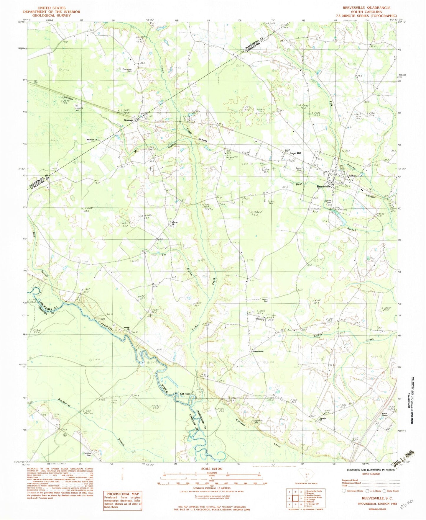
Historical USGS topographic quad map of Reevesville in the state of South Carolina. Map scale may vary for some years, but is generally around 1:24,000. Print size is approximately 24" x 27"
This quadrangle is in the following counties: Colleton, Dorchester, Orangeburg.
The map contains contour lines, roads, rivers, towns, and lakes. Printed on high-quality waterproof paper with UV fade-resistant inks, and shipped rolled.
Contains the following named places: Appleby Cemetery, Appleby Church, Bear Branch, Bethel Cemetery, Bethel Church, Beulah Cemetery, Beulah Church, Big Branch, Box Branch, Cat Hole, Cattle Creek, Cattle Creek Fire Department Station 1, Cattle Creek School, Connor Cemetery, Dorange, Dorange School, Edisto School, Greenville Church, Greenville School, Hagerman Cemetery, Harver Chapel, Heaton Cemetery, Huggins Oak School, Independence School, Independent School, Jericho Church, Joint School, Kelley School, Magnolia Cemetery, Mill Branch, Mount Pisgah Church, Murray Branch, Oak Villa Church, Oak Villa School, Old Miss Cemetery, Patrick Cemetery, Reevesville, Reevesville Baptist Church, Reevesville Division, Reevesville Fire Department, Saint Matthews Church, Saint Peters School, School Number 82, Sugar Hill, Thompson Cemetery, Town of Reevesville, Whitestone Cemetery, Whitestone Church, ZIP Code: 29471