MyTopo
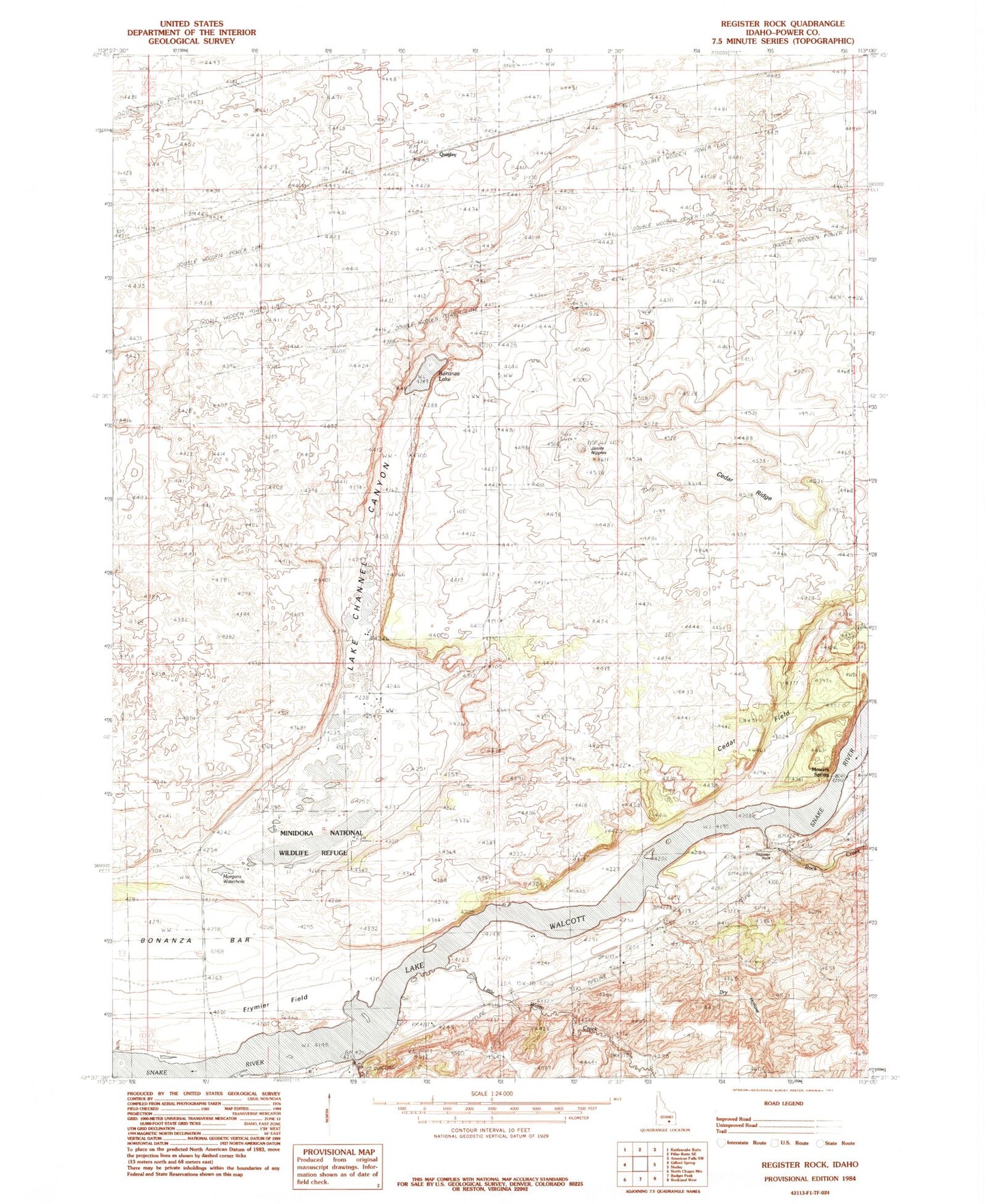
Classic USGS Register Rock Idaho 7.5'x7.5' Topo Map
Regular price
$16.95
Regular price
Sale price
$16.95
Unit price
per
Couldn't load pickup availability
Historical USGS topographic quad map of Register Rock in the state of Idaho. Map scale may vary for some years, but is generally around 1:24,000. Print size is approximately 24" x 27"
This quadrangle is in the following counties: Power.
The map contains contour lines, roads, rivers, towns, and lakes. Printed on high-quality waterproof paper with UV fade-resistant inks, and shipped rolled.
Contains the following named places: Bonanza Lake, Cedar Field, Cedar Ridge, Dry Hollow, Fall Creek, Frymier Field, Janies Nipples, Lake Channel Canyon, Little Warm Creek, Morgans Waterhole, Mowers Spring, Quigley, Register Rock, Register Rock State Picnic Ground, Rock Creek, ZIP Code: 83211