MyTopo
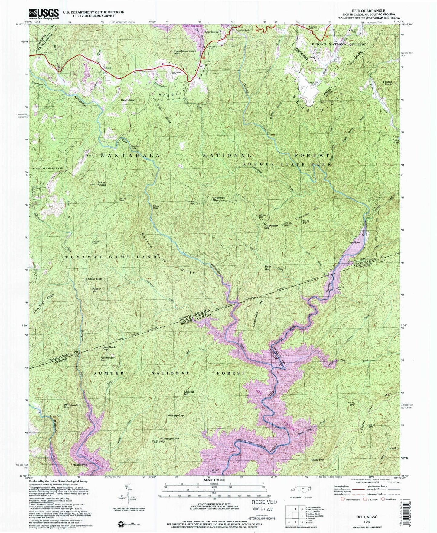
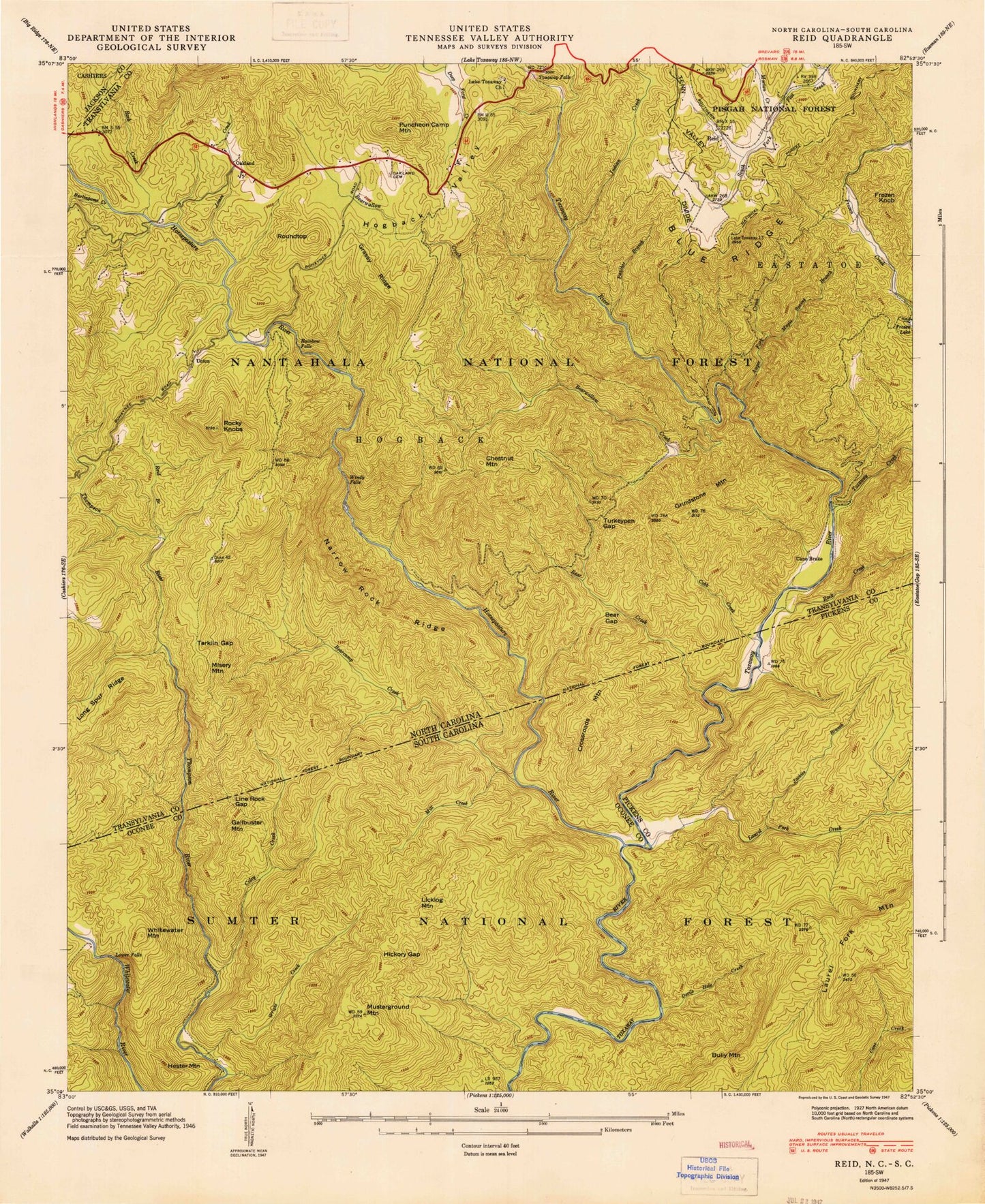
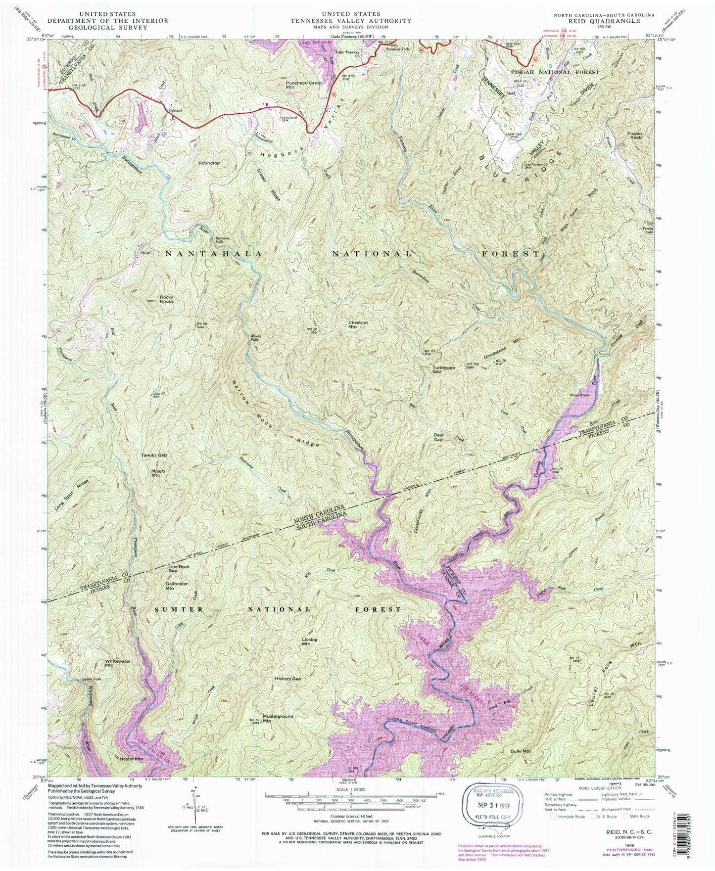
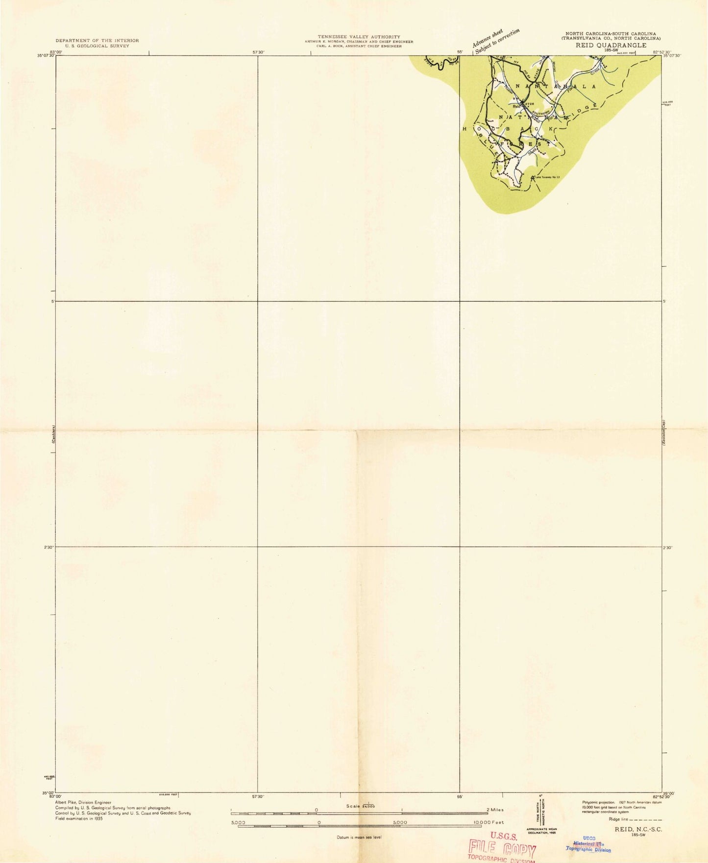
Classic USGS Reid North Carolina 7.5'x7.5' Topo Map
Couldn't load pickup availability
Historical USGS topographic quad map of Reid in the states of North Carolina, South Carolina. Typical map scale is 1:24,000, but may vary for certain years, if available. Print size: 24" x 27"
This quadrangle is in the following counties: Jackson, Oconee, Pickens, Transylvania.
The map contains contour lines, roads, rivers, towns, and lakes. Printed on high-quality waterproof paper with UV fade-resistant inks, and shipped rolled.
Contains the following named places: Auger Fork Creek, Bear Creek, Bear Gap, Bearcamp Creek, Bearwallow Creek, Burlingame Creek, Cobb Creek, Coley Creek, Grassy Ridge, Hogback, Horsepasture River, Indian Creek, James Creek, Lake Toxaway Church, Line Rock Gap, Maple Spring Branch, Morton Creek, Narrow Rock Ridge, Oakland Cemetery, Panther Branch, Rainbow Falls, Reid Branch, Rock Creek, Rock Creek, Rocky Knobs, Tarkiln Gap, Toxaway Creek, Toxaway Falls, Turkeypen Gap, Windy Falls, Toxaway Falls, Bear Wallow Hollow, Bear Wallow Springs, Whitewater Pines, Eastatoe Ford, Cane Brake, Chestnut Mountain, Frozen Knob, Grindstone Mountain, Misery Mountain, Oakland, Puncheon Camp Mountain, Reid, Roundtop, Union, Whitewater Falls, Township of Hogback, Gorges State Park, Lake Toxaway Fire Rescue Station 2, Sapphire Post Office, Horsepasture Wild and Scenic River, Devils Hole Creek, Hickory Gap, Jackies Branch, Mill Creek, Rock Creek, Wright Creek, Bully Mountain, Crossroads Mountain, Gallbuster Mountain, Hester Mountain, Licklog Mountain, Musterground Mountain, Tri-State Club (historical), Horse Pasture School (historical), Laurel Fork Creek, Laurel Fork Mountain, Lower Falls, Whitewater Mountain, Auger Fork Creek, Bear Creek, Bear Gap, Bearcamp Creek, Bearwallow Creek, Burlingame Creek, Cobb Creek, Coley Creek, Grassy Ridge, Hogback, Horsepasture River, Indian Creek, James Creek, Lake Toxaway Church, Line Rock Gap, Maple Spring Branch, Morton Creek, Narrow Rock Ridge, Oakland Cemetery, Panther Branch, Rainbow Falls, Reid Branch, Rock Creek, Rock Creek, Rocky Knobs, Tarkiln Gap, Toxaway Creek, Toxaway Falls, Turkeypen Gap, Windy Falls, Toxaway Falls, Bear Wallow Hollow, Bear Wallow Springs, Whitewater Pines, Eastatoe Ford, Cane Brake, Chestnut Mountain, Frozen Knob, Grindstone Mountain, Misery Mountain, Oakland, Puncheon Camp Mountain, Reid, Roundtop, Union, Whitewater Falls, Township of Hogback, Gorges State Park, Lake Toxaway Fire Rescue Station 2, Sapphire Post Office, Horsepasture Wild and Scenic River, Devils Hole Creek, Hickory Gap, Jackies Branch, Mill Creek, Rock Creek, Wright Creek, Bully Mountain, Crossroads Mountain, Gallbuster Mountain, Hester Mountain, Licklog Mountain, Musterground Mountain, Tri-State Club (historical), Horse Pasture School (historical), Laurel Fork Creek, Laurel Fork Mountain, Lower Falls, Whitewater Mountain, Auger Fork Creek, Bear Creek, Bear Gap, Bearcamp Creek, Bearwallow Creek, Burlingame Creek, Cobb Creek, Coley Creek, Grassy Ridge, Hogback, Horsepasture River, Indian Creek, James Creek, Lake Toxaway Church, Line Rock Gap, Maple Spring Branch, Morton Creek, Narrow Rock Ridge, Oakland Cemetery, Panther Branch, Rainbow Falls, Reid Branch, Rock Creek, Rock Creek, Rocky Knobs, Tarkiln Gap, Toxaway Creek, Toxaway Falls, Turkeypen Gap, Windy Falls, Toxaway Falls, Bear Wallow Hollow, Bear Wallow Springs, Whitewater Pines, Eastatoe Ford, Cane Brake, Chestnut Mountain, Frozen Knob, Grindstone Mountain, Misery Mountain, Oakland, Puncheon Camp Mountain, Reid, Roundtop, Union, Whitewater Falls, Township of Hogback, Gorges State Park, Lake Toxaway Fire Rescue Station 2, Sapphire Post Office, Horsepasture Wild and Scenic River, Devils Hole Creek, Hickory Gap, Jackies Branch, Mill Creek, Rock Creek, Wright Creek, Bully Mountain, Crossroads Mountain, Gallbuster Mountain, Hester Mountain, Licklog Mountain, Musterground Mountain, Tri-State Club (historical), Horse Pasture School (historical), Laurel Fork Creek, Laurel Fork Mountain, Lower Falls, Whitewater Mountain