MyTopo
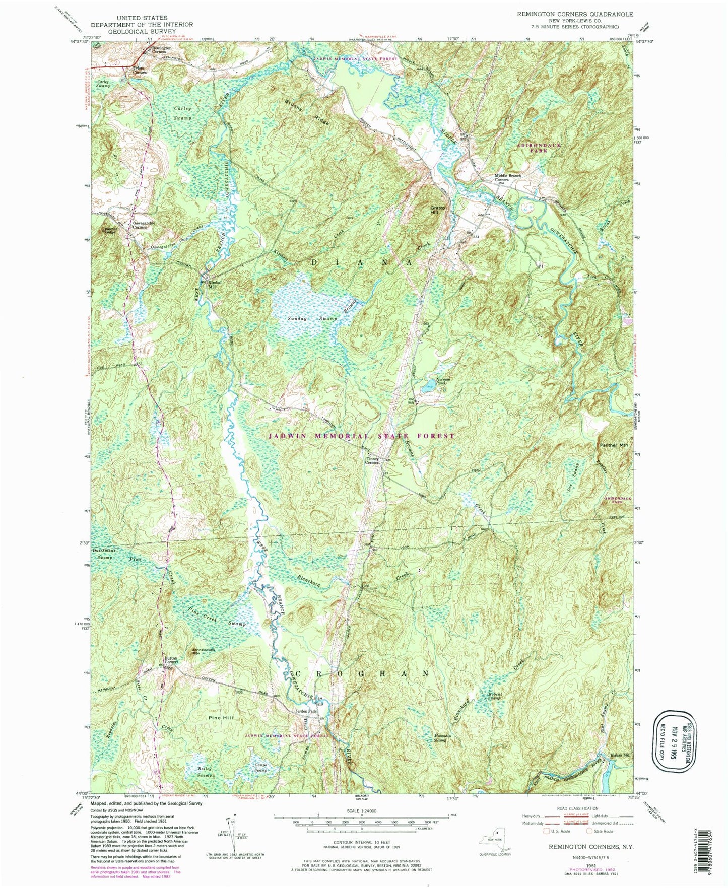
Classic USGS Remington Corners New York 7.5'x7.5' Topo Map
Couldn't load pickup availability
Historical USGS topographic quad map of Remington Corners in the state of New York. Typical map scale is 1:24,000, but may vary for certain years, if available. Print size: 24" x 27"
This quadrangle is in the following counties: Lewis.
The map contains contour lines, roads, rivers, towns, and lakes. Printed on high-quality waterproof paper with UV fade-resistant inks, and shipped rolled.
Contains the following named places: Bailey Swamp, Blanchard Creek, Blue Swamp Creek, Bobcat Swamp, Browns Creek, Brushy Ridge, Carley Swamp, Carley Swamp, Compo Creek, Compo Swamp, Doe Swamp, Dutchmans Swamp, Dutton Corners, Elijah Creek, First Creek, Grassy Hill, John Browns Mountain, Kimball Creek, Middle Branch Corners, Mountain Swamp, Norman Pond, Oswegatchie Corners, Oswegatchie Creek, Palmer Ledge, Panther Creek, Pine Creek, Pine Creek Swamp, Pine Hill, Remington Corners, Sunday Swamp, Tims Creek, Tinney Corners, Tylers Corners, Panther Mountain, Bishas Mill, Jerden Falls, Kimball Mill, Middle Branch Oswegatchie River, Fish Creek, Town of Diana, Oswegatchie Cemetery, Jerden Falls